
If you’re yearning for a tranquil escape where the modern world’s hustle fades into the background, Northern Arizona is sprinkled with hidden gems that offer just that.
I’ve always been drawn to places where nature’s serenity takes center stage, and in this region, secluded towns nestled among mountains, forests, and canyons provide the perfect retreat.
From vast open spaces to tight-knit communities far removed from urban sprawl, these towns offer unique experiences that let you truly disconnect and immerse yourself in the beauty of the Southwest.
Join me as I count down my favorite secluded spots in Northern Arizona, each offering a slice of peaceful paradise.
25. Houck: Wind‑Swept Plains and Painted Cliffs
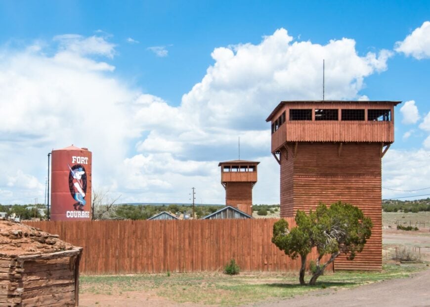
Houck, home to just over 200 residents, rests on a stretch of wind-swept grasslands framed by painted cliffs and sandstone escarpments. The landscape here feels expansive and untouched, with each sunrise spilling color across the rock faces like a living mural. Daily life unfolds slowly, defined by rhythm rather than rush.
There are no fast-food signs or busy plazas—just a small store, a post office, and the quiet shuffle of community events. What defines Houck isn’t what’s there, but what isn’t: noise, traffic, crowds. It’s a town where the sound of wind and the scent of sagebrush are constants, and even small movements feel purposeful.
To visit Houck is to step into a gentler pace—one shaped by the land and safeguarded by silence. There’s a stillness here that settles in the bones.
Where is Houck?
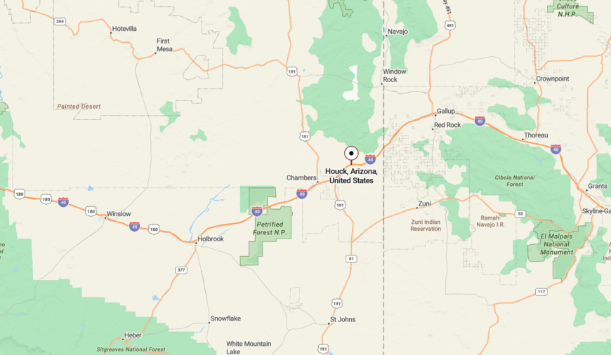
Houck sits in far-eastern Apache County, along Interstate 40 near the New Mexico border. Though it’s directly off the highway, the community seems hidden behind its surrounding cliffs and broad, open plain.
Visitors exit I-40 and follow a single paved road into town, where the space opens up, but signage thins out. The town’s subtlety is its shield—it’s there if you look, but easy to miss if you don’t.
24. Birdsprings: Butte Shadows and Breeze
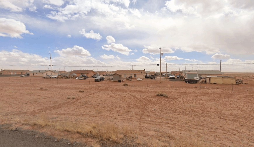
Birdsprings drifts across high desert ridges where ravens circle and the wind hums over the land. With under 200 residents, it feels less like a town and more like a place gently held together by memory and terrain. Here, silence is the default, and nature’s details command attention.
There’s no town center, no commercial district—only scattered homesteads and dusty lanes that disappear into the desert. Rusting fences and lone mailboxes suggest more than they reveal, giving the area an almost dreamlike quality. It’s the kind of place where even footsteps seem to echo a little longer.
Life in Birdsprings is measured in light and shadow, in wind shifts and canyon breezes. It’s not remote by accident—it’s remote by identity.
Where is Birdsprings?
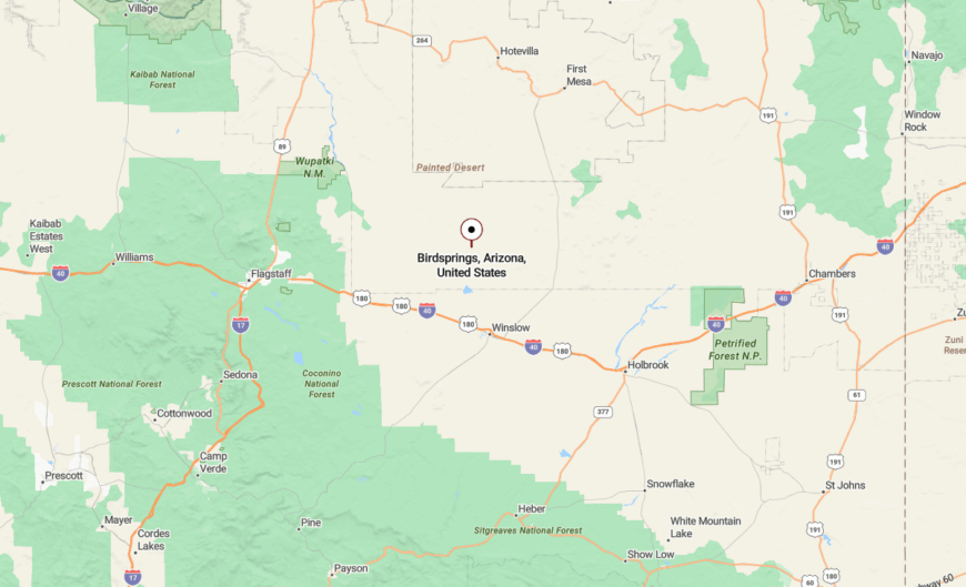
Birdsprings is located just west of Leupp in Navajo County, near the junction of Navajo Route 15 and Indian Route 18. The approach runs past mesas and through ridgelines that feel both ancient and cinematic.
Most travelers reach the area from Winslow, about 35 miles southwest, but signs grow sparse as you near. It’s a place best found by intuition—and left to those willing to get a little lost.
23. Cornfields: Traditional Life in a Desert Hollo
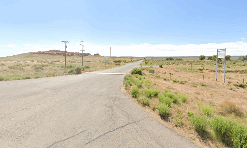
Cornfields is a quiet settlement surrounded by the embrace of red cliffs and dusty desert hollows. Fewer than 300 residents live here, scattered across traditional plots and shepherding grounds where maize, sheep, and ceremony still guide the day. The land cradles the people—and the people, in turn, live gently with the land.
There are no chain stores, no restaurants, no strip malls. The town consists of a post office, a school, and homes that echo with generational stories. Summer winds thread through yucca and cornstalk, and sunsets linger long after the light is gone.
Cornfields is less a destination than a preservation. It offers a glimpse into a rooted way of life, quietly carried forward in the heart of the desert.
Where is Cornfields?
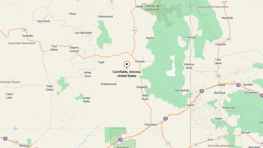
Cornfields lies in Apache County, about 10 miles southwest of Ganado. Navajo Route 15 winds into the valley, descending into a shallow basin ringed by rock.
The terrain folds softly here, and signage is minimal—those who find Cornfields usually do so with local direction or luck. It’s a town hidden more by intention than obscurity.
22. Nazlini: Arroyo Canyons and Pinyon Quietude
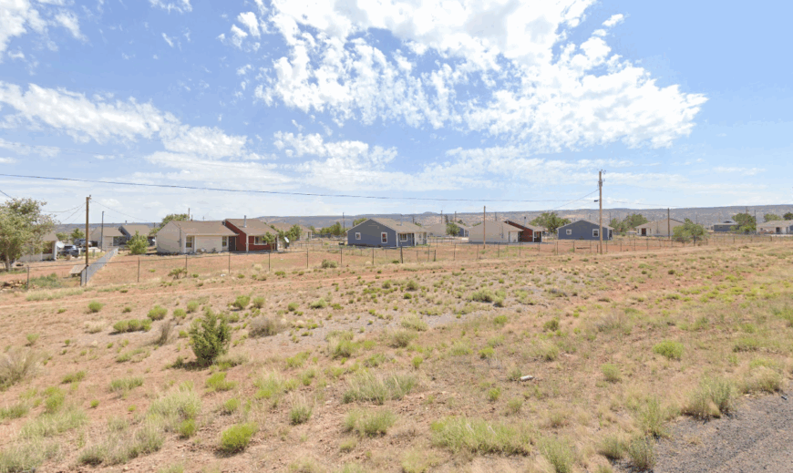
Nazlini rests in the hollows of northern Arizona’s canyon country, its homes and chapter houses tucked among sandstone ridges and juniper. With just over 400 people, it’s a place that feels deeply embedded in the land. Everything here—from the footpaths to the fences—moves with the earth, not over it.
There’s no commercial strip, no gas station—only the occasional creak of a windblown gate and the quiet hum of daily routines. Cattle wander between pinyon trees, and children play along dusty arroyos. It’s a setting that feels timeless, with just enough movement to remind you life carries on.
Nazlini isn’t showy. Its strength lies in its subtlety—a quiet chapter in the story of the desert.
Where is Nazlini?
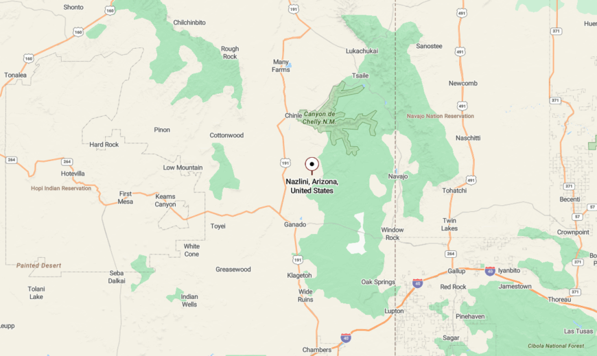
Nazlini is located in Apache County, about 20 miles north of Ganado. It’s reached by narrow reservation roads that shift from pavement to dirt as you approach.
Mesas cradle the area in shallow folds, creating a natural barrier to outside view. Even once inside Nazlini, the layout feels hidden—stitched gently into the landscape.
21. Wide Ruins: Ancient Silence on the Plains
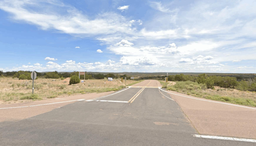
Wide Ruins sits on a pale plateau scattered with the bones of history. Adjacent to ancestral Puebloan structures, it’s a place where the past still murmurs through the soil. Today, a few dozen homes and a school carry on quietly under big skies.
There are no stores, no noise, and rarely a reason for anyone to rush. The land stretches out flat and uninterrupted, making movement feel slower and time more generous. Even horses here seem to step softly.
It’s easy to overlook Wide Ruins—but those who pause find an extraordinary calm woven into its vastness. It’s less of a town and more of a reflection held on the land.
Where is Wide Ruins?
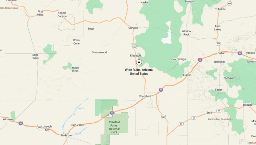
Wide Ruins is located in Apache County, roughly 30 miles south of Ganado along US Route 191. It lies between Chinle and Sanders, seated within a broad grassland plain.
While the highway runs nearby, few travelers stop. The stillness of Wide Ruins waits just beyond notice, expansive and uninterrupted.
20. Greasewood: Sage Flats with Ancient Footsteps
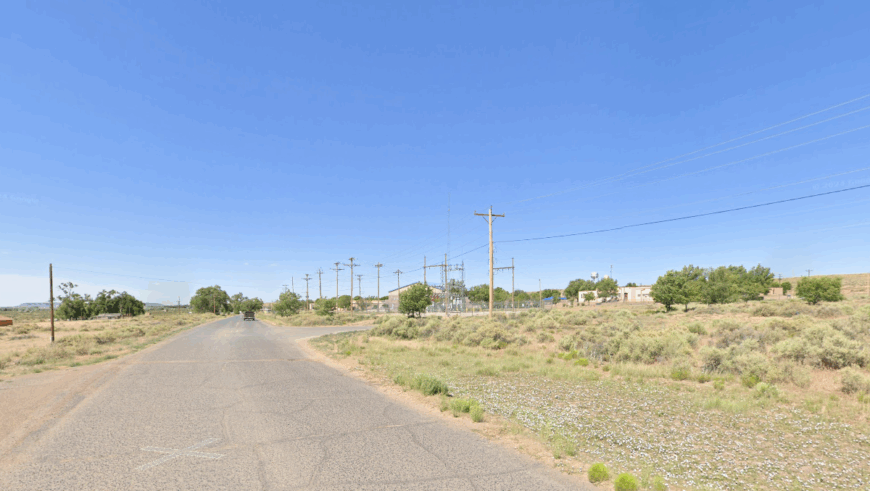
Greasewood spreads across high, scrub-dotted flats where the sky feels impossibly large. With roughly 450 residents, this is a place where livestock roam freely, and children play beneath the watchful arms of juniper trees. Shadows stretch long here, especially at dusk, painting the land in copper and quiet.
There are no downtown blocks or shopping plazas—just homesteads, dirt roads, and memories passed down through generations. Stories live in the wind, carried by Diné elders who recount histories not written in books. Each home feels self-contained, but also connected by rhythm and reverence.
Greasewood doesn’t announce itself—it hums with continuity. Life here is slow, deliberate, and deeply anchored to place.
Where is Greasewood?
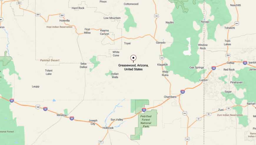
Greasewood is located in Apache County, southwest of Ganado, along Navajo Route 15. The journey involves gravel paths and unmarked turn-offs that cut across sage-covered land.
Access often comes from Indian Route 6, though most residents navigate by memory. This absence of signage enhances the feeling that you’ve left behind a mapped world.
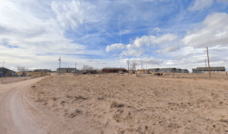
19. Leupp: Desert Bluffs and Endless Sky
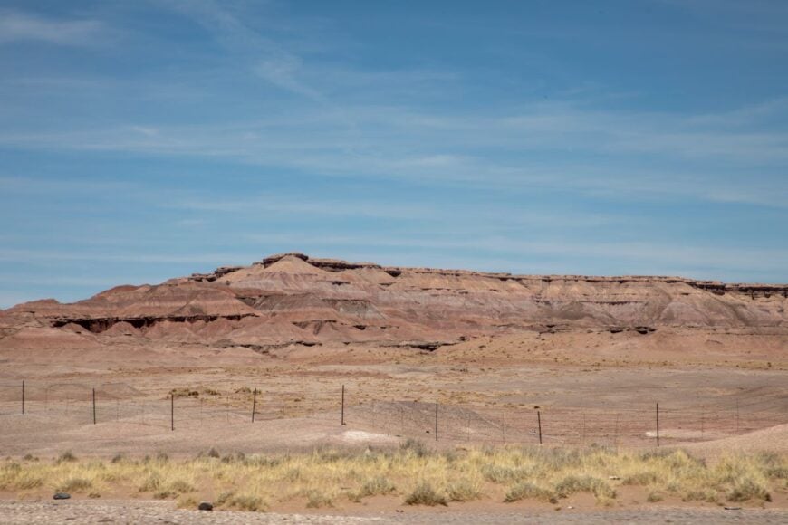
Leupp rests on open high-desert plains rimmed by red bluffs, where the horizon seems to stretch in all directions. With around 1,000 residents, it’s one of the larger communities in this quiet region—but it maintains an unmistakable sense of calm. Traditional practices and family life guide the days here, shaped by wind and wide space.
There’s no commercial bustle—just a school, a church, and homes spaced far apart across the land. Ravens glide overhead, and afternoons are marked more by shifting light than ticking clocks. Life unfolds at its own pace, with the desert offering both shelter and distance.
Leupp isn’t isolated by geography alone—it’s separated by the rhythm of a quieter life. For those who seek reflection, it’s more than enough.
Where is Leupp?
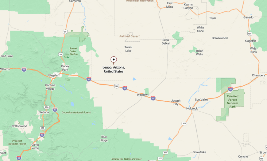
Leupp lies in northeastern Coconino County, about 35 miles northeast of Flagstaff. It’s accessed via Leupp Road, a turnoff from Interstate 40 near Winona.
The route leads into the southwestern edge of the Navajo Nation, surrounded by mesas and wide-open skies. With only one main road in and no highways nearby, Leupp keeps its peaceful distance.
18. Tolani Lake: Desert Reservoir and Sacred Stillness
Tolani Lake wraps around a shallow, seasonal reservoir framed by volcanic rock and rolling grassland. Its 400 residents live far apart, preserving the silence that defines the landscape. Homes blend into the surroundings—scattered, soft-spoken, and tied to tradition.
Nearby sacred hills serve as ceremonial spaces, and the natural rhythms of sunrise and shadow guide daily life. There’s no retail strip or grid of streets—just fences, gates, and long gravel tracks between neighbors. The quiet here feels sacred, not incidental.
Tolani Lake teaches you how to slow down. It’s a place where even light seems to linger longer on the earth.
Where is Tolani Lake?
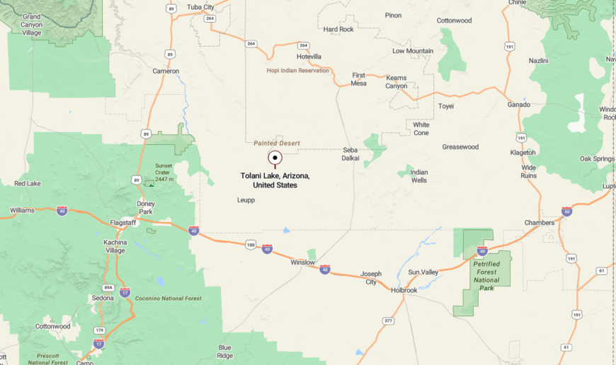
Tolani Lake is situated in Coconino County, approximately 40 miles northeast of Flagstaff. The route in winds through open desert on unpaved Navajo Route 71.
Sparse landmarks mean you may not know you’ve arrived until the horizon narrows. It’s a place meant to be approached gently—and often found by those who need it most.
17. Steamboat: Volcanic Spires and Pinyon Quiet
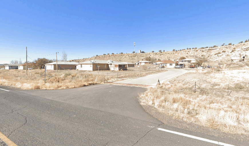
Steamboat takes its name from a dramatic volcanic spire that rises over a basin of pinyon and scrub oak. About 500 people live quietly in its shadow, where woodstoves, starry nights, and silence define the local rhythm. There’s a sense that the land speaks first—and residents simply listen.
A school and small community center offer gathering spaces, but much of life here unfolds in solitude. Paths lead to canyons, and fences divide more space than people. You won’t see many signs, but you’ll feel the stillness immediately.
Steamboat is a town tucked not just into geography, but into itself. It invites slowness like few places can.
Where is Steamboat?
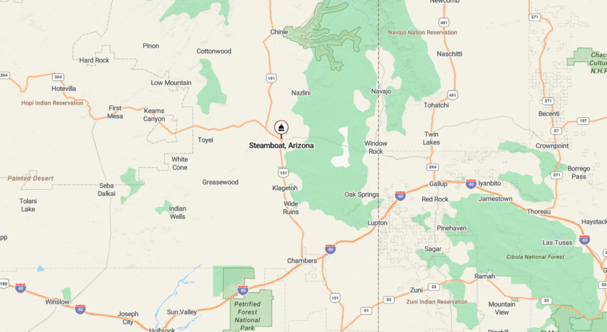
Steamboat is located in Apache County, off US Route 191 between Ganado and Chinle. Its entrance is easy to miss—a single dirt road points the way toward its hidden basin.
The rock spire for which it’s named offers the only clue. The rest is revealed slowly, as the cliffs rise and the valley opens around you.
16. Seba Dalkai: Hidden Homesteads in Juniper Draws
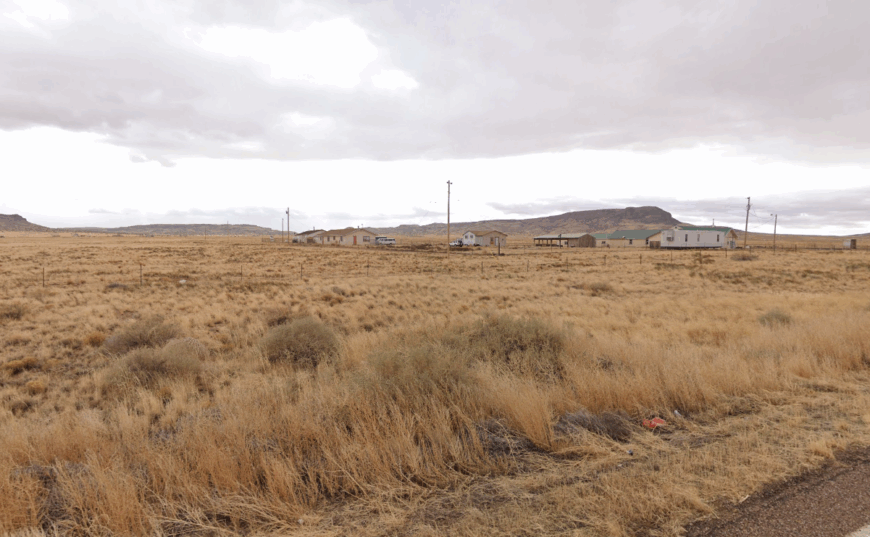
Seba Dalkai is more suggestion than settlement—a scattering of homes hidden in juniper draws and weathered hills. Fewer than 200 people live here, mostly along dirt tracks that seem to end nowhere and everywhere. The town hums so softly it’s nearly inaudible.
There are no stores, no traffic, no directional signs. Just sandstone outcrops, smoke from woodstoves, and the quiet cadence of self-reliance. Here, isolation isn’t an inconvenience—it’s a feature.
Seba Dalkai thrives in its hush. It’s a mapless place, best understood by those who live it.
Where is Seba Dalkai?
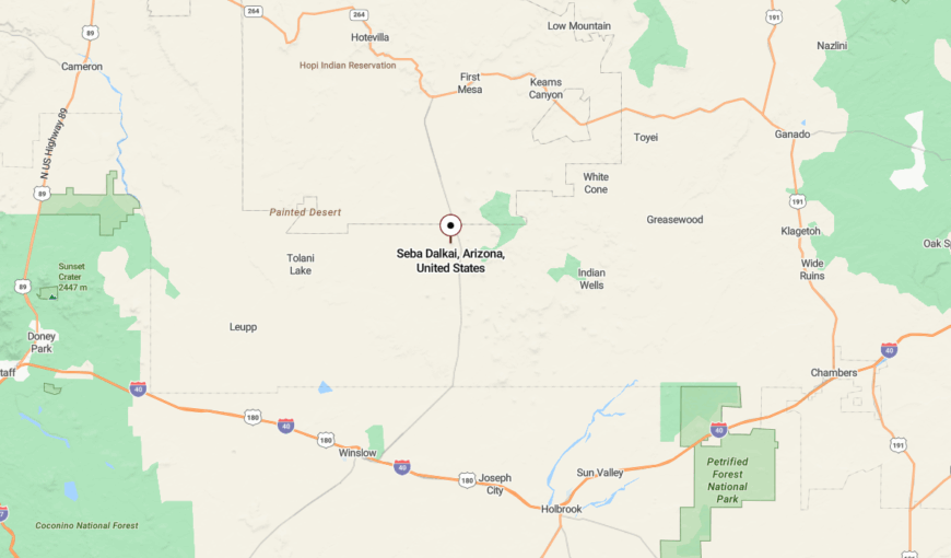
Seba Dalkai lies south of State Route 264 in Navajo County, just north of Dilkon. The roads in are rough and often require four-wheel drive.
Primitive paths wind through low canyons and dry washes with no signs to follow. Its location—and its life—remain almost entirely off the grid.
15. Jeddito: Wind‑Swept Mesa Between Worlds
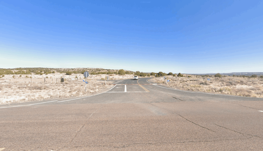
Jeddito, a mesa-top community with under 400 residents, feels balanced on the edge of the earth. It rests on sacred land shared between Hopi and Navajo peoples, with vast views in every direction. Here, chores still include hauling water and tending flocks beneath a boundless sky.
Life unfolds at its own pace—measured in stories, silences, and seasonal rituals. Electric lines stretch sparsely across the terrain, and the few homes seem to nestle against the stone as if in prayer. It’s a place where even the wind seems to whisper with intent.
Jeddito’s seclusion is more than physical—it’s cultural, emotional, and spiritual. To spend time here is to pause time itself.
Where is Jeddito?
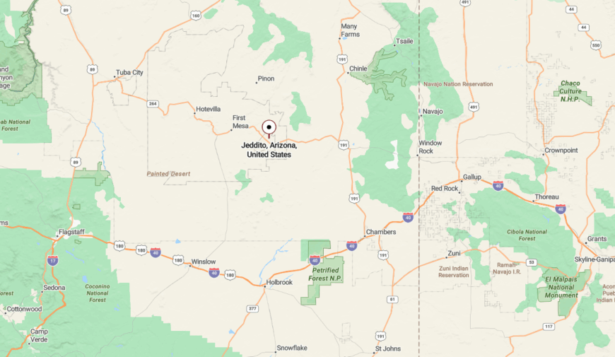
Jeddito lies in Navajo County, west of Keams Canyon, atop a sandstone mesa deep in Hopi–Navajo land. It’s reached via Navajo Route 4, followed by unmarked turn-offs that climb sharply.
There are no large signs, no gas stations—just the road, the rock, and a sense of entering sacred space. Visitors often rely on locals for directions, as maps tend to lose their accuracy here.
14. Lupton: Red Cliffs and Silence on the State Line
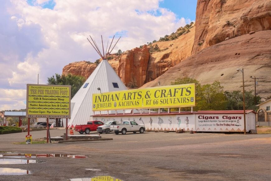
Lupton is a blink-and-you-miss-it border town perched below crimson cliffs on the Arizona–New Mexico line. Fewer than 100 residents live beneath hoodoo rocks and wind-blown sandstone ledges. The silence here is constant—broken only by trains or distant wind.
Though Interstate 40 roars nearby, Lupton feels like a forgotten overlook, bypassed by modern momentum. Old trading posts and relics of Route 66 linger in the shadow of time. Even the rocks seem to watch, unmoved.
Lupton isn’t hidden—it’s just unrecognized. And that makes its stillness all the more remarkable.
Where is Lupton?
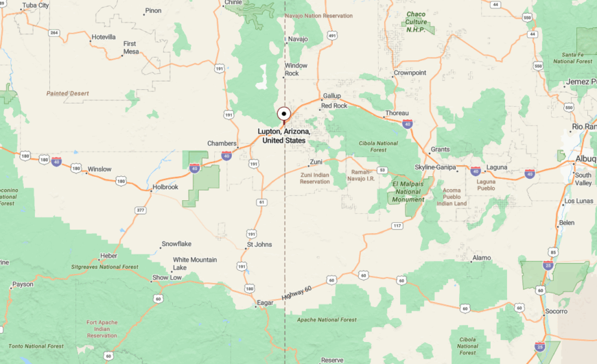
Lupton sits in eastern Apache County, just west of the New Mexico border along Interstate 40. It’s hemmed in by towering red cliffs and desert brush, almost invisible unless you stop to look.
The town is accessed directly off the highway, but remains unseen by most drivers. Its geography offers shelter, while its simplicity keeps it from ever feeling rushed.
13. Indian Wells: Remote Stronghold on Tribal Land
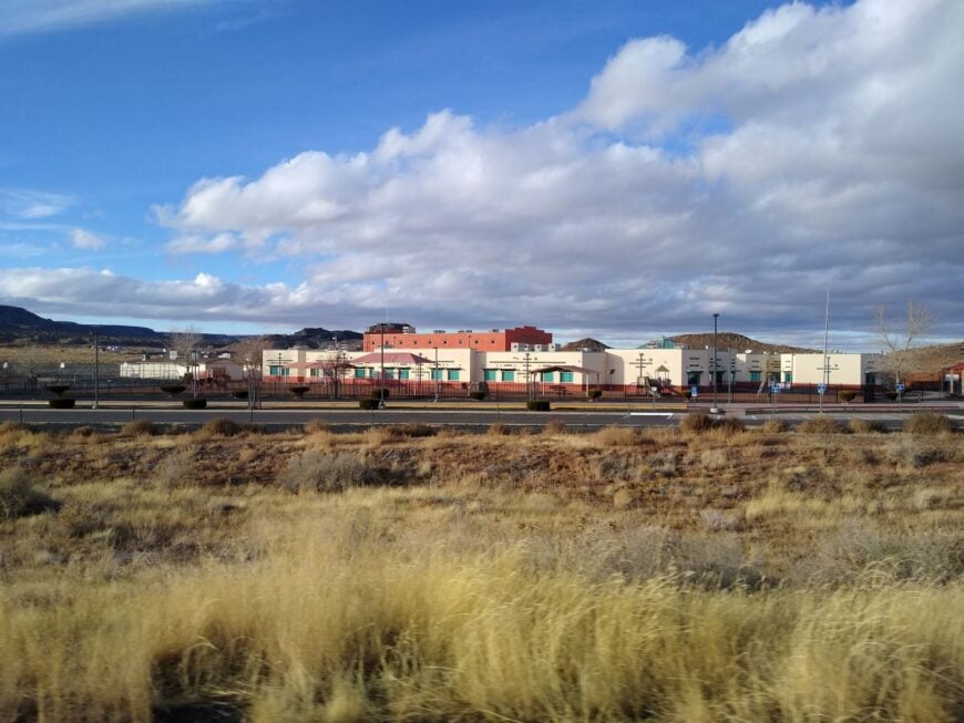
Indian Wells is a quiet outpost in the heart of tribal lands, where roughly 600 people live in the shadow of sacred buttes and starlit plains. Life here is shaped by tradition—sheep grazing, oral histories, and communal gatherings that honor both land and lineage. There’s no market, no gas station—just a school, a chapter house, and wide silence.
Days begin early, often with the wind, and nights stretch out under skies free of light pollution. Modern life reaches here lightly, and only by invitation. In Indian Wells, presence is more important than pace.
This is a town of endurance, humility, and quiet strength. A place to listen, not to speak.
Where is Indian Wells?
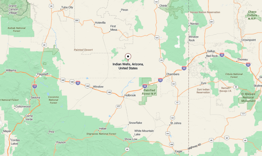
Indian Wells is located between Holbrook and Dilkon, in Navajo County. It’s accessed by Navajo Route 15, threading between canyon edges and grassy plateaus.
Roads are few, and the nearest services lie over 40 minutes away. GPS can falter here, so direction comes best from locals—and from patience.
12. Kaibito: Plateau Quiet in Monument Country
Kaibito is a plateau town with 1,500 residents scattered across wide, dry land in western Navajo Nation. The surrounding vistas are monumental—mesa ridges, open rangeland, and skies that stretch without end. Despite its population, the community feels vast and hushed.
There are no malls or major roads. Just a chapter house, a school, and homesteads set far apart. Horses still graze the outskirts, and winds are the only real soundtrack.
Kaibito is shaped by isolation and pride. A town as broad and quiet as the land beneath it.
Where is Kaibito?
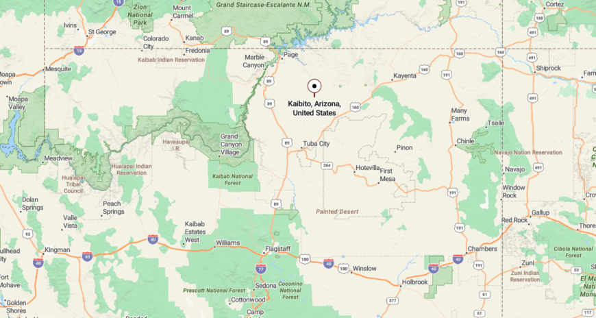
Kaibito lies in Coconino County, about 40 miles northeast of Page. It’s reached via Indian Route 21, which cuts through open desert toward distant monuments.
Most pass Kaibito on their way to Navajo Mountain or Tuba City. But those who pause find a community grounded in stillness and space.
11. Moenkopi: Desert Calm at the Edge of Hopi Lands
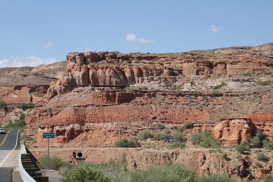
Moenkopi is a Hopi village beside Tuba City where fewer than 1,000 residents maintain quiet harmony with the land. Life here is rooted in agriculture, spirituality, and family—threads woven across generations. Even the air moves gently, as if not to disturb the rhythm.
There are no busy intersections or business districts. Just homes, fields, and the sound of wind passing through low hills. The pace is deliberate, grounded in values older than borders.
Though neighboring a larger town, Moenkopi feels like a world apart. A place that invites reverence, not review.
Where is Moenkopi?
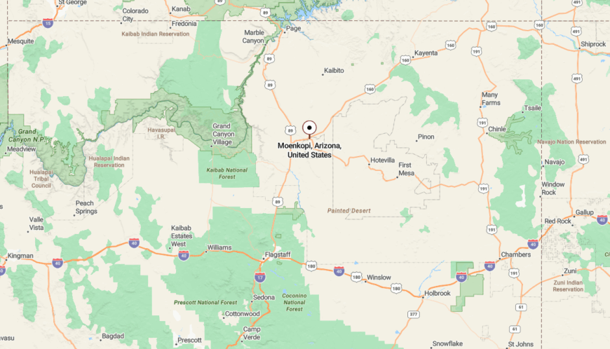
Moenkopi sits on the western edge of the Hopi Reservation, adjacent to Tuba City. It’s located along US Route 160, about 75 miles north of Flagstaff.
While close to services, Moenkopi is buffered by identity and topography. It remains spiritually and culturally distinct—quiet in a way only tradition can preserve.
10. Concho: Wide Open Spaces and Privacy
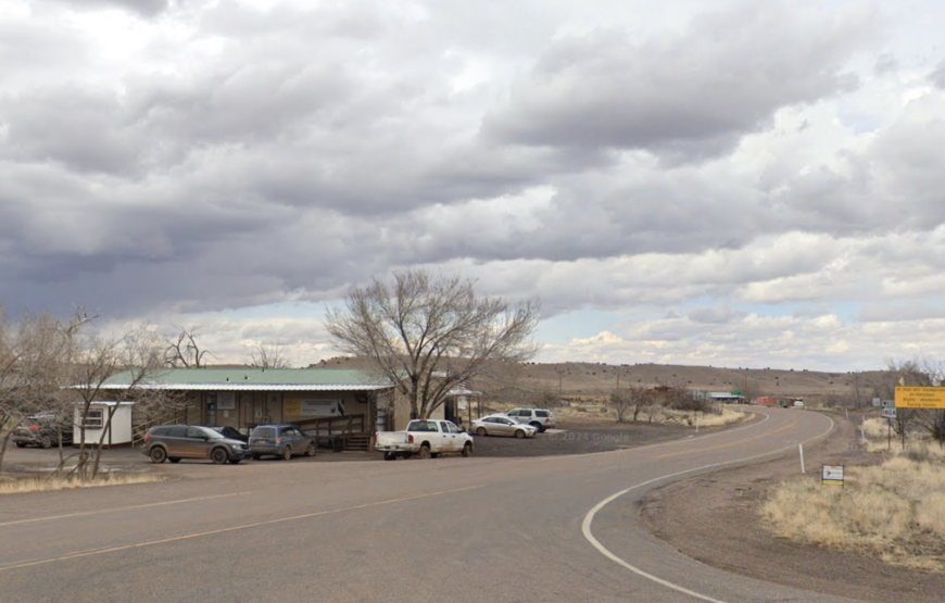
Concho is a high-desert haven where the land stretches wide and silence settles deep. With around 1,500 residents, the community is small but quietly proud, shaped by agriculture, ranching, and a love for open space. There’s room here—not just physically, but emotionally.
Fishing in Concho Lake, exploring the surrounding plains, or simply sitting under a sky lit with stars—these are the town’s main attractions. There’s no commercial core, only scattered homesteads and time to think. The pace is self-determined, and neighbors are often a fence-line or two away.
Concho’s seclusion isn’t just from cities—it’s from urgency. It’s a place for privacy, quiet work, and spacious thought.
Where is Concho?
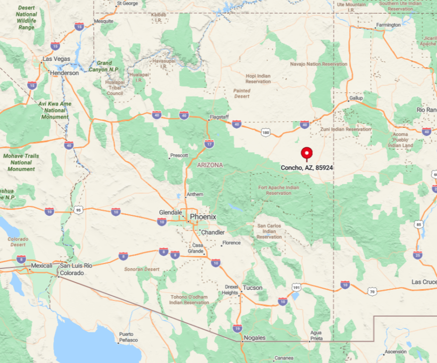
Nestled in Apache County, Concho lies in the northeastern part of Arizona, away from bustling cities and major highways. Its isolation is accentuated by the surrounding rolling hills and open plains, which stretch as far as the eye can see.
Reaching Concho usually involves a scenic drive along State Route 61, making it a peaceful journey away from crowded routes. This remoteness provides a quiet retreat, perfect for those like me who appreciate wide-open spaces and privacy.
9. Ash Fork: Historic Seclusion Off the Beaten Path

Ash Fork sits along storied Route 66 but carries none of the tourist clamor that marks other highway towns. Known historically as the Flagstone Capital of the USA, it now holds fewer than 500 residents—and a deep sense of quiet history. Old storefronts and fading signs speak more in silence than in spectacle.
The town still sees freight trains and occasional visitors, but the pace is gentle and the streets often empty. There are no crowds here, just the desert breeze and the muted echoes of the past. The surroundings—rugged, dry, and dramatic—add to the feeling of remove.
Ash Fork is where travelers stop for breath, not bustle. It’s a quiet point between everywhere else.
Where is Ash Fork?
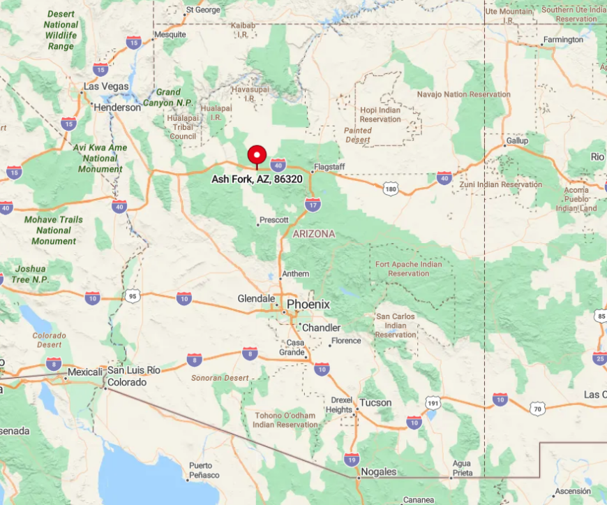
Located in Yavapai County, Ash Fork sits along the historic Route 66 but manages to stay off the main tourist radar. The town’s seclusion is enhanced by the expansive desert and rugged terrain that surrounds it.
To get there, I usually take Interstate 40 and exit onto quieter roads that lead into town, making the journey part of the tranquil experience. This isolation allows Ash Fork to maintain its peaceful ambiance, free from the rush of urban life.
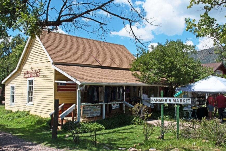
8. Strawberry: A Secluded Mountain Escape
Strawberry is a mountain town of just over 1,000 people, hidden in the forests above the Mogollon Rim. Its cool air and towering pines make it feel worlds away from the desert heat below. Quiet trails and crisp mornings define its rhythm.
The town is dotted with cabins, old buildings, and relics like Arizona’s oldest schoolhouse. Fossil Creek flows nearby, offering a lush escape amid the forest. There are few businesses, fewer distractions, and plenty of peace.
Strawberry is for wanderers, writers, and anyone who finds clarity in altitude. It’s a place that invites you to stay longer than you planned.
Where is Strawberry?
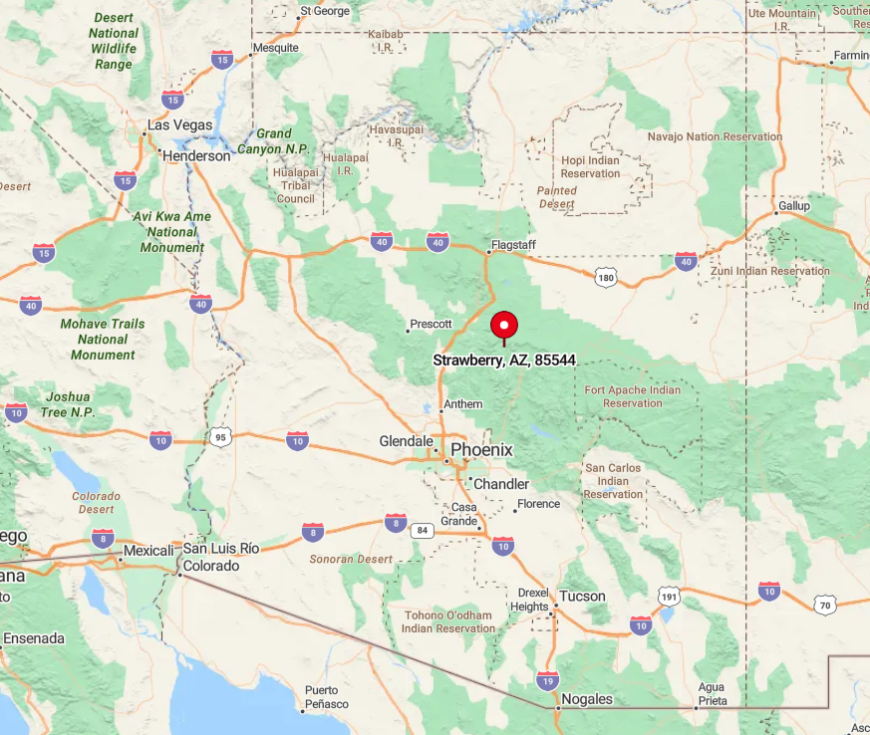
Strawberry is tucked away in Gila County, north of Payson, nestled among the forests of the Mogollon Rim. Its seclusion stems from its location miles away from bustling urban centers and major thoroughfares.
Accessing Strawberry involves winding roads through dense forests, which I find adds to the anticipation of reaching this tranquil escape. The town’s secluded setting provides a perfect backdrop for those looking to disconnect and embrace mountain living.
7. Pine: Hidden Among Towering Trees
Pine, with a population of around 2,000, is tucked between ridges in Gila County’s alpine edge. Towering trees, fresh air, and scenic trails surround a small downtown with just enough charm. It’s the kind of town where antique shops sit beside cafes and quiet comes easy.
The Pine-Strawberry Trail offers one of the area’s best views, winding through forest into foothills. You won’t find big developments or fast-paced life here—just space to breathe and explore. The natural barriers of the surrounding forest help preserve the town’s serenity.
Pine feels like a porch in the woods. It’s close enough to reach, and far enough to reset.
Where is Pine?
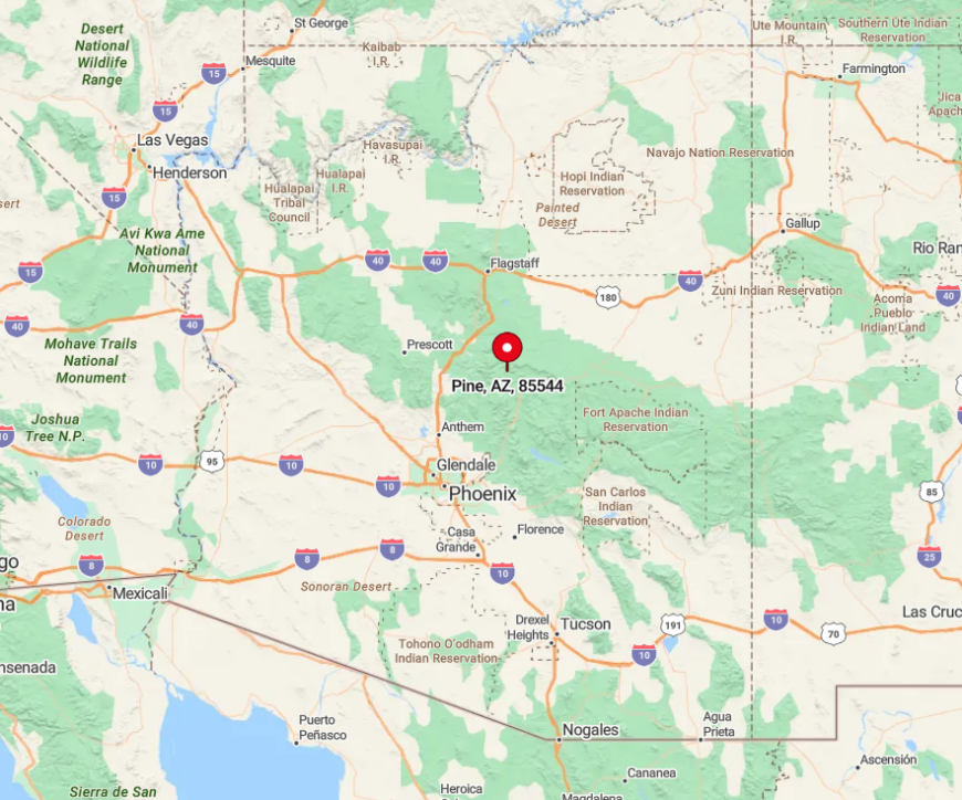
Situated just south of Strawberry in Gila County, Pine is nestled along Arizona State Route 87. Its location within the forested areas of the Mogollon Rim contributes to its seclusion.
The drive to Pine is a scenic one, with towering pines lining the route, making the journey as enjoyable as the destination. This hidden setting ensures that Pine remains a tranquil spot, perfect for anyone like me who appreciates the quiet beauty of nature.
6. Heber-Overgaard: Remote Living on the Rim
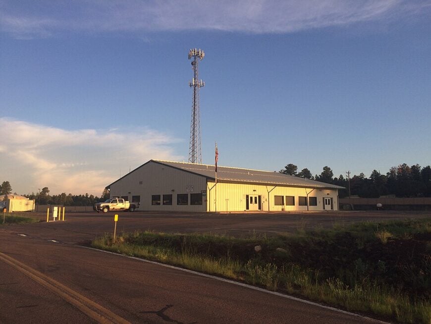
Heber-Overgaard is a dual community perched on the edge of the Mogollon Rim, home to about 2,800 residents. It’s a hub for hikers, campers, and those who find solace in the scent of ponderosa pine. With open skies and cool breezes, it feels like a mountain outpost from a quieter era.
Fishing lakes and wooded trails surround the town, while log cabins and local shops dot its interior. Though tourism sustains it, Heber-Overgaard maintains a calm, seasonal rhythm. The air here isn’t just fresh—it’s freeing.
This is the kind of place where people come to stay for a weekend—and end up staying for good. A forest-framed invitation to exhale.
Where is Heber-Overgaard?
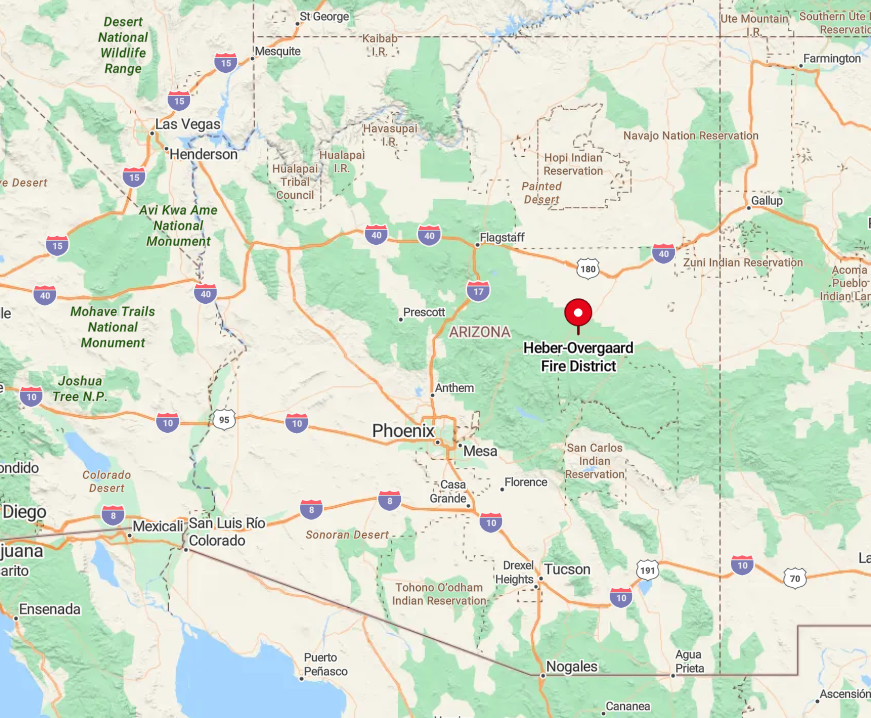
Located in Navajo County, Heber-Overgaard is accessible via State Route 260. The towns’ isolation is due in part to their elevation and the surrounding Apache-Sitgreaves National Forests, which provide a natural buffer from the outside world.
Getting there involves a drive through mountainous terrain, which I always find to be a refreshing escape from flat highways. This remoteness makes Heber-Overgaard ideal for those seeking a quiet life amid nature’s grandeur.
5. Young: A Quiet Valley Apart from the World
Young is a quiet valley community tucked between the Sierra Ancha mountains and acres of wild forest. With a population of around 600, it’s a town where ranching, solitude, and self-reliance still define everyday life. Visitors are welcomed by unpaved roads, waving grass, and the scent of pine and earth.
There’s no strip mall, no nightlife—just open land, remote trails, and homes that prize space and privacy. Haigler Creek offers fishing, and the surrounding Tonto National Forest opens countless opportunities to roam. The isolation here is intentional, and deeply felt.
Young is for those who want to live off the beaten path—both literally and philosophically. It’s a valley apart from the world.
Where is Young?
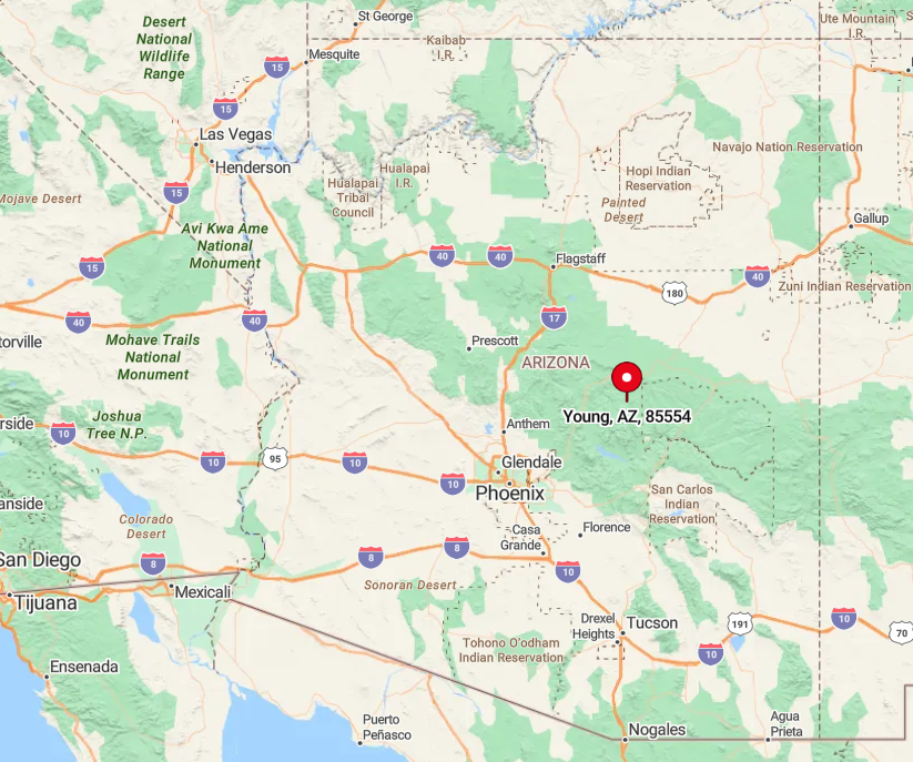
Nestled in Gila County, Young is off the beaten path, accessible by unpaved roads that wind through the mountains. Its seclusion is heightened by the rugged terrain and absence of major roadways, which I find adds to the sense of adventure in getting there.
This isolation from urban areas makes Young a perfect retreat for anyone wanting to disconnect and enjoy the simplicity of rural living.
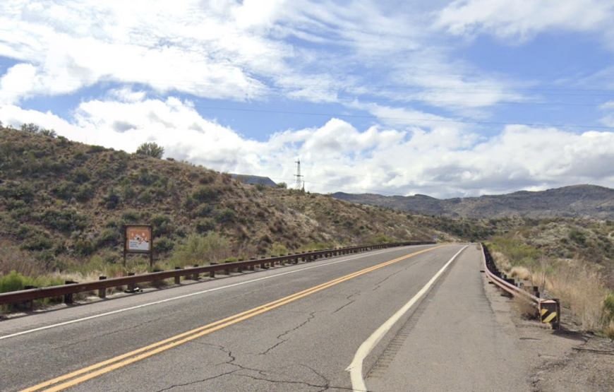
4. Marble Canyon: Solitude by the Canyon’s Edge
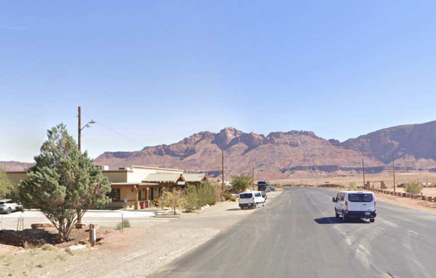
Marble Canyon isn’t much of a town—it’s a sliver of serenity tucked beside the Colorado River, framed by the Vermilion Cliffs. The population is minimal, and the development sparse, which only heightens the area’s raw, natural beauty. It’s a place of vast silence, broken only by the rush of wind and river.
Adventurers come for fly fishing, hiking, and photography, but many stay just to sit in the stillness. There’s no gas station or strip of shops—just wide views, warm rocks, and the sense that you’ve dropped into something ancient.
Marble Canyon is a sanctuary for solitude seekers. If you want to be reminded how small and lucky you are, this is the place.
Where is Marble Canyon?
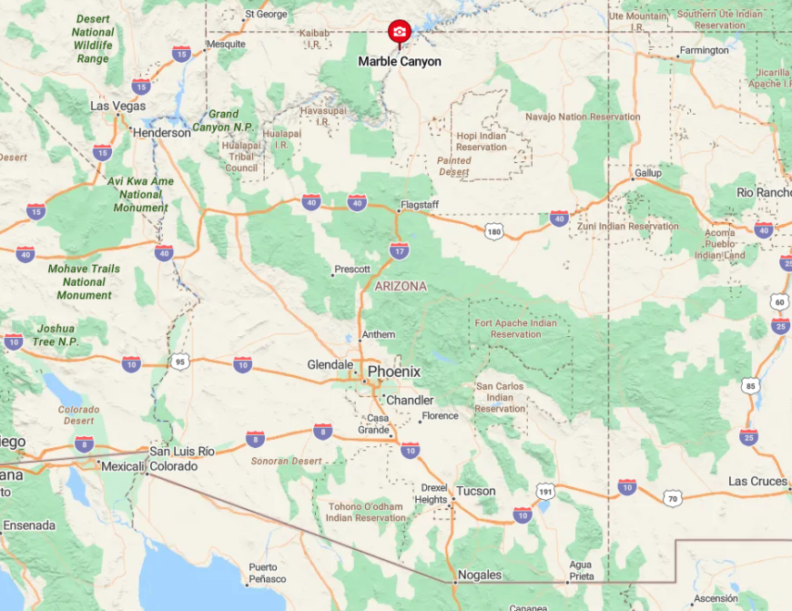
Located in Coconino County, Marble Canyon sits along U.S. Route 89A, just southwest of the Glen Canyon Dam. Its remote location, nestled between towering cliffs and deep canyons, enhances its secluded feel.
Reaching Marble Canyon involves traversing scenic routes that few travelers frequent, which I find captivating. The area’s isolation makes it a sanctuary for those who, like me, seek peace amid some of the most stunning landscapes in Arizona.
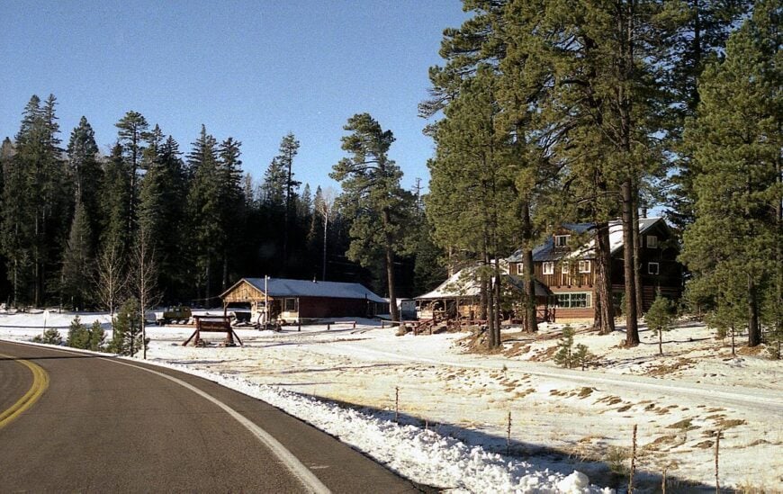
3. Jacob Lake: Seclusion Amidst Towering Pines
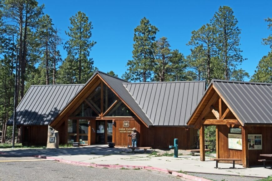
Jacob Lake is a gateway and a getaway all in one. Perched at the junction of U.S. Route 89A and State Route 67, this tiny outpost offers pine forest seclusion and direct access to the North Rim of the Grand Canyon. Its few permanent residents live among towering trees and quiet stretches of road.
The Jacob Lake Inn offers cookies, coffee, and stories to those passing through. But beyond the lodge, it’s the wilderness that speaks loudest. This is where the forest folds in and lets you disappear.
Jacob Lake is not just remote—it’s restorative. It’s where you stop moving and start listening.
Where is Jacob Lake?
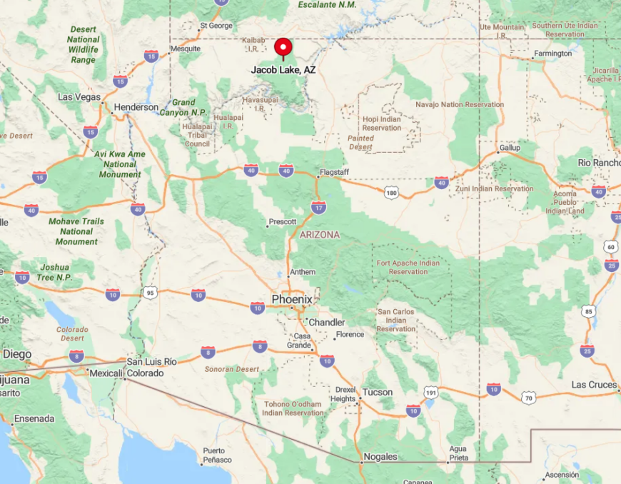
Situated in northern Coconino County, Jacob Lake is at the junction of U.S. Route 89A and State Route 67. Its seclusion comes from its high elevation and dense forest surroundings. Getting there involves a scenic drive through vast stretches of forest, which I always find serene.
The remote setting far from urban centers makes Jacob Lake an ideal spot for those wanting to immerse themselves in nature’s tranquility.
2. Alpine: Gateway to Pristine Wilderness
Alpine is a mountain retreat at 8,050 feet elevation, home to around 150 people and countless moments of peace. It’s nestled in the White Mountains, surrounded by forest and wildlife. You wake here to cold air, distant elk, and the hush of pine needles underfoot.
Fishing, hiking, and cross-country skiing define much of the year. There are no big stores, no fast roads—just cabins, quiet, and crisp horizon lines. The economy leans on tourism, but the tone is purely residential calm.
Alpine is the place you go to breathe deeply. Where silence is thick, and beauty lasts longer than the moment.
Where is Alpine?
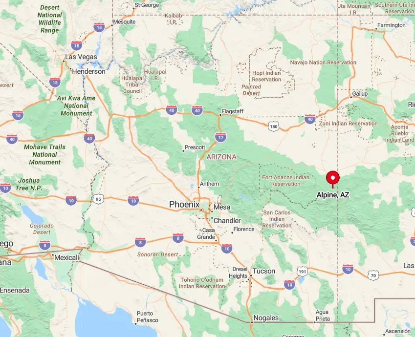
Located in Apache County, Alpine is accessible via U.S. Route 191. The town’s seclusion is heightened by its surrounding wilderness areas and the absence of nearby urban centers.
The drive to Alpine is filled with scenic beauty, which I find enhances the feeling of escaping to a peaceful haven. This distance from the hustle and bustle makes Alpine a perfect spot for those seeking a tranquil mountain retreat.
1. Greer: A Serene Mountain Hideaway
Greer is perhaps Arizona’s most idyllic hidden village—just 50 full-time residents live here at 8,500 feet, tucked into alpine meadows and forested slopes. It’s the kind of place where fly fishing in the Little Colorado River or watching snowfall over evergreens counts as a day well spent. There’s no rush in Greer—just rhythm.
The cabins are spaced out, the stars are unobstructed, and the quiet is complete. There’s no commercial buzz, only the hum of wood stoves and creek water. People come here to reset, and often, to stay.
Greer feels like a storybook retreat with no narrator. Just you, the forest, and the luxury of time.
Where is Greer?
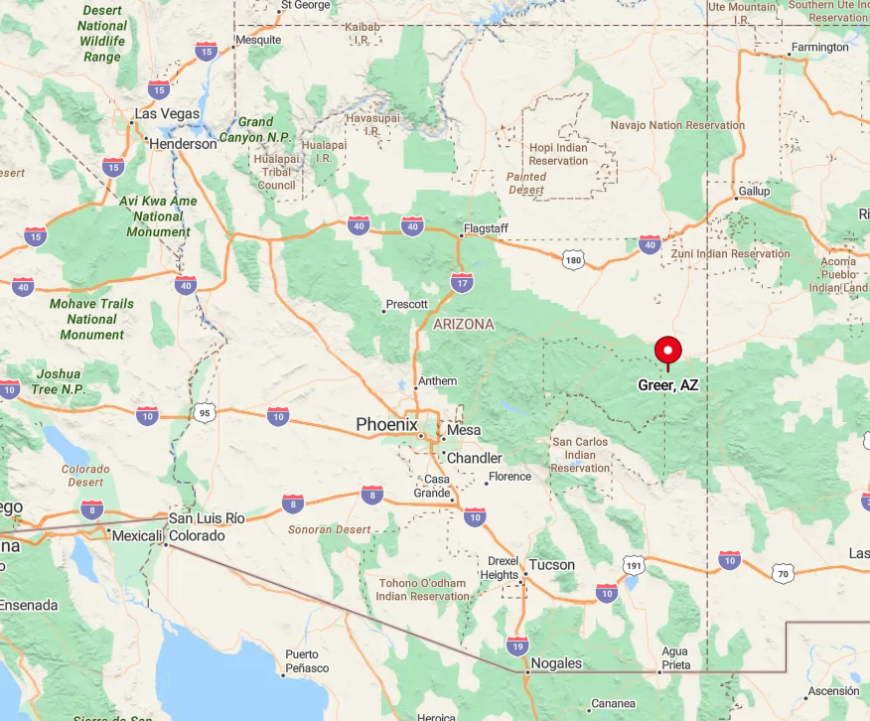
Situated in Apache County, Greer is accessed via State Route 373, branching off from State Route 260. Its seclusion is amplified by the dense forests of the Apache National Forest that envelop the area.
The journey to Greer involves winding mountain roads that I find both beautiful and calming. This tucked-away location ensures that Greer remains a quiet hideaway, perfect for immersing oneself in nature’s serenity.