
From Zitácuaro to Salina Cruz, communities, universities, and local governments across Mexico are creating open public transport maps. This national strategy is led by the Humanitarian OpenStreetMap Team (HOT), in collaboration with Codeando México and Trufi Association, to digitize routes, support transportation modernization efforts, and reduce gaps in urban mobility.
Image courtesy of Donobelo and Trufi.
In Mexico, millions of people use public transportation daily, most of which operates through unstructured systems. However, these routes remain invisible to those who plan, regulate, or design public policies—especially in mid-sized cities, which are growing the fastest. The lack of reliable data on routes, stops, and frequencies limits evidence-based decision-making, perpetuates inequalities in mobility access, and hinders comprehensive urban planning.
The United Nations Committee of Experts on Global Geospatial Information Management (UN-GGIM) has emphasized that most decisions related to sustainable development—such as urban planning and public transportation design—require geospatial data. In other words, if transport is not on the map, it’s not part of public policy.
In response, the Humanitarian OpenStreetMap Team (HOT) has taken regional leadership in designing and implementing a national strategy for participatory mapping focused on sustainable urban development, including public transportation. This strategy brings together technical, community, and governmental efforts. In collaboration with Codeando México and Trufi Association, HOT promotes the use of open-source tools to map in OpenStreetMap, such as OSM Tracker and JOSM, addressing everything from urban layouts to points of interest in mobility and transport. This methodology has proven effective, affordable, and replicable—providing local governments with access to high-quality open data while enabling citizens to participate directly in data creation.
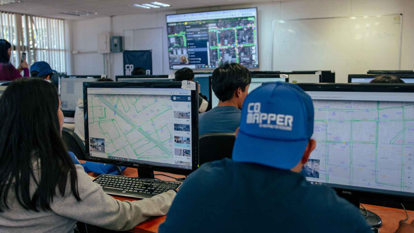
Image courtesy of Donobelo and Trufi. Shows the OSM mapping workshop by CoMapper.
Digital participatory mapping is a collaborative process of geographic representation, where local communities contribute to creating information about their living spaces using user-friendly technology tools. Far from being a purely technical exercise, it represents a cultural transformation: people become knowledge producers and data generators, taking part in the public policy cycle for the common good.
Through workshops, field trips, and collective editing sessions, students, volunteers, authorities, and local organizations generate real-time data that is integrated into OpenStreetMap and converted into GTFS files for use in mobility apps and urban planning systems. HOT has actively promoted this approach in Mexico as part of its global mission to democratize access to geospatial data, fostering the development of local communities with technical capacity and national network connections for territorial action.
Video courtesy of Donobelo and Trufi. It explores the public transport mapping experience in Oaxaca.
Since 2022, a series of mapping efforts have been implemented across the country: Zitácuaro, Zamora, and currently Toluca, Oaxaca, Salina Cruz, and Puerto Escondido. These were supported by the Deutsche Gesellschaft für Internationale Zusammenarbeit (GIZ) as part of the TranSIT program. HOT maintains an ongoing dialogue with local authorities across Mexico to offer methodological and technical guidance on collaboratively generating critical urban data. The strategy combines technical assessment, community training, data collection, and institutional sustainability in data governance. The involved cities face different challenges but share an urgent need to digitize their transport systems.
Mapping for local policy is an essential task that is rarely addressed due to limited capacity, time, and resources. Yet, neglecting it limits the reach of all urban planning areas. It is critical to organize the necessary mechanisms to eventually map most of the city’s critical infrastructure in a comprehensive and up-to-date manner. Though this may seem like a dream for local governments, it is achievable through collaboration—with civil society, academia, and citizens.
The methodology developed by HOT, Trufi, and Codeando México is structured in six stages:
-
Initial diagnosis: Technical assessment and interviews with local governments to define data needs, assess existing data, and evaluate current capacities. Diagnosis of the collaborative map status in OpenStreetMap.
-
Community training: Identification and strengthening of local technical communities. Recognition mechanisms for student involvement. Training students, collectives, and government staff in comprehensive mapping using OpenStreetMap, OSMTracker, and transport data use.
-
Data collection (desk and fieldwork): Mixed teams document city maps using open aerial imagery—critical infrastructure, full road network, mobility attractors, routes, frequencies, stops—using mobile apps.
-
Collaborative processing: Through datathons with trained communities, data is cleaned, structured, and integrated into the OSM ecosystem.
-
Socialization and integration: City data is published on OSM and released in vector and GTFS formats for apps like Rutómetro (a local Trufi App version). Data is shared with municipal and state governments and the public.
-
Sustainability and expansion: The collaborative mapping model is embedded into academic and service-learning programs, strengthening a national network of urban mappers engaged in various territorial themes.
The accumulated experience in Zitácuaro, Zamora–Jacona, and the cities of Toluca and Oaxaca has consolidated a scalable, participatory, and multisectoral model for collaborative public transport mapping in Mexico. Each case has contributed key lessons, enriching a national strategy grounded in evidence, civic innovation, and institutional collaboration.
In Zamora, Rosendo Farfán, Director of Mobility, notes: “The solution for cities lies in public transportation. Our goals are to improve quality and efficiency, reduce congestion, increase accessibility, and promote multimodal travel. It’s important to highlight that, for the first time, we have a clear route map, frequency indicators, schedules, and fares—thanks to the data we’ve meticulously collected over months of work.”
Guillermo Velázquez Velázquez and Ángel David Jiménez Hernández, volunteers in Salina Cruz, say: “This is the first time we’ve heard about such initiatives, and we’re pleasantly surprised. It’s clear that change is needed and that there’s a willingness to achieve it. Hopefully, more people start using technology to better understand routes and fares. When there are blockades, routes change, and people unfamiliar with the system get confused easily.”
Juan Berdeja, former Director of Planning and Policy at SEMOVI Oaxaca, adds: “Mapping routes helps the government develop strategies to identify what works on the ground and guide more realistic public policies.”
To learn more about each case, explore the following resources:
- 43 routes mapped in Zamora and Jacona
- 25,000 points of interest added to OSM in Toluca and Oaxaca
- 8,500 road errors corrected in Toluca and Oaxaca
- 330 public transport units documented and geolocated in Zamora and Jacona
- Active citizen apps like Rutómetro
- Municipal and state governments using the data
- University-level curriculum for technical volunteering
- National network of mappers trained across various territorial topics
We’ll be at the 10th edition of the Smart City Expo Latam Congress from June 10–12 in Puebla, Mexico. We’re hosting a one-hour discussion space to talk with city authorities about the challenges and potential of bringing this work to more mid-sized cities. Join us by registering here.
Distributed mapping with supervised citizen participation is transforming how Mexico and Latin America plan their territories—and daily mobility. Designed to be open, replicable, and low-cost, this action model generates tangible local impact while creating strategic links to global networks.
Based on HOT’s experience through the Urban Resilience Cities program in Latin America and the Caribbean, this approach has proven that local governments can build urban resilience using open mapping tools to address a wide range of challenges—from transport and risk management to the relationship between cities and the environment—for more sustainable development.
If your city struggles with public transport data gaps or seeks to strengthen evidence-based and participatory planning, this is your opportunity. Contact us at hublac@hotosm.org!