
Northeast Nevada is the kind of place where the highway runs long and the pauses between towns feel like whole chapters. The desert floor stretches toward distant ridges, sagebrush spilling to the horizon, and a wind that seems older than the fences and ranch gates it rushes past. Out here, the landscape doesn’t hurry, and neither do the people who’ve settled in its pockets of quiet.
Towns like Jackpot and Wells feel stitched into the basin country, their main streets holding diners, motels, and a few locals who know everyone by name. Farther out, you come to places where history still lingers in abandoned stage stops and old mining camps, reminders that this land once pulsed with booms and busts. The stories aren’t gone, they just wait in weathered boards and forgotten signs.
Closer to the Ruby Mountains, the land shifts to high valleys where ranching holds steady, and creeks run off peaks that locals call the “Alps of Nevada.” It’s a surprising kind of beauty, sharp and green in summer, snow-bound in winter, and always a world away from the rush of cities. These towns lean on that rhythm — steady, seasonal, and rooted.
Together they form a map of seclusion, not the kind that shuts you out but the kind that leaves space to breathe. Northeast Nevada’s towns remind you that life can be measured by open sky and the slow turn of weather, where the desert and mountains set the pace and the people simply live by it.
25. Wells: Crossroads Beneath the Peaks
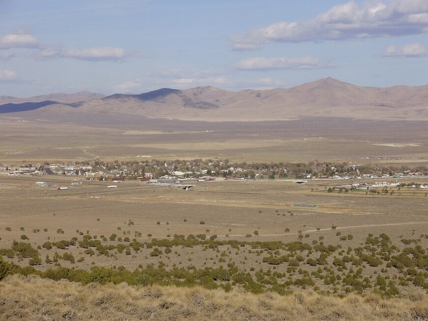
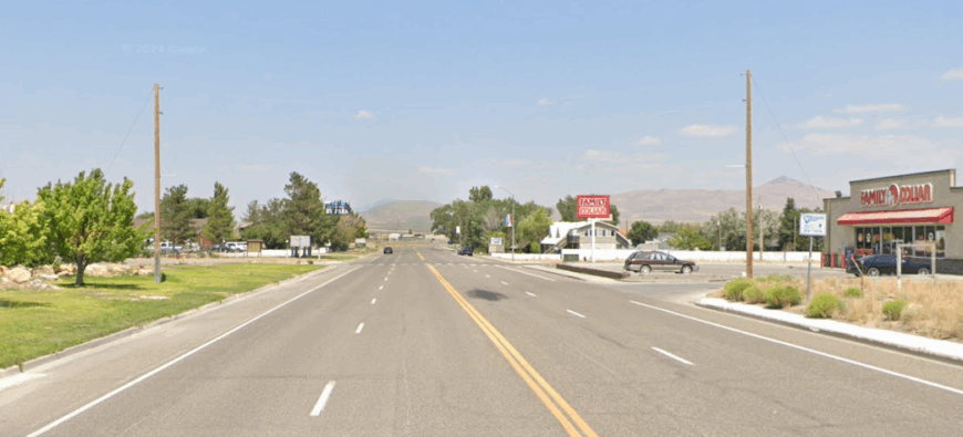
Wells may be a highway junction on the map, but in person it feels like a frontier town caught between sage flats and the looming East Humboldts. Old stone storefronts along Front Street speak of the railroad boom, while the quiet hum of modern life stays at a low murmur.
The draw here isn’t bustle but geography — Angel Lake glimmers high above in a glacial cirque, and the Ruby Mountains begin just beyond ranchland pastures. Travelers stop for fuel, but linger for the view that makes the town seem folded neatly under sharp ridgelines.
With its Basque heritage, cattle country roots, and a handful of historic motels, Wells sits at the threshold of wilderness. It feels less like a destination than a sturdy outpost, keeping watch where mountain and desert meet.
Where is Wells?
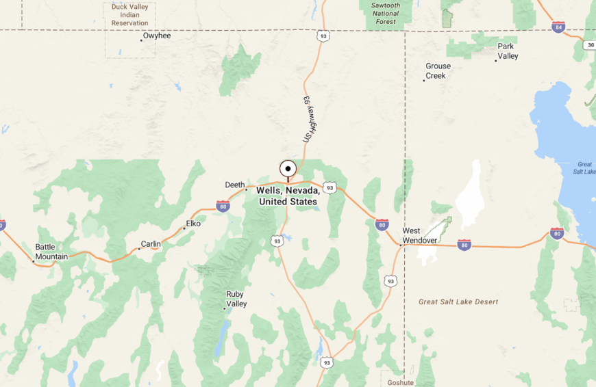
Wells lies in northeastern Nevada’s Elko County, at the junction of Interstate 80 and U.S. Route 93. The town is about 50 miles east of Elko and 60 miles west of the Utah line.
From its crossroads, roads lead toward the Ruby Mountains, Angel Lake, and long sweeps of sagebrush plain.
24. Midas: A Ghost Town with Golden Silence
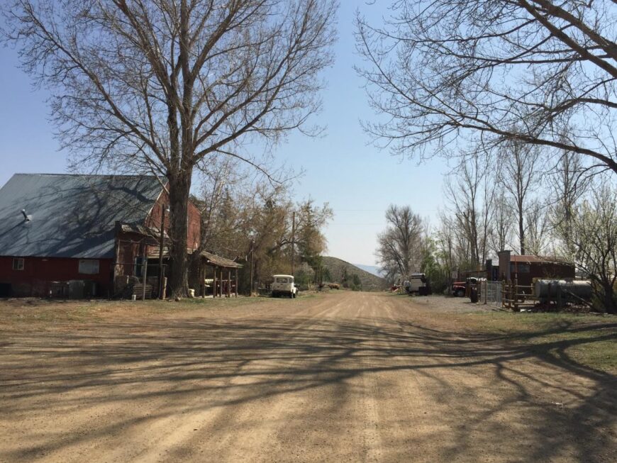
Tucked deep into Nevada’s high desert, Midas lies far from any major road, hidden among lonely sagebrush hills that keep it quietly off the map. Once a feverish boomtown, it now drifts in soft silence where old mining cabins and a weathered saloon still stand watch over dusty streets.
The air carries hints of rust, juniper, and stories best told at the town’s tiny outpost café. Visitors wander among abandoned gold sites, hike forgotten trails, or simply watch the desert stretch toward forever.
A few locals remain, ranching or keeping history alive for curious passersby. It’s the kind of place that makes you believe solitude still has a heartbeat.
Where is Midas?
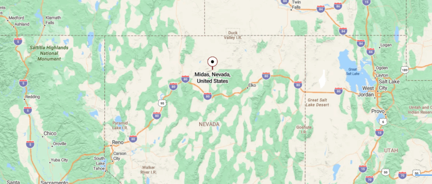
Midas sits in north-central Nevada’s Elko County, roughly 40 miles northwest of Tuscarora and about 75 miles north of Interstate 80 near Battle Mountain. Travelers reach it by turning off the highway onto long stretches of dirt roads that wind through high desert hills and sagebrush.
With no nearby towns and only open land stretching in every direction, its remoteness feels absolute. It’s close enough to find with intention, but far enough to make the rest of the world fade away.
23. Goshute: Ancestral Peace in the Desert
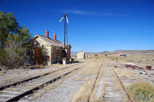
Goshute barely announces itself — a handful of rugged buildings resting at the foot of the Deep Creek Range where Nevada blurs into wilderness. Shadows sweep across the basin as if the land remembers every bootprint, whispering stories older than the town itself.
This is a place for wandering quietly: tracing faint trails to alpine streams, discovering petroglyphs carved into sun-bleached rock, or watching summer storms gather over the ridges. There are no shops or sidewalks, only a small community tending cattle and carrying forward long-held traditions tied to the desert.
Night falls suddenly here, unveiling stars so sharp they feel almost close enough to touch. It’s the kind of place you don’t stumble upon — you arrive because you were meant to.
Where is Goshute?
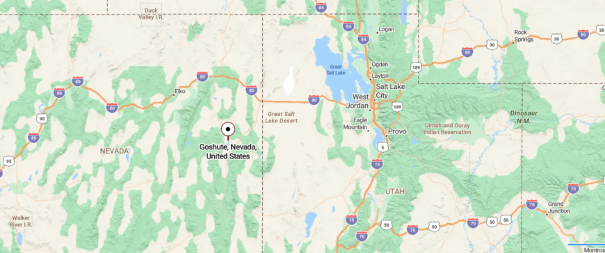
Goshute lies near the Nevada–Utah border in White Pine County, southeast of West Wendover. The area sits at the edge of the Deep Creek Range, where desert basin land presses against rugged mountain slopes.
Though the old settlement itself has faded, the name endures as a reference point tied to the Goshute people who lived across this stretch of high desert. Today, the landscape feels defined more by geography than community, marked by quiet ridges and long horizons.
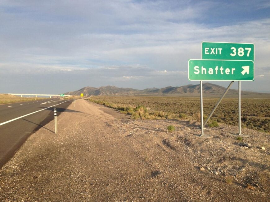
22. Shafter: Echoes Along the Railroad
Tucked far northeast in the Great Basin, Shafter feels like a forgotten dot on the Nevada map—hidden by endless sagebrush flats and distant, rugged mountains. Once a railroad boomtown, it now lingers in near silence, where weatherworn ruins and whispering winds create an eerie kind of calm.
With no major highway in sight, only dusty backroads guide the occasional traveler into its stillness, making every visit feel like a secret discovered. Visitors wander through crumbling stone foundations, trace the history of the old Lucin Cutoff, and hike the high desert while watching pronghorn drift across the open horizon.
With no real industry left, the town lives on through memory, solitude, and stubborn sun-baked resilience. It’s the kind of place that makes you wonder how loneliness can be so beautiful.
Where is Shafter?
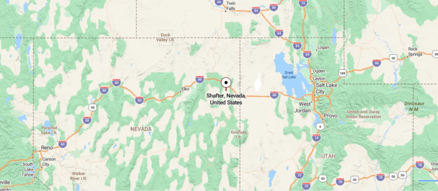
Shafter sits in northeastern Nevada’s Elko County, about 30 miles east of Wells and roughly 10 miles off U.S. Route 93. Getting there involves following a sparsely traveled spur road that branches into the desert and runs parallel to old railroad tracks.
With nothing but sagebrush flats, distant mountains, and the remnants of a mining past, its surroundings feel almost untouched by time. It’s the sort of stillness that makes you notice how much sky there really is.
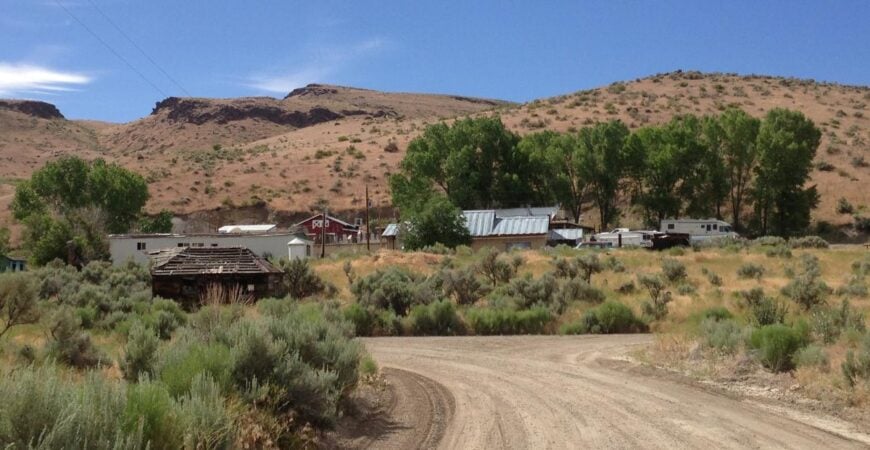
21. Toano: Forgotten Station in the High Desert
Far from Nevada’s main highways, Toano lies quietly in the high desert where empty land stretches to every horizon. Once a bustling rail stop, it is now little more than sun-bleached timbers, rusted tracks, and echoes caught in the wind.
Few wander this way except to explore forgotten rail relics, follow faint trails into sagebrush country, or watch jackrabbits dart between tufts of grass. There’s no town center, no hum of commerce — just the stubborn remains of history resisting the pull of time.
Ranching once anchored life here, though most signs of livelihood have drifted away like dust. It’s the kind of place that makes silence feel like its own destination.
Where is Toano?
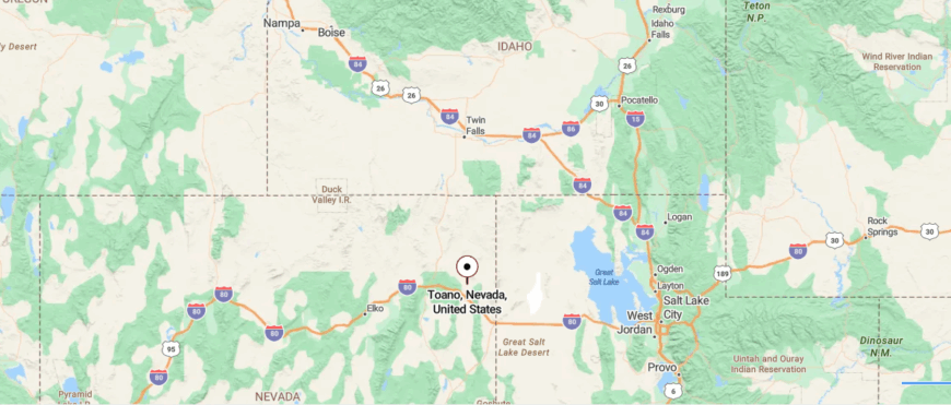
Toano lies in far northeastern Nevada’s Elko County, situated about 35 miles east of Wells and just north of Interstate 80 near the Utah border. The route there follows a former railroad frontage road that slips away from the interstate and crosses wide, empty desert flats.
Bordered by sagebrush plains and distant mountain silhouettes, it feels set apart from the rhythms of nearby travel. It’s the kind of quiet outpost where you arrive by choice — and stay for the silence.
20. Palisade: Canyon Views and Solitude
Hidden in a canyon carved by the Humboldt River, Palisade sits shielded by walls of rugged rock that make it feel worlds away from Nevada’s busy highways. What was once a raucous Wild West town now rests in near-forgotten quiet, its old stone and timber structures slowly surrendering to time.
Curious travelers stop to roam the discarded railbeds, photograph crumbling storefronts, and hike the nearby bluffs where eagles circle overhead. There’s no modern bustle here — only the sound of wind threading through cottonwoods and the distant rattle of passing freight.
Mining and railroading once gave Palisade its pulse, but today solitude is its last enduring trade. It’s the kind of place that makes you feel like you’ve stumbled into a ghost still dreaming of its glory days.
Where is Palisade?
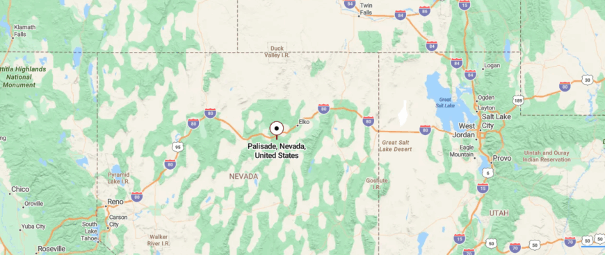
Palisade sits in north-central Nevada’s Eureka County, roughly 35 miles south of Elko and about 20 miles off Interstate 80 along the Humboldt River corridor. Reaching it means turning onto a narrow county road that threads through rocky canyons and follows the bends of the old railroad grade.
With only rugged cliffs, desert brush, and the river rushing below, its surroundings feel dramatically removed from busy routes. It’s a place where the landscape itself seems determined to keep the outside world at a respectful distance.
19. Jiggs: Ranching Life on the Fringe
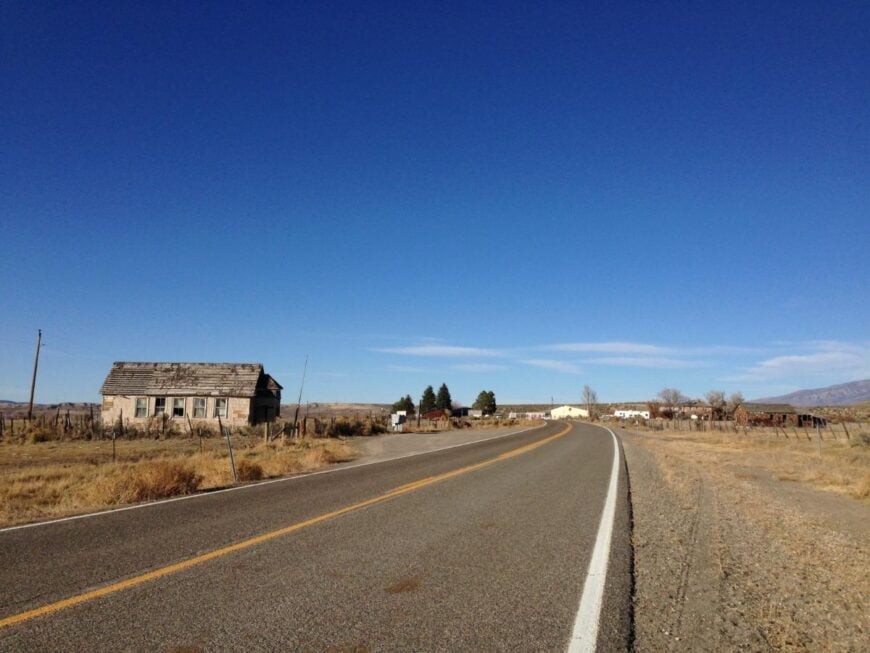
Way off the main road in central Elko County, Jiggs is the kind of spot you might miss unless you were truly looking for it. Tucked amid rolling sagebrush hills and surrounded by ranchland, the town feels isolated not by distance alone but by its stubborn slice of quiet.
There’s a tiny cluster of buildings — including a weathered old bar and community hall — that hint at its rowdy cattle-town past. Visitors might drop by to snap photos of quirky roadside signs, attend a small-town barbecue, or hike the nearby Ruby Mountains rising just beyond the valley.
Ranching still keeps the place alive, though on most days it seems time has relaxed its grip and decided to linger. It’s the sort of town that reminds you how much charm can fit between wide skies and very few neighbors.
Where is Jiggs?
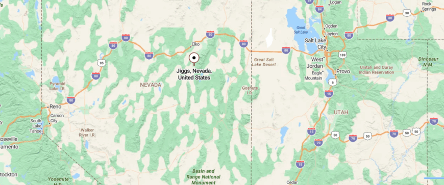
Jiggs sits in the high desert of northeastern Nevada’s Elko County, some 30 miles south of the city of Elko. The drive winds along State Route 227 before veering onto smaller county roads that narrow as they enter ranchland.
Pockets of cottonwoods, open rangeland, and the distant Ruby Mountains surround it with quiet instead of neighbors. You don’t just pass through Jiggs — you arrive knowing you’ve stepped into a pocket of time few people find.
18. Ruby Valley: Hidden at the Base of the Rubies
Cradled in a long, open basin southeast of Elko, Ruby Valley feels tucked behind its towering namesake mountains like a secret held close to the earth. Miles of gravel roads and sweeping ranchland separate it from the pace of everyday life, making each arrival feel earned.
The valley breathes a slow rhythm — sandhill cranes call from marshy meadows, cottonwoods rustle near century-old homesteads, and the wide sky seems to stretch forever. Those who come fish the cool waters of the Ruby Lake National Wildlife Refuge, wander old wagon tracks, or simply watch the light change against the jagged Ruby Mountains.
Ranching remains the backbone of the valley, marked by weathered fence posts and cattle grazing across vast sage fields. It’s the kind of place that reminds you how solitude can feel expansive, not empty.
Where is Ruby Valley?
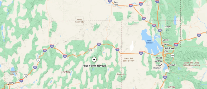
Ruby Valley stretches across eastern Nevada’s Elko County, about 60 miles southeast of Elko and nearly 30 miles east of the closest highway near Spring Creek. The route there involves turning off pavement onto gravel backroads that run along the base of the Ruby Mountains, growing lonelier with every mile.
Framed by marshlands, wide basins, and towering peaks, it feels worlds away from towns and traffic. It’s the sort of hidden valley where silence gathers — reminding you just how remote real beauty can be.
17. Independence Valley: Windswept and Wild
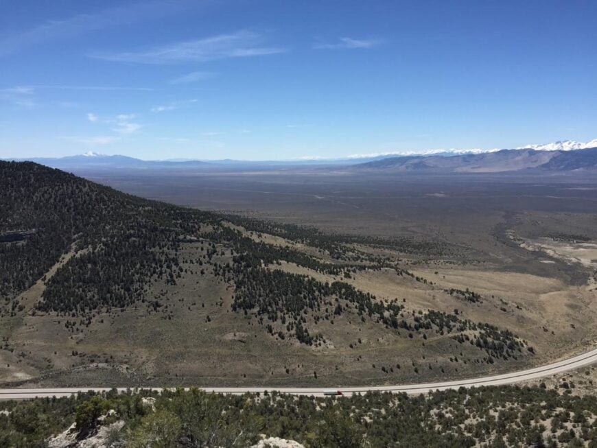
Tucked far off Interstate 80, Independence Valley sprawls quietly between mountain ranges, so vast and open it feels like a world left to sky and sage. Reaching it means long drives on gravel roads where antelope outnumber travelers and dust twists into tiny cyclones across the flats.
The valley itself hums with understated life — ranches scattered miles apart, wind pushing through cottonwoods, and distant ridgelines purpled by dusk. Visitors come to hunt, camp near hidden springs, or explore remnants of Basque sheep camps that once dotted the hills.
Cattle ranching still anchors the community, though most days the land seems content to exist with more wildlife than people. It’s the kind of place that makes you appreciate how silence can stretch and fill the heart.
Where is Independence Valley?
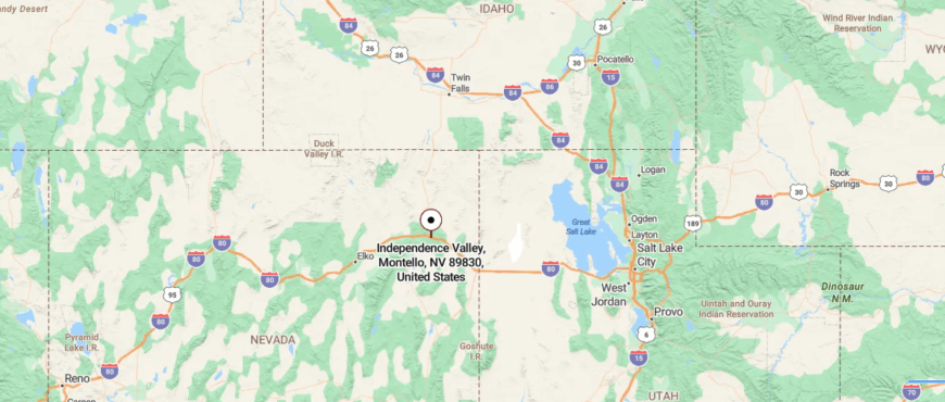
Independence Valley lies in northeastern Nevada’s Elko County, roughly halfway between Wells and Carlin and nearly 25 miles north of Interstate 80. Travelers turn off the interstate onto dirt and gravel roads that disappear into vast sagebrush plains before reaching the settlement tucked near the Pequop Mountains.
Surrounded by sweeping basin land, distant ridges, and few signs of modern life, its location feels profoundly removed. It’s the kind of landscape where the road behind you fades — and the quiet ahead stretches endlessly.
16. Deeth: High Desert Quietude
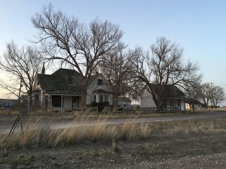
Along a quiet stretch of northeastern Nevada, Deeth sits where the railroad once promised bustle but left behind only whispers and weathered cabins. It feels secluded not for lack of roads, but because time seems to have slowed the moment you turn off the highway.
There’s a scattering of historic ranch buildings, an old post office, and vast rangeland where hawks ride thermals above grazing cattle. Travelers pass through to photograph the rustic remnants, follow dirt tracks into the East Humboldt wilderness, or hunt along nearby creekbeds.
Ranching still gives the area its heartbeat, though the land seems determined to keep its own pace. It’s the sort of place that reminds you how the past can linger quietly in open spaces.
Where is Deeth?
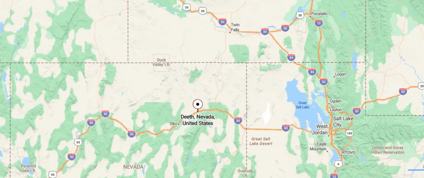
Deeth sits in northeastern Nevada’s Elko County, about 20 miles east of Elko and just north of Interstate 80 along a lightly traveled county road. The turnoff leaves the highway behind quickly, trading bustle for open pasture land and railroad-era remnants that hint at its early frontier roots.
Surrounded by broad sagebrush flats and distant mountain silhouettes with no major towns nearby, it still feels tucked far from the present day. It’s the kind of quiet place where the sky seems bigger — and time stretches just a little slower.
15. Metropolis: A Ghost Town with Grand Dreams
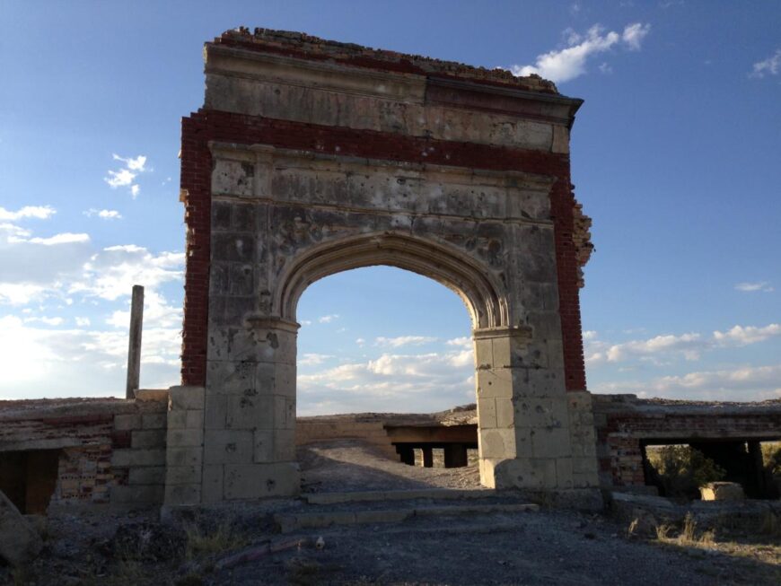
Marooned on a lonely stretch of northeastern Nevada, Metropolis is a vanished dream — a once-grand farming community now reduced to ruins and rattling fences. Its sense of seclusion comes not from remoteness alone, but from the eerie absence of what was meant to be: wide boulevards now overgrown, grand gateways crumbling into dust.
Travelers wander through the skeletal remains of the old hotel, trace irrigation ditches that never truly tamed the desert, and peer at brick schoolhouse walls still standing against the wind. There’s no town center anymore, just the sound of meadowlarks and coyotes echoing across sagebrush flats.
Ranching persists on nearby lands, a quiet successor to the collapsed promise of early 1900s agriculture. It’s the kind of place that makes you marvel at how ambition fades, yet stories remain etched into the land.
Where is Metropolis?
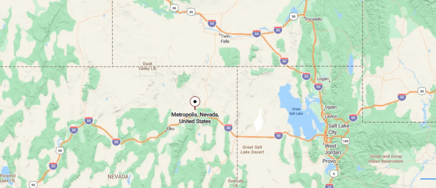
Metropolis stands in northeastern Nevada’s Elko County, roughly 15 miles north of Wells and nearly 10 miles off Interstate 80. Reaching it requires leaving the highway and following a dusty ranch road through flat sagebrush country toward the Copper Mountains.
With only scattered foundations, vast open land, and distant peaks surrounding what remains of the town, its isolation feels strikingly complete. It’s a place where the horizon goes on forever — and civilization feels like a memory.
14. Lamoille: At the Gateway to the Rubies
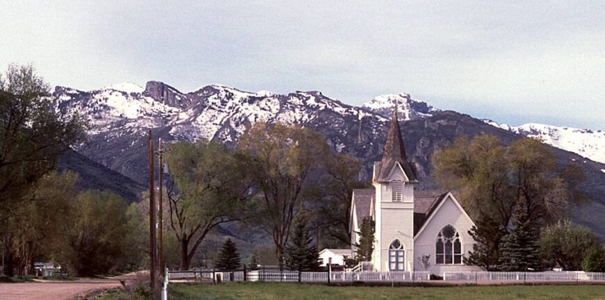
Lamoille seems too small to warrant its reputation until you drive into the canyon that shares its name. Cottonwoods arch over fences, red barns sit close to creeks, and the jagged granite of the Ruby Mountains rises without ceremony at the town’s edge.
It feels like Nevada’s rare alpine hamlet — with trails, waterfalls, and meadows just minutes away. Lamoille’s church steeple, ranch houses, and a scattering of bed-and-breakfasts keep its pace slow, almost domestic, though wilderness presses in from all sides.
The canyon itself has been called the “Yosemite of Nevada,” and from Lamoille you step directly into that drama. It’s a reminder that seclusion isn’t only about distance — sometimes it’s about being tucked into a natural amphitheater.
Where is Lamoille?
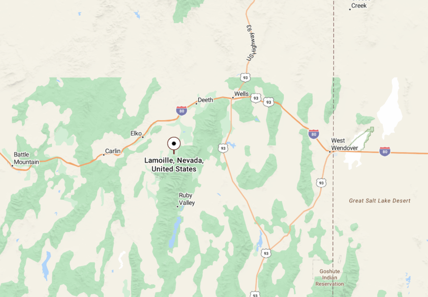
Lamoille sits in northeastern Nevada’s Elko County, about 20 miles southeast of Elko.
It rests at the mouth of Lamoille Canyon along State Route 227, the byway that climbs into the heart of the Ruby Mountains.
13. Baker: Edge of the Wilderness
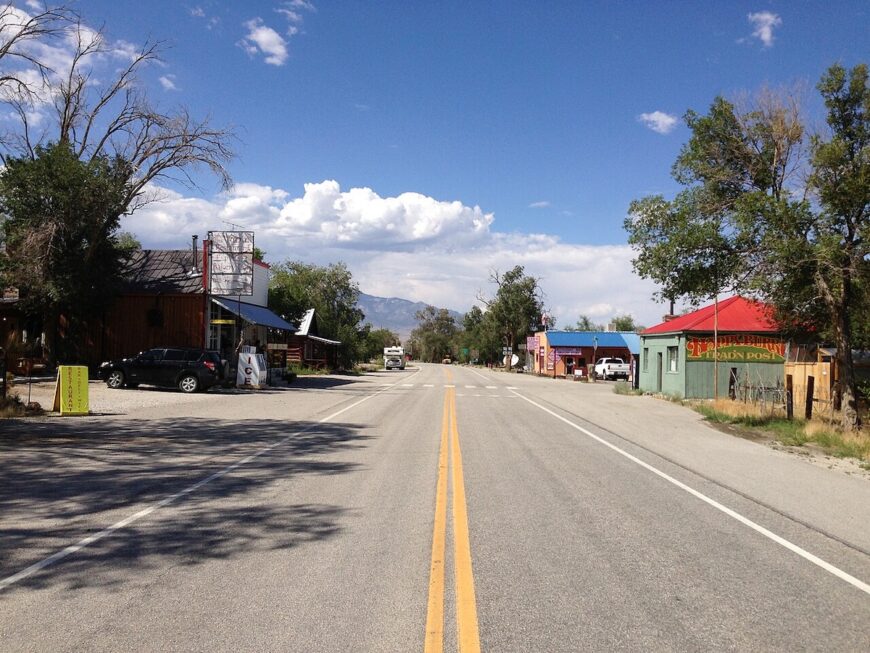
Baker has fewer than a hundred residents, but it feels like a hinge between two worlds: the high desert stretching west and the soaring peaks of the Snake Range rising east. On one side are dusty ranch fields, on the other the bristlecone forests and alpine lakes of Great Basin National Park.
The town itself holds a café, a couple of inns, and the kind of post office that doubles as a gathering place. Nights are darker than dark here, with some of the clearest stargazing in the continental United States.
Baker’s solitude is not absolute — travelers pass through on their way to Wheeler Peak — but its scale and setting keep it quiet. It’s a village pressed against wilderness, surviving at the edge of Nevada’s loftiest mountain.
Where is Baker?
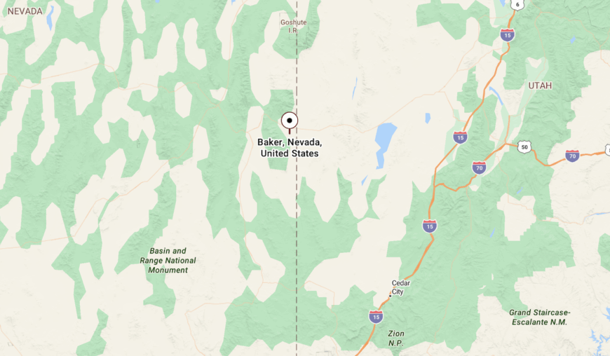
Baker is in White Pine County, about 60 miles east of Ely along U.S. Route 50 and State Route 487.
It sits just five miles from the entrance to Great Basin National Park, shadowed by Wheeler Peak and close to the Utah line.
12. Tippett: Wide Horizons and Stillness
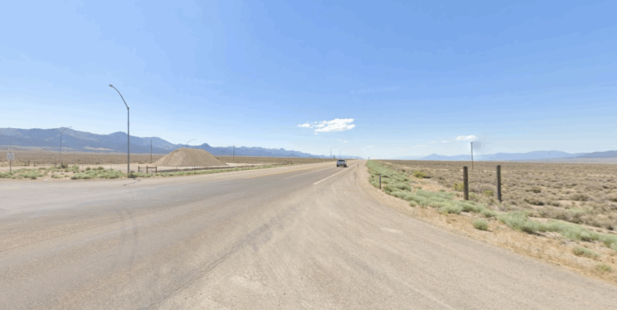
Far from major highways in the eastern Nevada desert, Tippett sits quietly at the foot of isolated mountain ranges where vast ranchland touches the sky. The town is little more than a sprinkling of structures, making it feel as though civilization has politely stepped back to let the land speak.
Travelers who make the journey fish the cool ponds near Tippett Creek, explore remnants of historic ranch outposts, and hike trails that weave toward the towering Snake Range. There’s no bustle here — just the soft rush of wind through sagebrush and the distant clatter of cattle moving across open range.
Ranching is still the backbone of life, steady and enduring beneath endless skies. It’s the sort of place that shows how seclusion can feel like a gentle invitation rather than a barrier.
Where is Tippett?
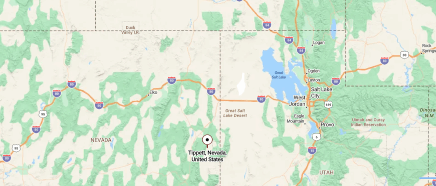
Tippett sits in White Pine County, strung along U.S. Highway 93 between West Wendover and Ely. It lies in a wide stretch of valley floor where the desert highway runs straight for miles, with the Antelope Range rising quietly to the west.
The former stage stop is now more landmark than town, its name carried on maps and road signs. Around it, ranchland and open flats stretch toward the Steptoe Valley, giving travelers a sense of Nevada’s vast distances and empty horizons.
11. North Fork: Ranchland at the River’s Bend
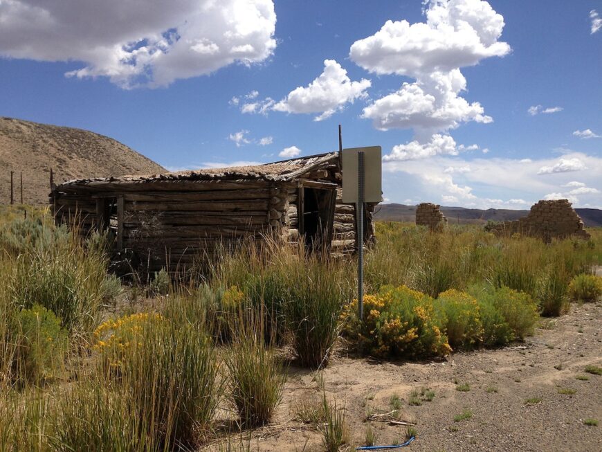
North Fork rests quietly where its namesake river joins the main Humboldt, a tiny ranching outpost that has always lived at the pace of cattle and creek. There’s little more than a handful of houses and ranch buildings, but the wide pastures and willow-lined banks make it feel complete.
This place once buzzed as a stage stop and supply point for travelers pushing into the Rubies. Today, its seclusion shows in the long gaps between neighbors, the steady roll of ranch trucks on gravel, and the quiet evenings that settle over hayfields.
Travelers find no tourist bustle here, only a landscape of cottonwoods, fences, and open range. It’s a reminder that in Nevada, community doesn’t need size — just enough persistence to keep life moving on the land.
Where is North Fork?
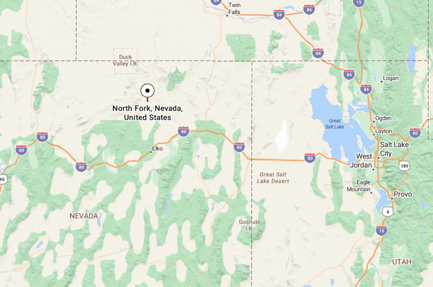
North Fork lies in northeastern Nevada’s Elko County, about 25 miles north of Elko along State Route 225.
The settlement sits where the North Fork of the Humboldt River meets the main river, surrounded by rangeland and foothills that open toward the Ruby Mountains.
10. Pequop: Seclusion Amidst Majestic Ranges
Pequop is a tiny settlement that barely registers on most maps, with a population that I estimate to be less than 50 residents. Nestled amidst the Pequop Mountains, this area offers breathtaking views and an abundance of wildlife.
Hiking and horseback riding are popular activities here, allowing you to immerse yourself in the untouched landscape. There’s no major industry, which adds to its untouched charm, but the railroad does pass nearby, echoing the town’s historical roots.
What makes Pequop truly secluded is its remote location amid mountain ranges, with minimal development and vast open spaces that make you feel like you have the world to yourself.
Where is Pequop?
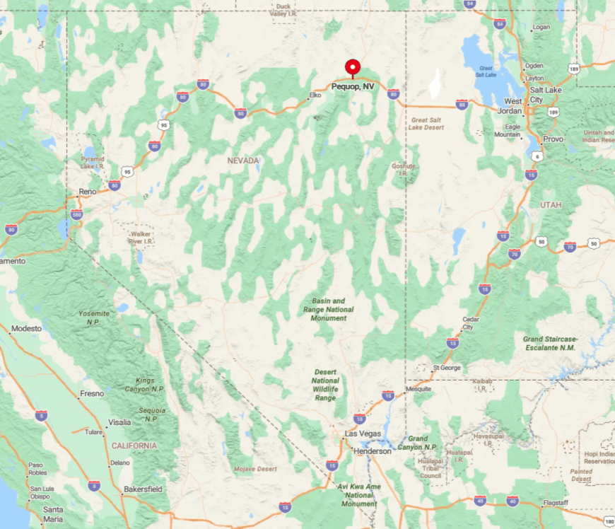
Located in Elko County, Pequop sits just off Interstate 80, but don’t let that fool you—it’s surrounded by miles of rugged terrain. The town’s seclusion is amplified by the surrounding mountains that act as natural barriers, making it feel far removed from the rest of the world.
Getting there involves a drive through sweeping plains and up into the mountains, which I find both exhilarating and calming. The lack of nearby urban centers and sparse population density make Pequop a perfect spot for those yearning for solitude amid Nevada’s majestic ranges.
9. Contact: Peaceful Living in Rugged Terrain
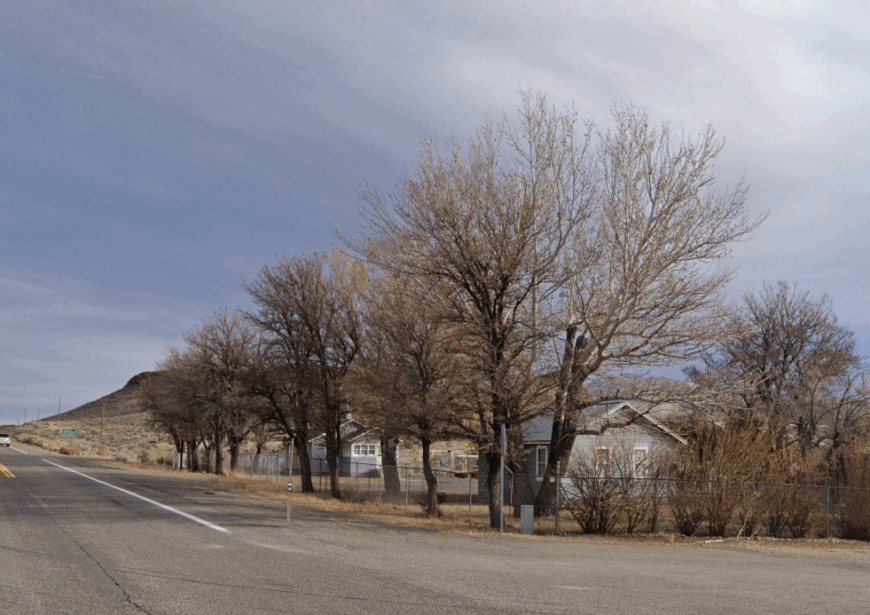
Contact is a sparsely populated area with an estimated population of around 30 people. This former mining town is rich in history, and I find its remnants of old mines and structures fascinating to explore.
The rugged hills surrounding Contact are perfect for off-road adventures and hiking, offering sweeping views of the Nevada landscape. While there’s no significant industry today, the town’s history is deeply rooted in mining, which adds an intriguing layer to its quiet atmosphere.
What makes Contact secluded is its remote location amid Nevada’s rugged terrain, where the vastness of the land and the scarcity of modern development create a peaceful haven away from the noise of city life.
Where is Contact?
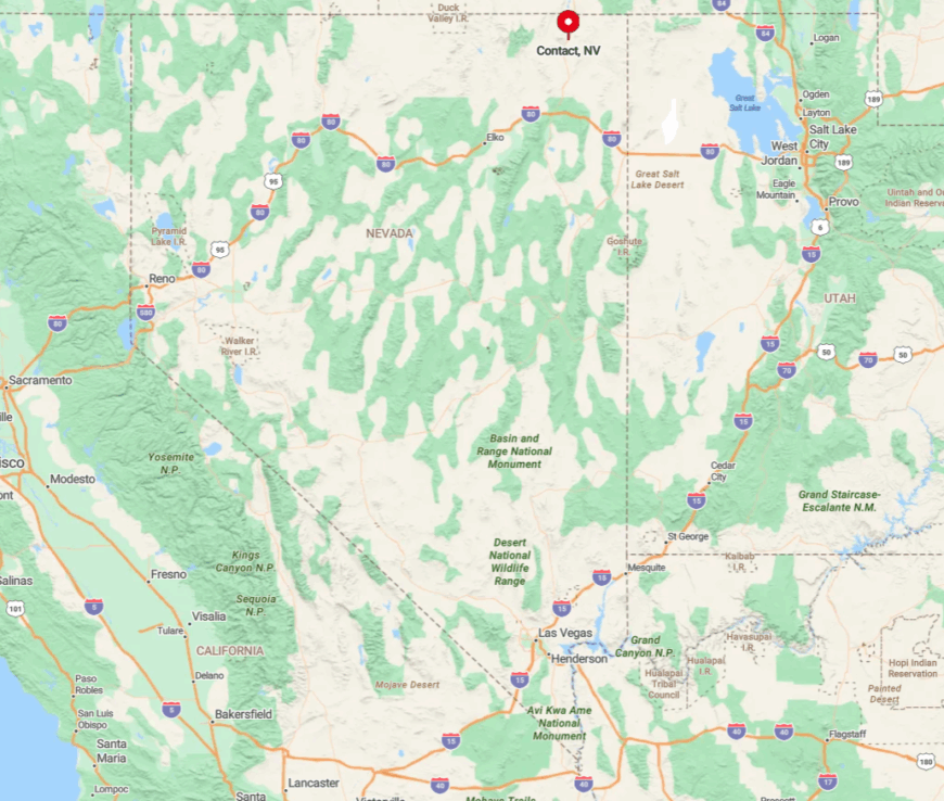
Contact is located in Elko County, just off U.S. Route 93, north of Wells. The town’s seclusion is enhanced by the surrounding hills and the lack of nearby major urban centers.
To get there, I usually drive along the scenic stretches of highway that pass through expansive deserts and rolling hills, providing a sense of escape with every mile.
The sparse population and the rugged surroundings make Contact feel like a hidden retreat, perfect for those seeking tranquility in Nevada’s vast landscapes.
8. Currie: Serenity in Expansive Plains

Currie is a remote area with a population of fewer than 50 residents, characterized by its expansive plains and open skies. The town offers a tranquil lifestyle where you can enjoy activities like stargazing, wildlife watching, and exploring the vast open spaces.
There’s little in the way of industry, which means minimal noise and pollution—something I greatly appreciate when visiting. Currie’s large lot sizes and low population density make it perfect for anyone desiring privacy and room to roam.
The sheer openness of the land is what makes Currie truly secluded, providing a serene environment that’s hard to find elsewhere.
Where is Currie?
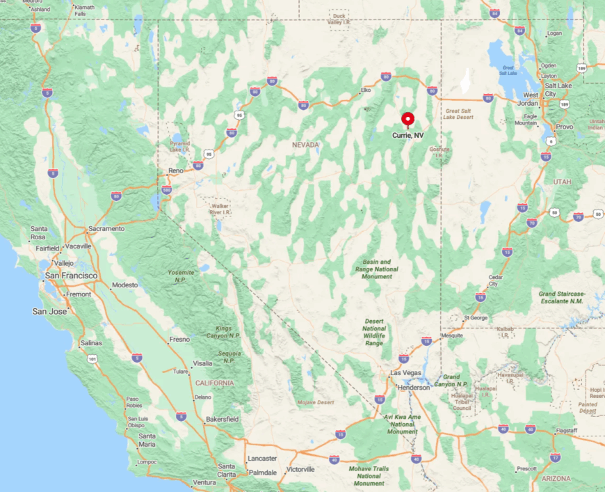
Situated in White Pine County along U.S. Route 93, Currie is quite a distance from any major city. Its seclusion stems from its placement amid expansive plains and the long stretches of road that connect it to other towns.
Getting there involves a journey through Nevada’s characteristic desert landscapes, which I find both peaceful and awe-inspiring. The isolation of Currie is amplified by the vastness of the surrounding terrain, making it an ideal spot for those looking to disconnect and find solace in nature.
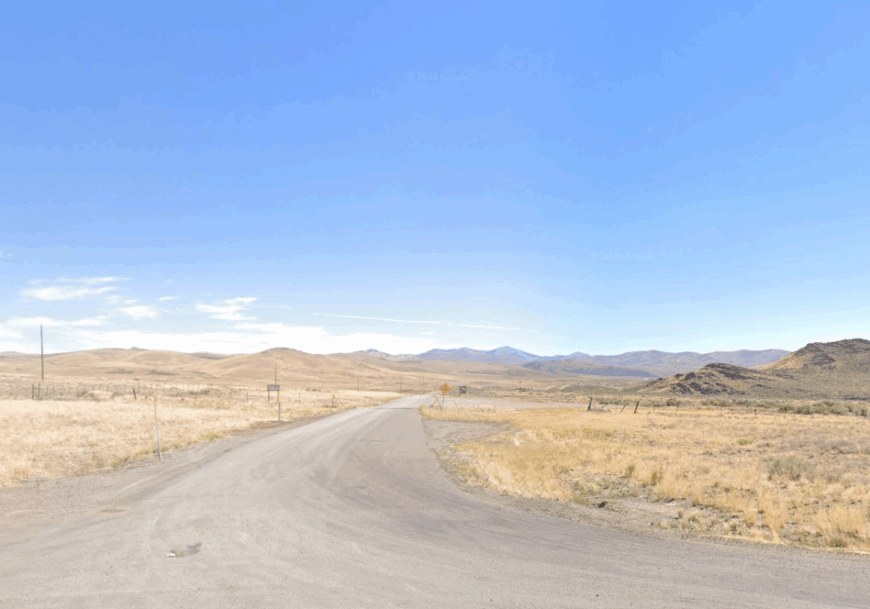
7. Oasis: A Tiny Community Amid Vast Deserts
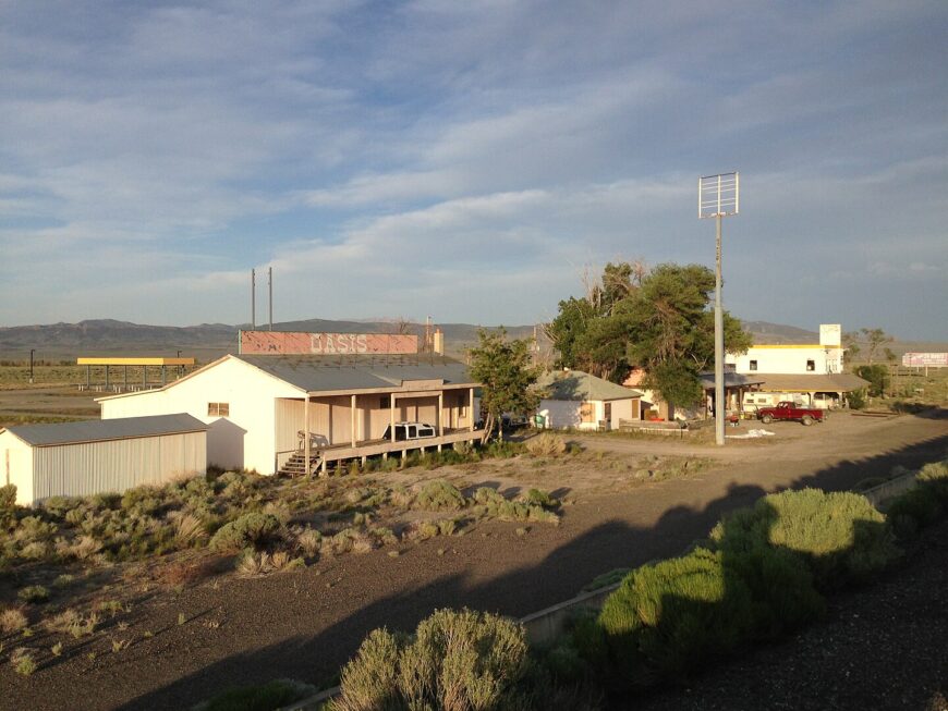
Despite its name, Oasis never grew into the settlement its location might have promised. It lies at the junction of I-80 and U.S. 93 Alt., tucked into the Pequop Mountains where emigrant trails once crossed.
For ranchers, the site offered a touch of water and a base for grazing, but the community never grew beyond a scattering of homesteads and the marker on the highway. Travelers still register it as a landmark more than a destination.
In modern Nevada, Oasis is defined less by population than by geography. The sign remains, pointing to a place where mountains lift from the sagebrush and the road bends toward deeper country.
Where is Oasis?
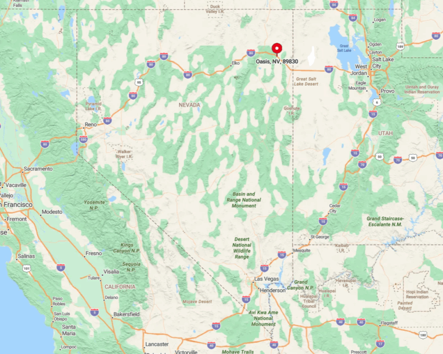
Oasis is located in Elko County, near the border with Utah, and is accessible via dirt roads branching off major highways. Its secluded nature is heightened by the miles of desert that separate it from other communities.
When I visit Oasis, the journey itself feels like an adventure, driving through stretches of untouched landscape. The limited accessibility and the surrounding natural environment make Oasis a perfect spot for those seeking solitude amid the deserts of Northeast Nevada.
6. Gold Creek: An Isolated Historic Locale
Gold Creek is an unincorporated community with a rich history dating back to Nevada’s mining boom, and currently has a population of fewer than 50 people.
I love exploring the historic sites here, including old mining structures and artifacts that tell tales of the past. The area offers outdoor activities like hiking and horseback riding through undeveloped land.
There’s no significant industry today, which keeps the environment pristine and the community quiet. The seclusion of Gold Creek comes from its isolation in the vast wilderness, with ample undeveloped land that makes it ideal for those seeking a secluded environment steeped in history.
Where is Gold Creek?
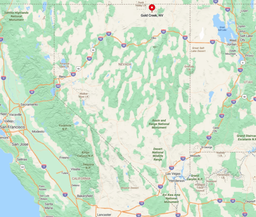
Gold Creek is situated in Elko County, northwest of the city of Elko. The town is nestled in a remote area that’s accessible via dirt roads, further enhancing its sense of isolation.
Traveling to Gold Creek involves navigating through valleys and over hills, which I find adds to the charm and anticipation. The absence of nearby towns and the expansive surrounding wilderness make Gold Creek a hidden gem for those looking to escape into a peaceful and historic locale.
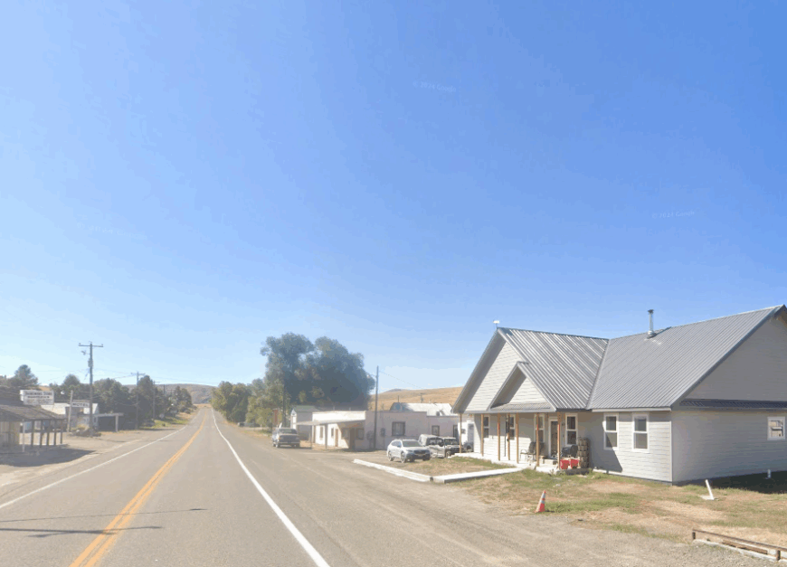
5. Jackpot: Quiet Living on the Border
Jackpot is a small town with a population of around 1,000 people, offering a blend of rural charm and seclusion. Located just over 10 miles from the Idaho border, the town is known for its casinos and as a stopover point for travelers.
Beyond the gaming, I enjoy the quiet parks and golf courses that provide leisurely activities. While tourism is a main industry, the town retains a peaceful atmosphere due to its remote location.
Jackpot’s seclusion is enhanced by the open land that surrounds it, creating a buffer from larger urban centers and allowing for a tranquil lifestyle.
Where is Jackpot?
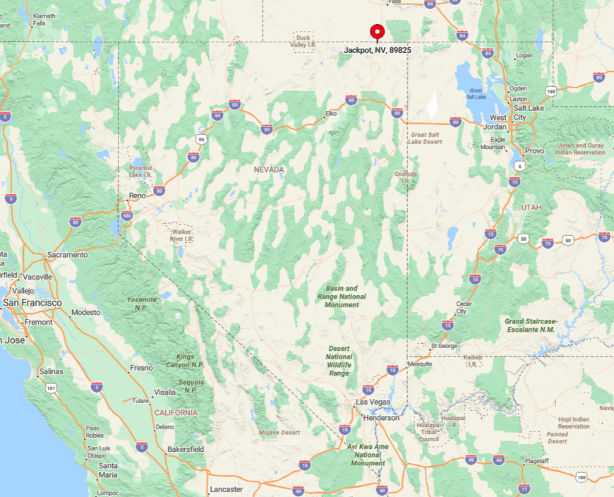
Situated in Elko County along U.S. Route 93, Jackpot is the northernmost town in Nevada before crossing into Idaho. Its distance from major cities—over 70 miles from Twin Falls, Idaho—contributes to its secluded feel.
Getting there involves a scenic drive through high desert landscapes that I find both calming and picturesque. The town’s location on the border and the vast open spaces around it make Jackpot a unique spot for quiet living while still offering essential amenities.
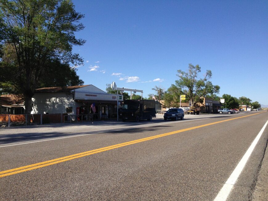
4. Mountain City: A Hidden Retreat in the Mountains
Mountain City is a small town near the Idaho border with an estimated population of less than 100 residents. Tucked away in the Owyhee Mountains, the area offers scenic vistas and abundant outdoor activities like fishing, hunting, and hiking.
There’s a strong sense of community here, which I appreciate whenever I visit. The main industries are ranching and some small-scale mining, contributing to its rustic charm.
Mountain City’s seclusion is due to the natural barriers provided by the surrounding mountains and its distance from larger towns, making it a perfect hideaway for those seeking peace amid nature.
Where is Mountain City?
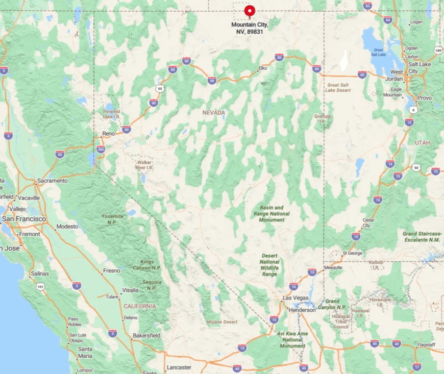
Located in Elko County along State Route 225, Mountain City sits close to the border with Idaho. Its hidden nature is amplified by the mountainous terrain that encircles it, creating a sense of remoteness.
I find that the drive to Mountain City, through winding mountain roads and breathtaking scenery, is an adventure in itself. The town’s isolation from major highways and urban centers ensures a quiet environment where one can truly disconnect and unwind.
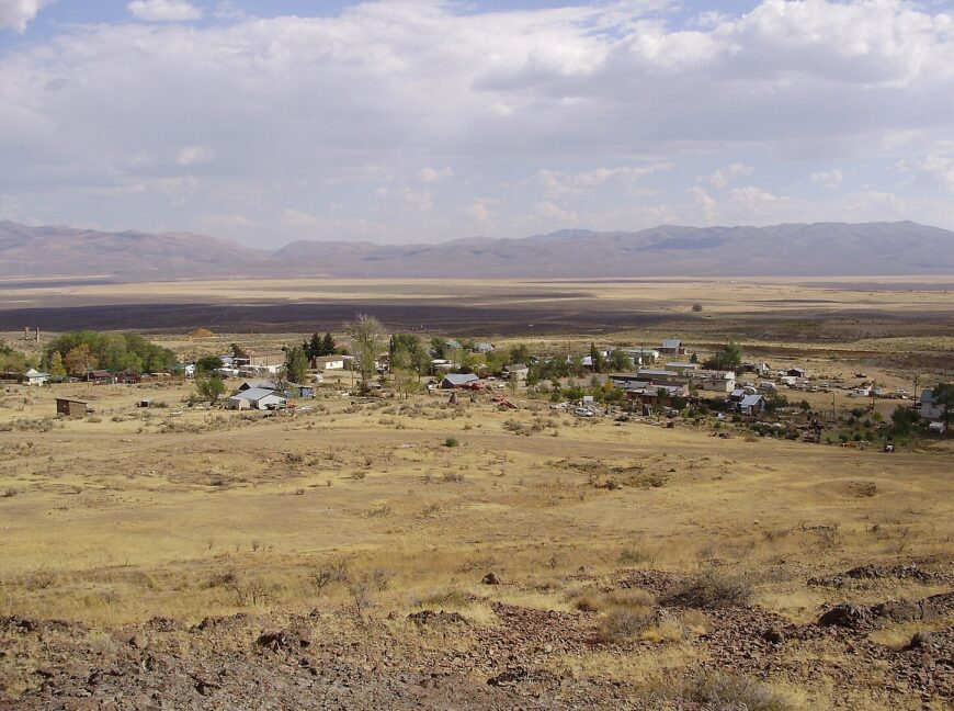
3. Montello: Tranquility Along the Rails
Montello is a peaceful town with a population of about 80 people, situated along a historic railroad line. The town offers tranquility and a glimpse into Nevada’s railroad history, which I find captivating.
Activities here include exploring the surrounding desert, bird watching, and enjoying the quiet atmosphere. There are minimal industries apart from some ranching and railway operations.
Montello’s seclusion comes from its remote location and the expansive landscapes that surround it, making it ideal for a serene lifestyle away from urban distractions.
Where is Montello?
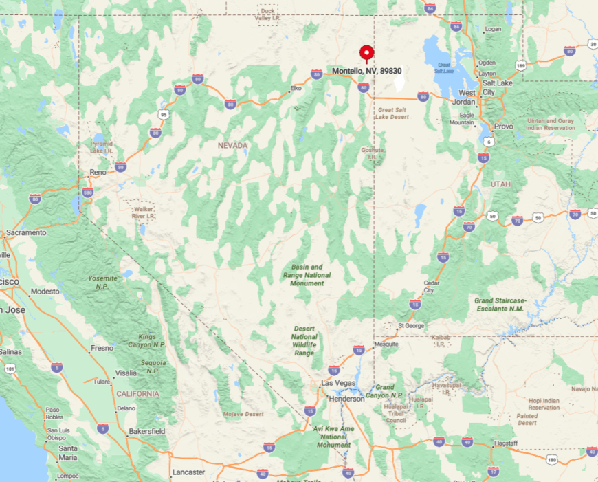
Montello is located in Elko County, near the Utah border, accessible via State Route 233. The town’s seclusion is accentuated by its distance from major cities and the vast stretches of desert that lie between it and other settlements.
The journey to Montello takes you through some of Nevada’s most open and unpopulated areas, which I find both calming and humbling. Its location along the rails adds a historical charm while maintaining a peaceful environment perfect for those seeking solitude.
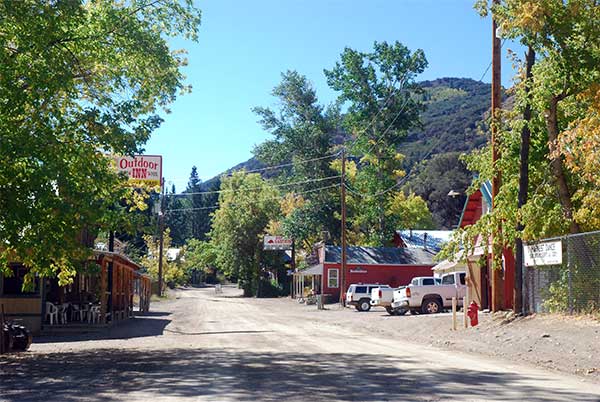
2. Tuscarora: An Artistic Haven in the High Desert
Tuscarora is a quiet community with a population of around 50 people, known for its art colony nestled in the high desert. The town attracts artists and creatives who, like me, are inspired by the vast open spaces and serene environment.
Activities include visiting art studios, exploring historical sites, and enjoying the rugged beauty of the landscape. There’s a small artist community that contributes to the local culture, but otherwise, there’s little industry to speak of.
Tuscarora’s seclusion is perfect for those seeking solitude and inspiration, with its remote location offering peace and a break from the hectic pace of city life.
Where is Tuscarora?
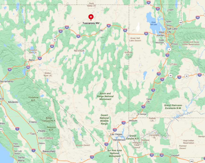
Located in Elko County, northwest of the city of Elko, Tuscarora is accessible via a long drive on gravel roads that wind through the desert. The town’s seclusion is heightened by the lack of paved roads and the vast distances to other towns.
I find that the journey itself, through the quiet and expansive high desert, sets the tone for a peaceful retreat. Tuscarora’s isolation makes it a unique haven for artists and anyone looking to immerse themselves in the tranquility of Nevada’s open spaces.
1. Jarbidge: A Remote Mountain Gem
Jarbidge is perhaps the most secluded town in Northeast Nevada, with a population of about 25 residents. Nestled deep in the Jarbidge Wilderness, this mountain gem offers unmatched privacy and natural beauty.
I love hiking the numerous trails, fishing in the Jarbidge River, and absorbing the area’s rich history as a former gold mining town. There’s no predominant industry today, which helps preserve its untouched charm, though some small businesses cater to outdoor enthusiasts.
What makes Jarbidge truly secluded is its location; it’s one of the most isolated towns in Nevada, surrounded by wilderness and far from urban centers, providing a perfect escape into nature.
Where is Jarbidge?
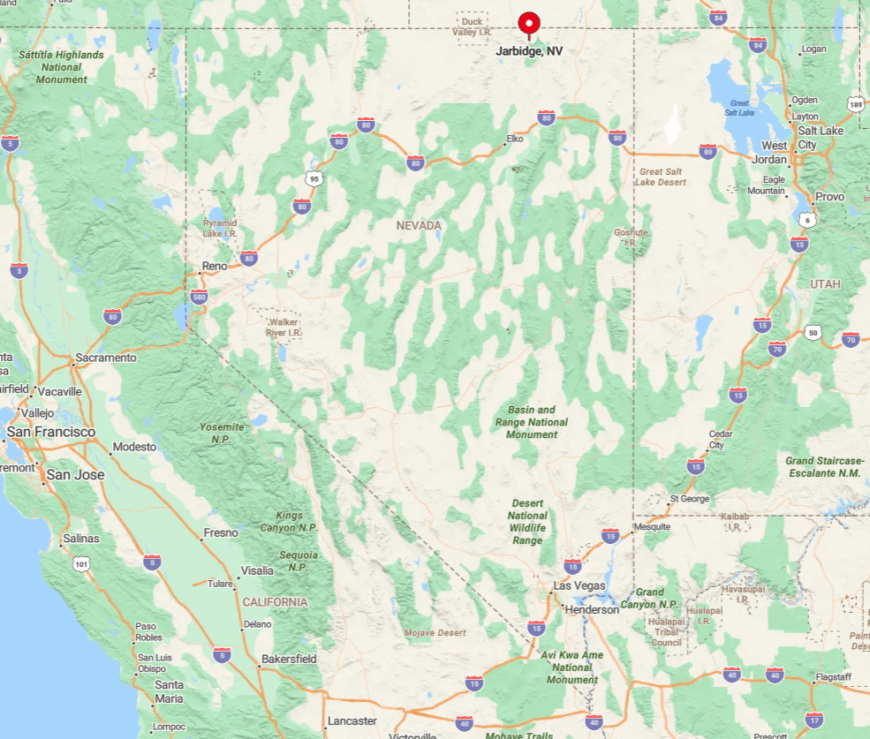
Jarbidge is located in Elko County near the Idaho border, deep within the Jarbidge Mountains. Getting there is an adventure in itself, involving a drive on unpaved roads that are often inaccessible during winter months.
The town’s seclusion is amplified by its rugged surroundings and the lack of nearby major highways. I find that the journey to Jarbidge, through stunning mountain landscapes and remote terrain, enhances the sense of isolation and serenity.