
Western Washington still keeps a few quiet corners where cedar scent drifts across two-lane roads and mountain peaks crowd out cell towers. These hamlets sit behind walls of granite, forest, and snow, so far from neon that stars feel almost within reach.
Our roundup moves from the most remote settlement to the least, highlighting pockets of community that remain largely untouched by crowds. Every town offers its own mix of river bends, historic rails, or lakeside reflections, yet all share the gift of true breathing room.
Pack hiking boots, a good map, and a taste for silence, because the following 25 spots trade hurry and noise for slow mornings and clear Cascades air.
25. Neah Bay – Salt Spray at the End of the Road
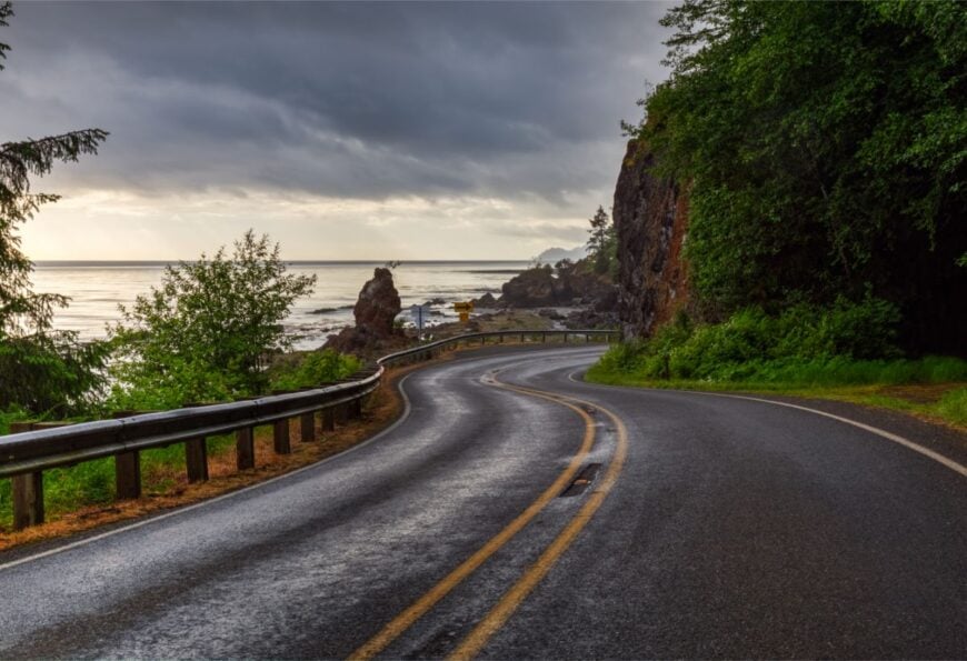
Neah Bay sits where the continent exhales—cedar scent on the wind, surf thudding beyond sea-stacked headlands. Its remoteness is simple geography: the highway ends here, and the Pacific begins.
💼🏠 When the CEO of the biggest real estate brokerage on the planet speaks about buying or selling, it’s worth listening. Hear what Robert Refkin has to say.
Days unspool with hikes to Cape Flattery’s platforms, beachcombing for polished driftwood, and watching gray whales roll past the point in season. The community vibe is respectful and rooted, with local art and heritage centers grounding visitors in place.
Fishing, small lodging, and tribal enterprises form the modest economic rhythm. Nights are ocean-loud and people-quiet, stars pricking the black like distant lanterns. It’s the kind of edge-of-the-map calm that resets your breathing.
Where is Neah Bay?
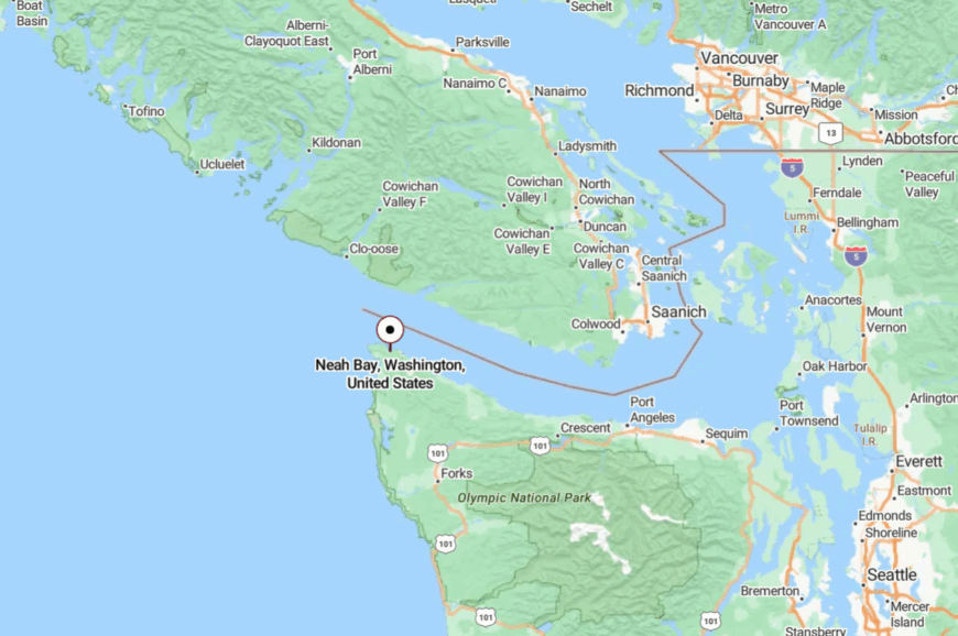
Tucked into the northwestern tip of the Olympic Peninsula in Clallam County, Neah Bay is about 85 miles west of Port Angeles. You’ll follow WA-112 as it narrows and curls along cliffs and coves.
The road dead-ends at the village; everything beyond is sea, rock, and sky. It’s close enough for a day trip, far enough to feel like you’ve stepped off the grid.
24. La Push – Tide-Loud Village of Sea Mist and Cedar
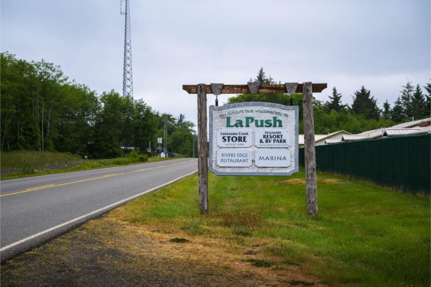
La Push feels hushed even with the surf booming—First, Second, and Third Beach strung like pearls along a wild coastline. Seclusion comes from forest walls, limited roads, and the sense that weather is the real mayor here.
Walk the drift logs at low tide, watch eagles quarter the shoreline, and time sunset when stacks turn to silhouettes. Local life orbits small outfitters, fishing, and a scattering of cabins and cafes.
There are no bright marquees—only lantern light and the rhythm of waves. Morning fog slips through spruce like whispered news. It’s a place that invites you to speak softly.
Where is La Push?
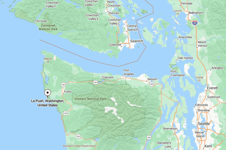
On the central Pacific edge of the Olympic Peninsula, La Push lies about 15 miles west of Forks. WA-110 spurs off US-101 and simply stops at the beach.
The last miles cut through deep forest, cell bars fading away. When the road ends, so does the hurry.
23. Sekiu – Harbor Quiet and Salmon Skies
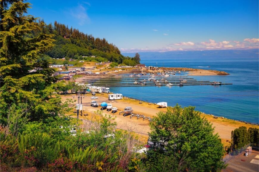
Sekiu curls around a petite harbor where boats sway to the pulse of the Strait. Its out-there feel comes from the long, cliff-shadowed drive and the absence of chain anything.
Anglers launch before dawn, beach walkers trace kelp lines, and photographers wait for pink skies over kelp wrack and gulls. The town’s pace runs on fishing seasons, small motels, and waterfront eateries serving chowder thick enough to stand a spoon.
Between runs, the docks go slow and story-rich. At night, the only neon is bioluminescence in the shallows. Sekiu is a harbor that keeps its own time.
Where is Sekiu?
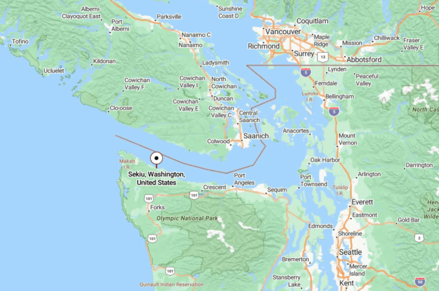
Set along WA-112 on the north coast of the Olympic Peninsula, Sekiu sits about 20 miles west of Joyce. The highway hugs bluffs and coves, throttling speed to scenery.
Past the harbor, road and shoreline thread into emptier country. It’s close to the strait, far from the world’s noise.
22. Joyce – Blackberry Fences and Rain-Fresh Air
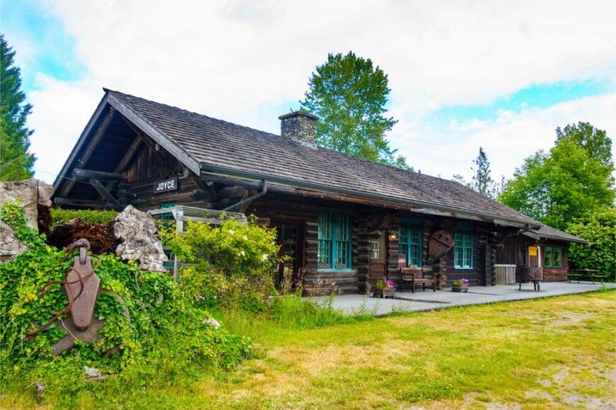
Joyce is a one-street smile of a town where porches face the strait and the rainforest whispers from behind. Seclusion here is more mood than miles—two-lane roads, tall timber, and a calendar marked by community potlucks and the famed blackberry festival.
Pop into the tiny museum, wander Crescent Beach’s tidepools, or follow the Spruce Railroad Trail along blue-green Lake Crescent. The vibe is neighborly and nostalgic, heavy on homemade pies and barn tools that still earn their keep.
Logging history lingers; today’s life leans on small trades and tourism. Evening fog softens everything to watercolor. It’s the kind of quiet that arrives on tiptoe.
Where is Joyce?
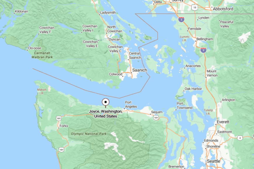
Joyce rests on WA-112 about 16 miles west of Port Angeles. The town nestles between the Strait of Juan de Fuca and mossy foothills.
Access is an easy coast-hugging drive that still feels a world apart. You’ll know you’ve arrived when the trees lean in and the pace lets go.
21. Amanda Park – Rainforest Gateway on a Glassy Lake
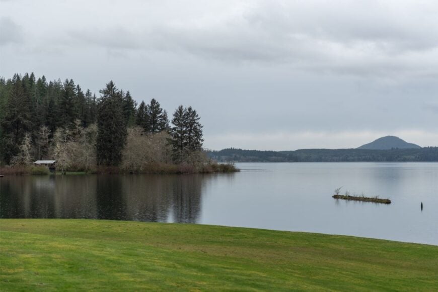
Amanda Park gathers around the Quinault River where it tips into Lake Quinault, a mirror framed by spruce and sword fern. The world narrows to birdsong and rain-drip, with clouds draping low over mossy giants.
Loop the lake road under cathedral trees, stroll to Willaby Creek Falls, or watch elk ghost the meadows at dusk. Lodges, a store or two, and seasonal work tied to the lake form the economy.
There’s no rush—only a slow rhythm of paddle strokes and woodsmoke. When rain taps the cabin roof, time stretches. Seclusion is the house specialty.
Where is Amanda Park?
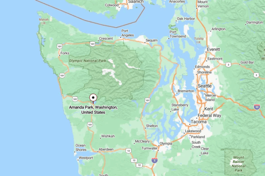
In western Grays Harbor County, Amanda Park sits along US-101 at the southern edge of Lake Quinault. The highway arrives through miles of damp, green hush.
Side roads end quickly at trailheads or water. It’s easy to reach, hard to forget.
20. Moclips – Wind, Dunes, and Big West Skies
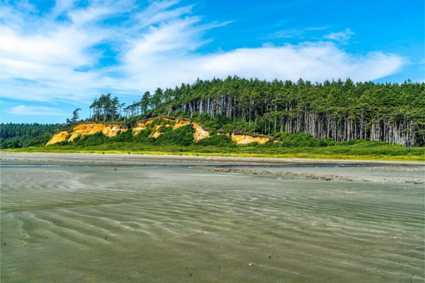
Moclips sits low to the ocean, a scatter of cottages and weathered stairways cresting the dunes. Isolation comes by way of distance from any city center and a shoreline that seems to roll forever.
Beachcombers hunt agates, storm watchers collect dramatic skies, and low-tide walkers stitch long, empty miles. A couple of inns and cafes fuel the local hum, with fishing and clamming adding seasonal spice.
The soundtrack is gulls and breakers, not engines. Even the streetlights seem to dim for stars. Moclips is a salt-rimmed lullaby.
Where is Moclips?
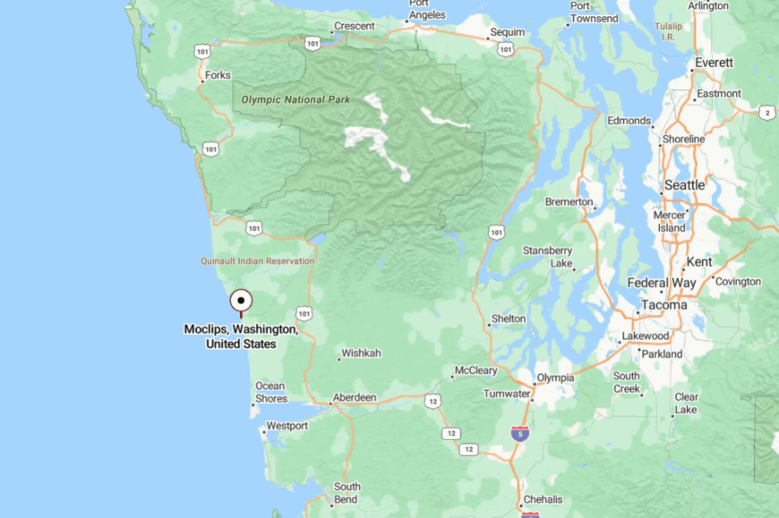
Perched on the north Grays Harbor coast, Moclips lies north of Pacific Beach along SR-109. You reach it via US-101, then a string of two-lane seaside miles.
The last bends reveal dunes, surf, and little else. It’s close to the sea and far from hurry.
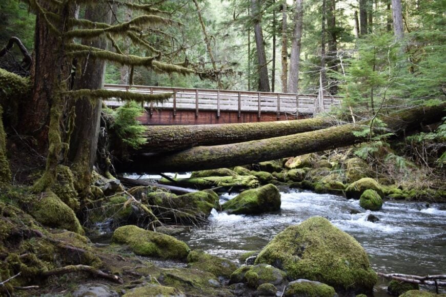
19. Hoodsport – Fjordside Hamlet Beneath Dark Forests
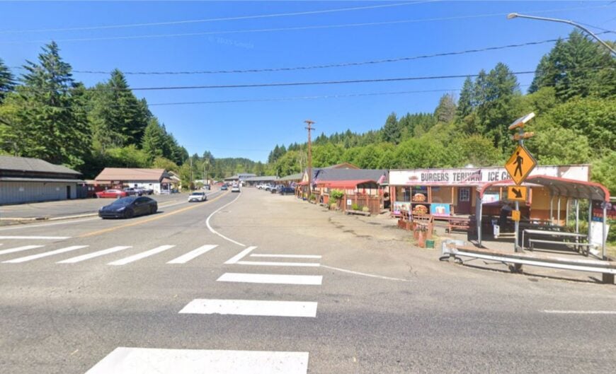
Hoodsport keeps its voice low along Hood Canal, where mountains drop steeply into cold, clear water. Its tucked-away feel comes from the long, curving approach and the deep woods pressing to the shoreline.
Dive cold-water reefs, hike Staircase into Olympic National Park, or slurp local oysters on a sundrenched deck. Small marinas, cafes, and guide services anchor the economy; beyond town, it’s trees and tide.
Mornings smell like cedar and brine. Hoodsport is a needle-thin seam between forest and fjord where quiet slips easily into your pockets.
Where is Hoodsport?
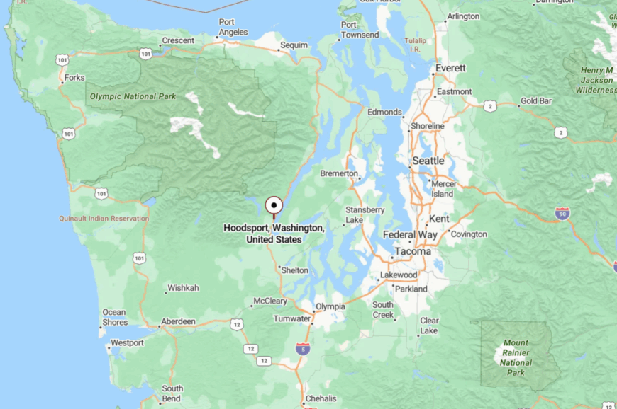
On the west shore of Hood Canal in Mason County, Hoodsport sits about 40 miles north of Olympia. US-101 snakes along the water until the storefronts appear like a pause in the forest.
Trails and park roads rise immediately into the hills. It’s close enough for lunch, remote enough to reset you.
18. Quilcene – Oyster Flats and Mountain Silhouettes
Quilcene spreads between river and tidelands, a valley town known for oysters and soft dusk light. Seclusion arrives courtesy of low traffic, preserved forest, and mountains hemming the horizon.
Harvest oysters at a public beach, drive to Mount Walker’s quick summit views, or paddle still water while herons stalk the shallows. Shellfish operations and small workshops keep hands busy without changing the skyline.
Even the post office feels unhurried. Quilcene is quiet industry wrapped in mountain calm.
Where is Quilcene?
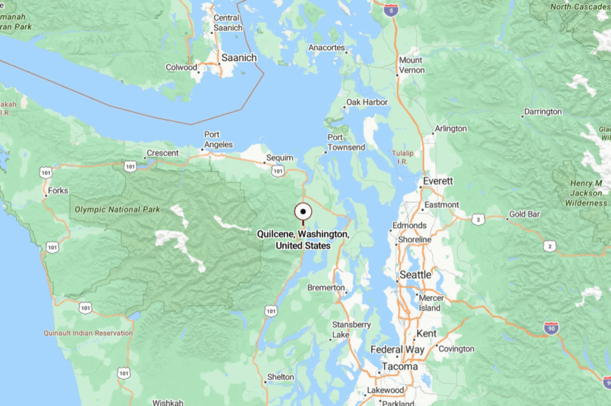
Set in eastern Jefferson County on the Hood Canal’s curve, Quilcene lies roughly 20 miles south of Port Townsend. US-101 links it to the world but never overwhelms.
Side roads dive into timber and dead-end at water. It’s an easy detour that feels like a discovery.
17. Brinnon – Waterfall Town with Eagles Overhead
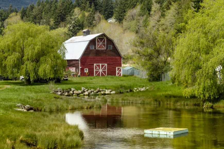
Brinnon strings along the canal under steep green slopes where creeks tumble in white ribbons. Its out-of-the-way flavor comes from long shoreline distances and mountains that keep towns far apart.
Watch elk on Dosewallips flats, picnic at Whitney Gardens when rhododendrons explode, or follow river trails into cool canyon shade. Life here leans on shellfish, small inns, and park day-trippers who disappear by dark.
After sunset, it’s just tide, breeze, and star scatter. Brinnon is a narrow place with a wide sense of peace.
Where is Brinnon?
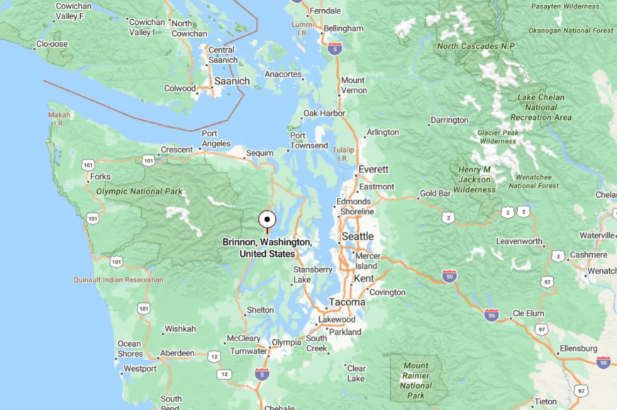
In southeastern Jefferson County on US-101, Brinnon sits about 45 miles north of Olympia. The highway squeezes between the mountain and the canal, slowing naturally.
Spur roads end at trailheads or beaches within minutes. Once you pull over, the rest of the world thins to a whisper.
16. Matlock – Meadow Lanes and Timber Echoes
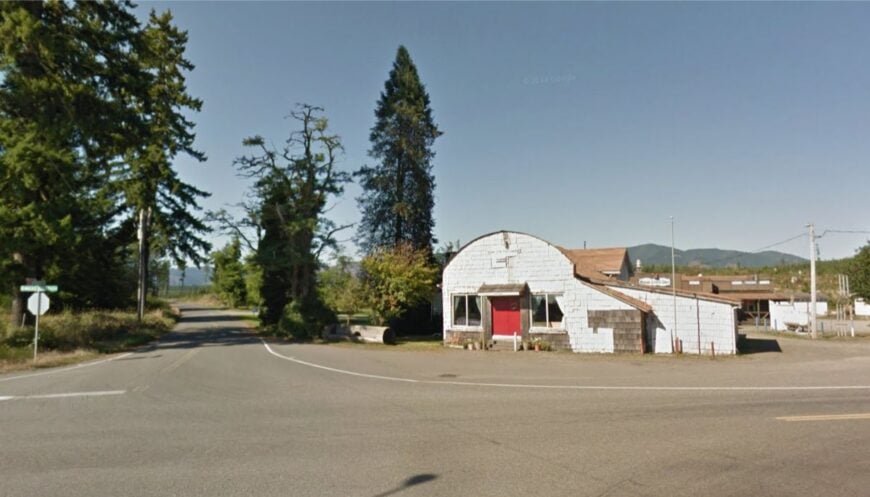
Matlock is more crossroads than town, and that’s exactly the charm—barns, meadows, and thin blacktop curling into forest. It feels tucked away because it is: miles from interstates, surrounded by working timberlands and quiet farms.
Spend a lazy afternoon at nearby Schafer State Park on the Satsop River, cast for cutthroat, and picnic under bigleaf maples. Community events happen on lawns and in halls, with potlucks doing the heavy lifting.
Logging and small agriculture still shape the week. Nights are owl-lit and crickets-loud. Matlock is a soft-spoken corner that hums at countryside tempo.
Where is Matlock?
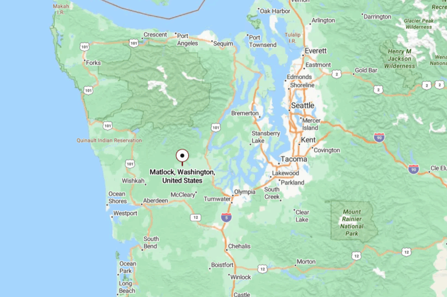
Matlock sits in western Mason County, roughly 25 miles northwest of Shelton. You reach it by rolling two-lane roads that trade speed for scenery.
Turnouts reveal farms, then trees reclaim the view. It’s close enough for a drive, far enough to forget the clock.
15. Carbonado – River Canyons and Old Railbeds
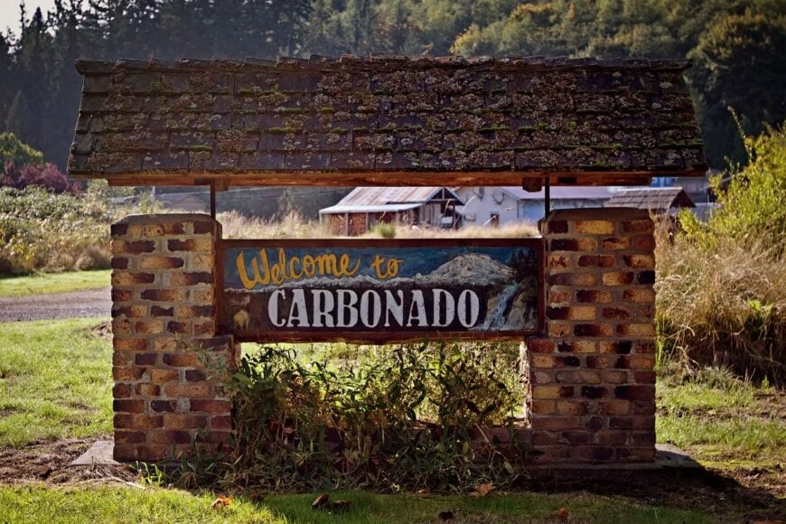
Carbonado rests near a deep basalt canyon where the Carbon River saw log trains a century ago. Its seclusion persists thanks to narrow approaches and a wall of foothills that keep suburbs at bay.
Walk the old rail grade into mossy river country, stand atop the lofty Fairfax Bridge, or wander past coal-era homes with tidy porches. The vibe is historic and woodsmoky, with weekend trailheads stealing the spotlight.
Work now leans toward commuting and small trades; the forest is still the loudest neighbor. Even a whisper sounds big in the canyon. Carbonado feels like a time capsule tucked in fir.
Where is Carbonado?
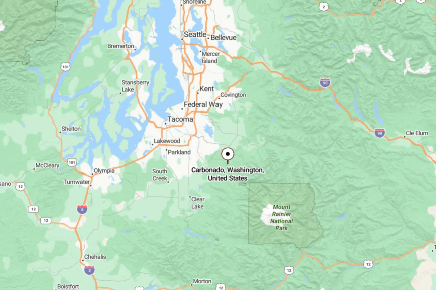
In northeastern Pierce County, Carbonado sits about 20 miles southeast of Enumclaw near the Carbon River. Access comes via WA-165, a winding route that crosses high bridges and narrows under trees.
Roads quickly turn to gravel beyond town toward parks and rivers. The approach itself is a courtesy notice that quiet is ahead.
14. Wilkeson – Coke Ovens and Mountain Backroads
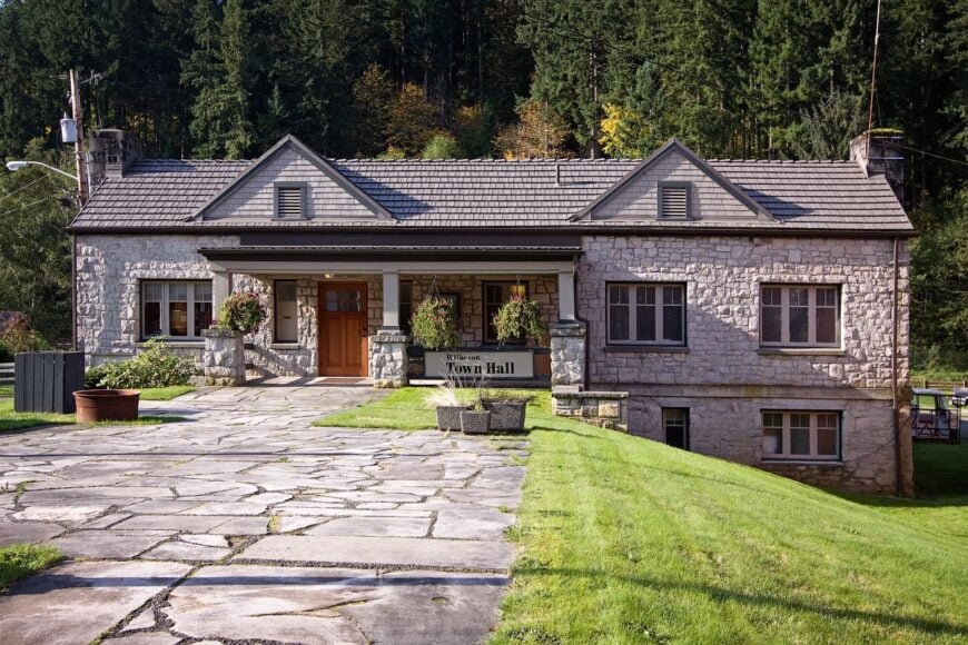
Wilkeson hums softly between brick coke ovens and forested ridges, a little main street with big history. Seclusion comes from geography and scale: there’s only one way in, and not much reason to rush through.
Explore the historic ovens, bike segments of the Foothills Trail, or linger over milkshakes at a vintage counter when hikers head for nearby peaks. The town’s economy is small—cafes, craft shops, trail traffic—and the evenings belong to porch talk and train echoes.
Mountain weather writes the day’s script. Wilkeson keeps its head down and its welcome warm.
Where is Wilkeson?
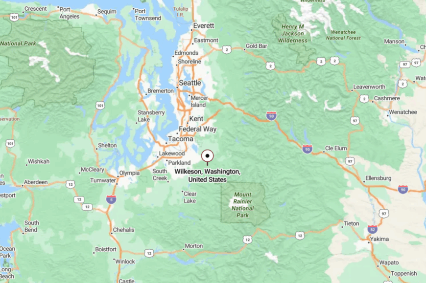
Just south of Buckley in Pierce County, Wilkeson sits near the end of WA-165. Past town, pavement thins as it aims toward recreation sites and gravel spurs.
The surrounding ridges curtain off outside noise. The farther you go, the older the landscape feels.
13. Elbe – Tiny Chapel, Big Forest
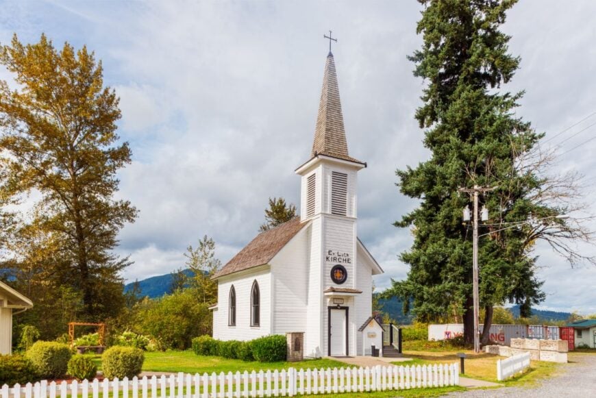
Elbe is a postcard curve of highway: a petite white chapel, a rail museum yard, and a lakeside shimmer under tall timber. It feels secluded because it is—for miles it’s only you, the river, and the trees shouldering close.
Rent a canoe on Alder Lake, grab burgers from a train-car diner, or walk river flats where elk sign dots the sand. Tourism and park-bound traffic keep lights on, but nights fall fast and quiet.
The past is visible in every timber and trestle. Elbe’s charm is how small it stays beside so much forest.
Where is Elbe?
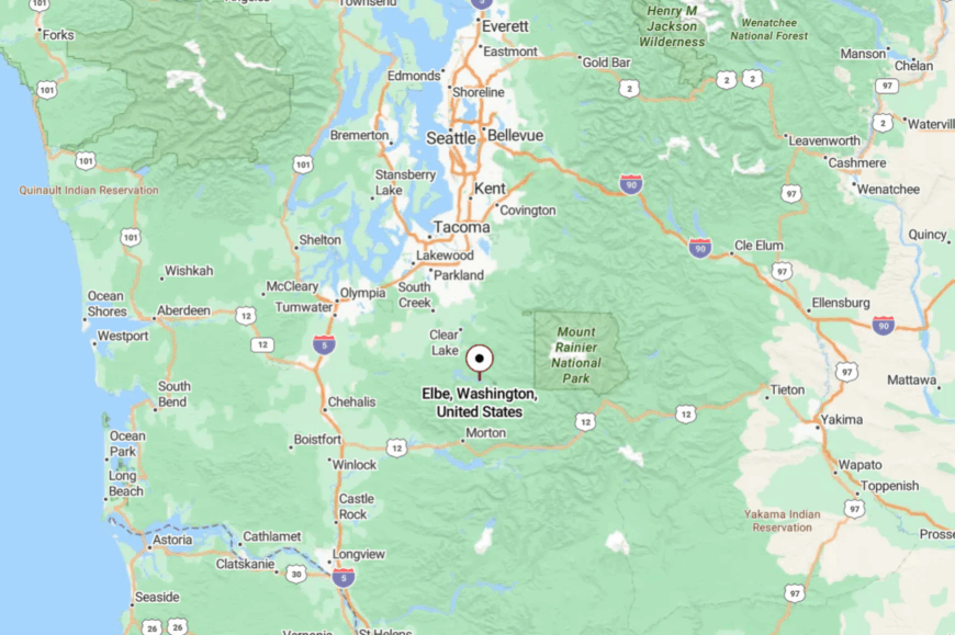
In southwest Pierce County on WA-7, Elbe lies about 13 miles west of Ashford. The highway traces the river and the reservoir, narrowing between banks of fir.
Side roads slip quickly to boat launches or fade into gravel. It’s the sort of stop you remember long after the taillights.
12. Randle – Wide Valley Under Big Cascades
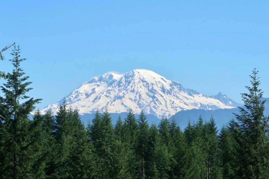
Randle opens like a green book—broad fields, the Cowlitz looping lazy, and the Cascades piled up blue on the horizon. Seclusion is a function of distance and forest: national forest lands ring the edges, and towns are few.
Drive out to Walupt Lake for mirrored mornings, explore backroads toward Windy Ridge, or sip coffee while elk graze along fence lines. Timber history holds hands with today’s trailheads and small shops.
Even on busy weekends, quiet is a short turn away. Randle feels like the last wide breath before wilderness.
Where is Randle?
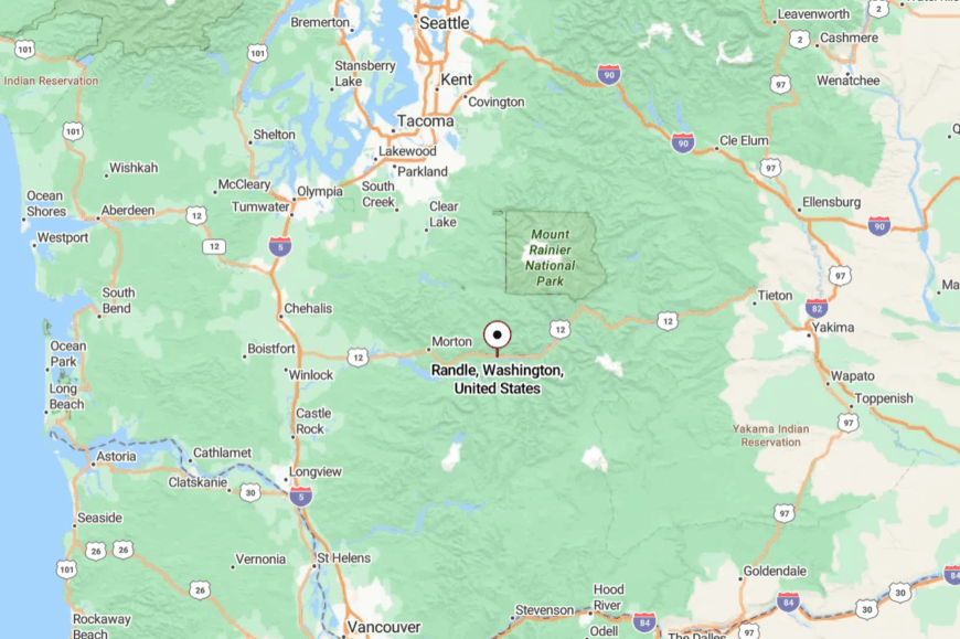
In eastern Lewis County along US-12, Randle sits about 55 miles east of Chehalis. One highway ties it together; the rest are forest spurs and ranch lanes.
Mountain passes and winter storms can slow everything to a murmur. Arriving feels like stepping onto a front porch that faces half the Cascades.
11. Darrington – Whitehorse Shadows and River Songs
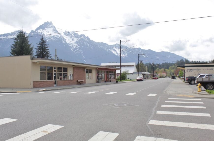
Darrington is wrapped in peaks—Whitehorse, Three Fingers, and Jumbo rising like sentinels above a grid of quiet streets. Its seclusion is geographic and intentional: reached by river roads and pinned between wilderness valleys.
Spend a morning on the Mountain Loop’s trailheads, cast into the Sauk for steelhead, or catch fiddle tunes at a community jam. Logging heritage runs deep; today, mills, trail crews, and guide services share the load.
Even the air seems clearer after rain scrubs the peaks sharp. Darrington is a town that makes space for mountains—and your thoughts.
Where is Darrington?
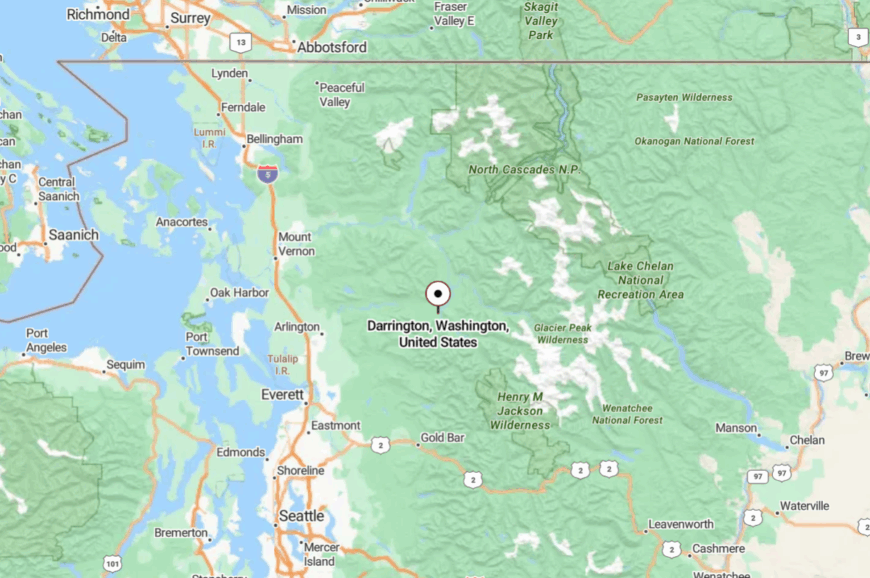
Set in northeast Snohomish County, Darrington is about 35 miles east of Arlington via WA-530. The Mountain Loop Highway connects seasonally, but snow and slides often turn it into a quiet cul-de-sac.
Ranges hem the town on three sides, keeping horizons steep and distractions few. The last miles teach your shoulders to drop.
10. Stehekin – Boat-Access Village Deep in the North Cascades
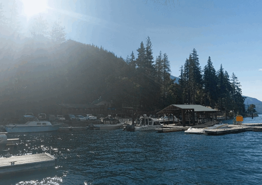
Approximately 75 full-time residents keep gardens and small orchards in this roadless valley at the head of Lake Chelan. Visitors rent simple bikes, fish for rainbow trout, or wander up to Rainbow Falls for a misty photo with no traffic hum in the background.
The local economy relies on seasonal lodging, the historic Stehekin Pastry Company, and National Park Service jobs tied to the nearby wilderness station. Commercial chains never arrived, so the village market stocks basics delivered by barge while hand-painted signs mark every storefront.
Dense peaks rise on all sides, and ninety percent of the surrounding land sits inside North Cascades National Park, sealing Stehekin off from suburban creep. Limited services, spotty Wi-Fi, and a nighttime hush broken only by lake waves make seclusion the default setting here.
Where is Stehekin?
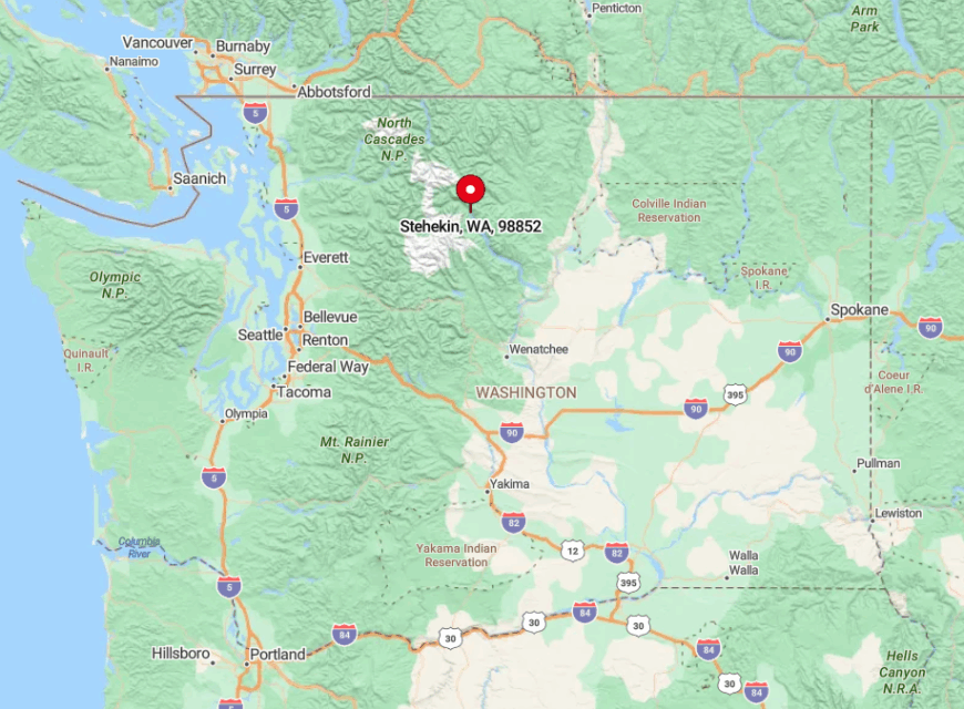
Stehekin rests at the northwest end of 50-mile-long Lake Chelan in Chelan County. The valley’s granite walls and lack of roads mean the only regular access comes by Lady of the Lake ferry, foot trail over Cascade Pass, or floatplane from Chelan.
These transport quirks keep day-tripper numbers low even in midsummer. Visitors who plan ahead and sync with the ferry schedule are rewarded with skies free of contrails and trailheads that still feel undiscovered.
9. Diablo – Company Town Turned Isolated Alpine Enclave
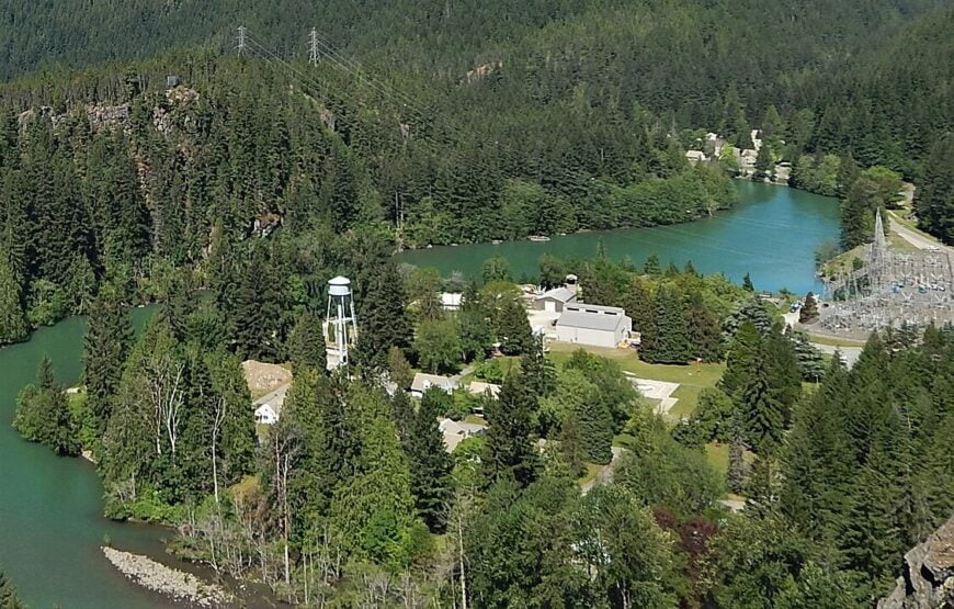
Fewer than 40 residents remain in the old Seattle City Light company houses tucked beside turquoise Diablo Lake. Kayaking past the floating log boom, night photography on the North Cascades Highway overlook, and tours of the historic Gorge Powerhouse rank among the few organized activities.
Hydroelectric operations and a tiny field school support most local employment, supplemented by summer lodge staff. With nearly all surrounding acreage under federal protection, no new construction creeps up the steep slopes or along the water’s edge.
The cliffs channel winds that erase highway sounds once the sun drops behind Sourdough Mountain. Lack of cellphone reception, minimal winter plowing, and towering walls of granite lock Diablo firmly off the tourist radar.
Where is Diablo?
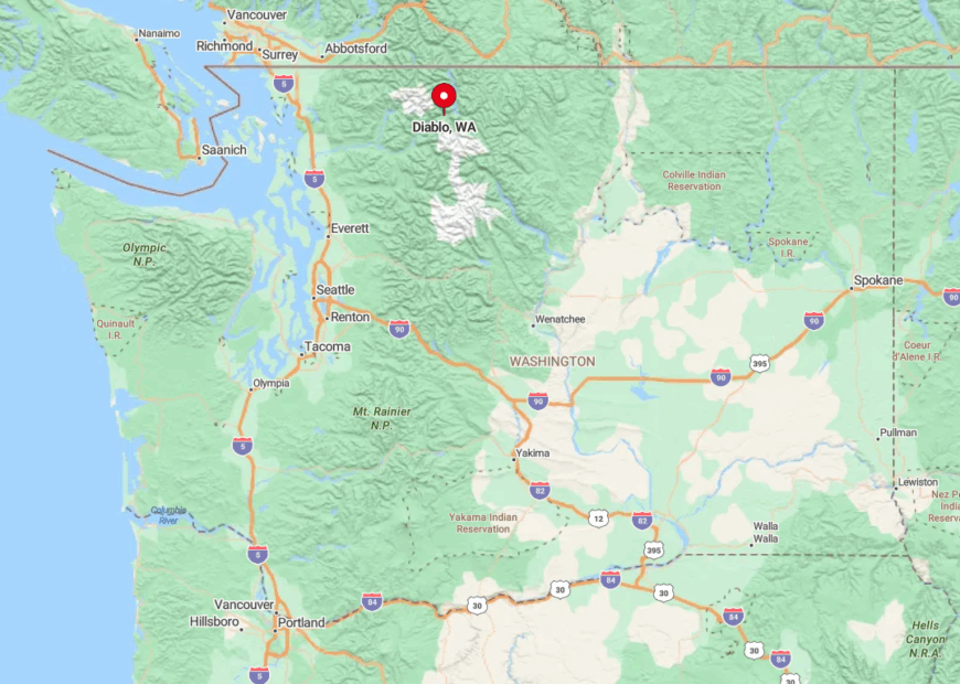
Diablo sits just north of State Route 20, midway between Marblemount and Winthrop in Whatcom County. Despite the highway, the town is hidden on a short spur that ends at the lake, beyond which mountains and wilderness extend for dozens of miles.
Winter closures of the North Cascades Highway for avalanche danger cut off eastern access entirely, further isolating the settlement. Most guests park at Colonial Creek Campground and paddle across mirror-flat water to reach trailheads or the quiet company dock.
8. Packwood – Elk-Roaming Valley with Roomy Homesteads
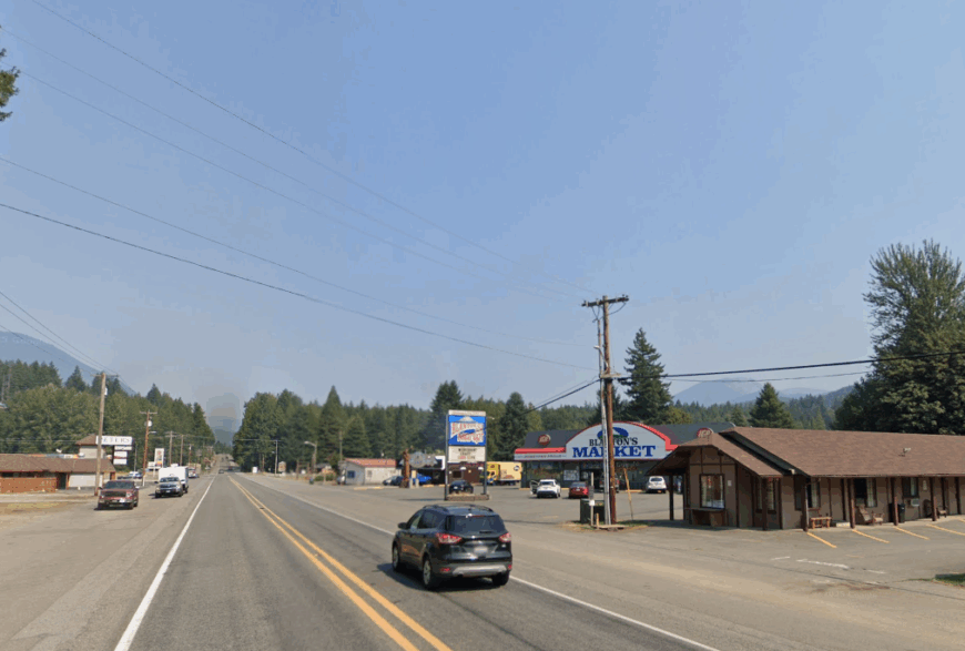
Roughly 1,300 people share this broad Cowlitz River valley shadowed by Goat Rocks and the southern ramparts of Mount Rainier. Weekends bring antique hunting along Main Street, wildlife watching as Roosevelt elk wander through backyards, and hikes to glacial Blue Hole swimming spot in Skate Creek.
Tourism, vacation rentals, and a handful of timber outfits provide the primary income streams. Old lumber warehouses still stand beside modern espresso shacks, yet big-box franchises remain absent.
Vast meadows buffer homes, and nightly silence arrives with the same certainty as the mountain silhouettes that encircle town. The nearest traffic light sits 30 miles away, giving Packwood that tucked-away feeling even during its popular Memorial Day flea market.
Where is Packwood?
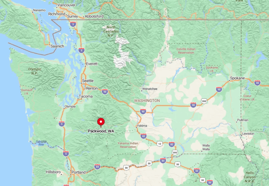
Packwood lies along US-12 between White Pass and Morton in eastern Lewis County. Surrounded on three sides by Gifford Pinchot National Forest, the valley has just one paved road in or out, forcing drivers to slow through canyons and over creek bridges.
Heavy snow can close White Pass and isolate the town for days each winter. Visitors typically arrive via Tacoma then wind south on SR-7, savoring ever-quieter forests with each mile.
7. Mineral – Lakeside Haven Hemmed by Fir-Covered Ridges
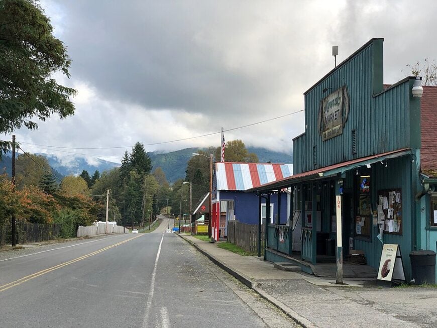
Around 200 residents cluster beside the glassy, mile-long Mineral Lake noted for its postcard reflections of Mount Rainier. Anglers chase hefty trout, photographers capture mist rising off the water at dawn, and families rent restored 1920s cabins lining the single lakeshore road.
The sole café doubles as a tackle shop while campgrounds and boat rentals make up the tiny service sector. Without supermarkets, theaters, or stoplights, nightly calm settles quickly once the day’s last boat is trailered.
Fir-cloaked ridges crowd close, blocking cell signals and framing the lake like a private amphitheater. Limited buildable land and lack of through roads keep Mineral pocket-sized and largely unchanged since logging camps faded a century ago.
Where is Mineral?
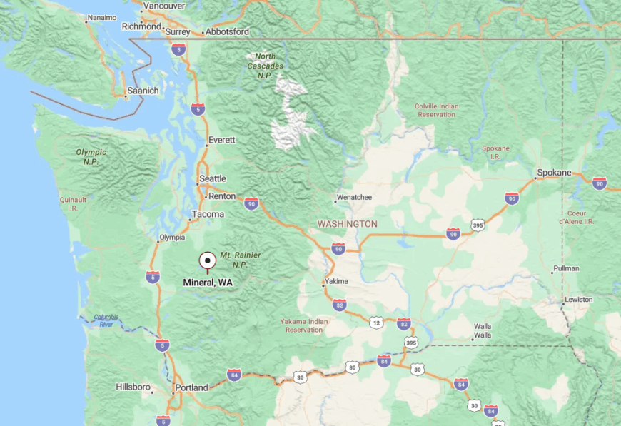
Mineral rests off SR-7 in northern Lewis County, about 25 miles south of the Nisqually entrance to Mount Rainier National Park. Drivers reach the settlement by following a spur that dead-ends at the lake, guaranteeing no pass-through traffic.
Dense forest surrounds every approach, and winter storms often drape the ridges in snow that further muffles outside noise. Most visitors continue the last leg on foot or bicycle to fully appreciate the hush that defines the shoreline.
6. Ashford – Quiet Rain-Soaked Gateway to Mount Rainier’s Wild West Side
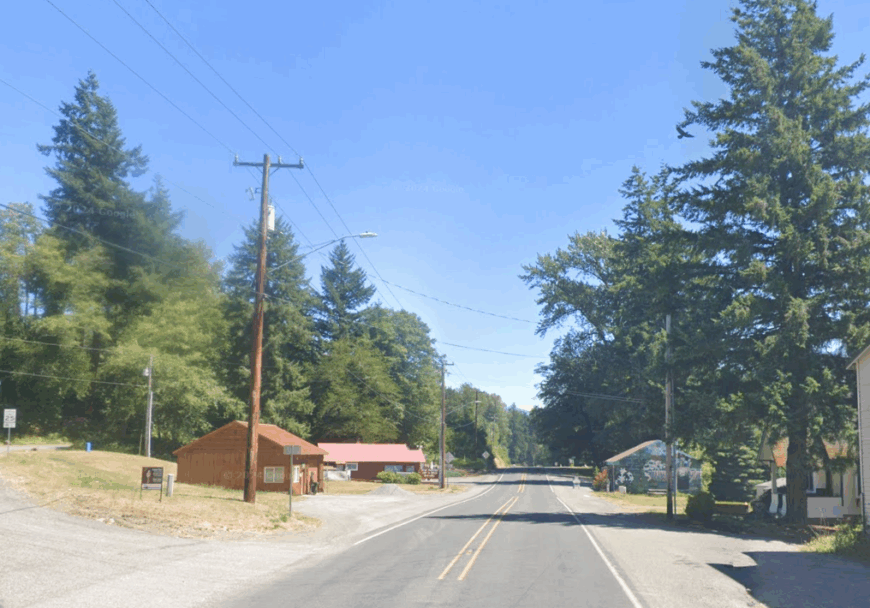
Approximately 350 year-round residents maintain cedar lodges and wood-stove homes stretched along State Route 706. Guests explore the Rainier Mountain Festival, sip small-batch brews at the BaseCamp Bar, or book a guided ascent of the volcano with regional climbing outfitters.
Hospitality, guide services, and park maintenance form the backbone of local employment. Chain restaurants never gained a foothold, so menus favor blackberry pies and locally roasted coffee served in log cabins.
Ashford’s temperate rainforest setting, dripping moss, and frequent cloud curtains create an enveloping sense of privacy minutes outside town. Tall hemlocks and steep foothills block views and noise, leaving the soft hiss of rain as evening soundtrack.
Where is Ashford?
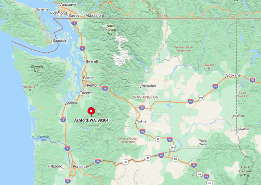
The community sits six miles west of Mount Rainier National Park’s Nisqually entrance in Pierce County. Only SR-706 connects Ashford to larger towns, narrowing to a ribbon as it threads between forest and river.
Storm-felled trees and seasonal floods sometimes close this route, intensifying the area’s tucked-away feel. Travelers usually reach Ashford from Tacoma via SR-7 before slowing to enjoy the final silent stretch along the Nisqually River.
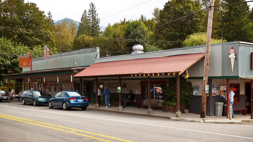
5. Skykomish – Historic Rail Outpost Hidden in Alpine Woods
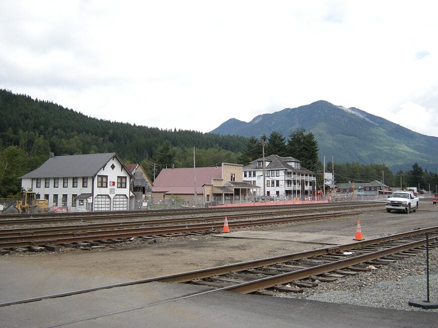
Skykomish counts roughly 195 residents living on spacious wooded lots beside the South Fork Skykomish River. Visitors photograph snow-dusted wooden trestles, ride restored locomotives at the Great Northern & Cascade Railway miniature park, or hike Deception Falls loop only five minutes away.
Rail maintenance, small outfitters, and seasonal hospitality fill most payrolls. The town center spans just a few blocks, and historic boardwalks still lead to the weathered depot that once hosted James J. Hill’s Great Northern trains.
Evergreen ridges surround the valley on every side, muting highway traffic to a distant whisper. Limited cell service and winter snows that blanket the single main street help preserve Skykomish’s unhurried rhythm.
Where is Skykomish?
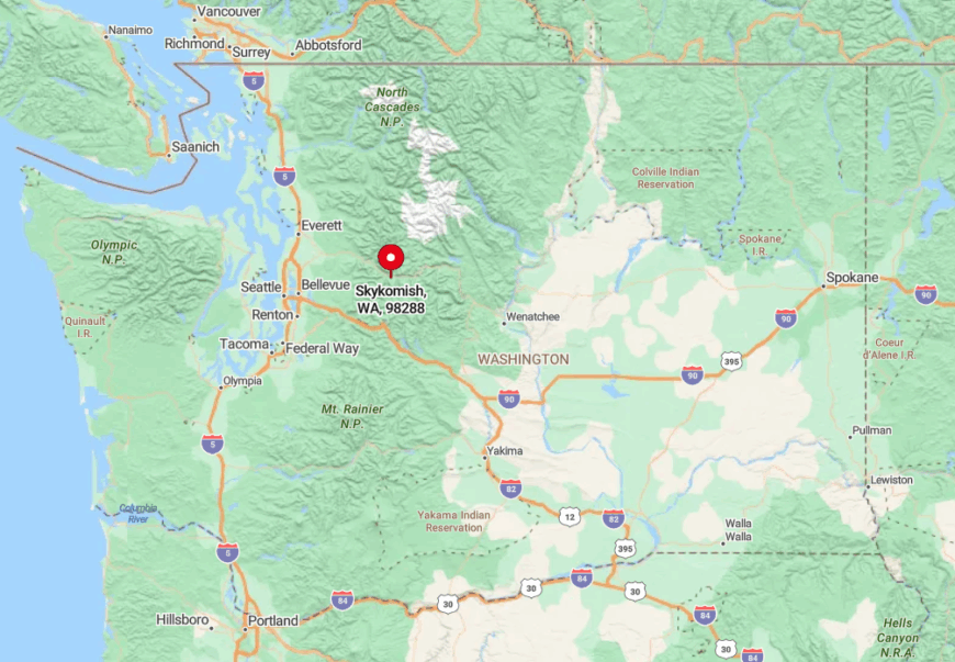
Located on US-2 near Stevens Pass in eastern King County, Skykomish nestles between Mount Baring and Beckler Peak. Though the highway passes close, steep slopes and thick timber separate the town from most travelers who speed toward the pass.
During heavy snowfall, avalanche control can close the highway, isolating residents for hours at a time. Seattle visitors follow a two-hour scenic drive, crossing high bridges over the river before dropping into the sheltered valley.
4. Glacier – Last Stop Before the Wilderness of Mount Baker
About 210 people reside in scattered chalets and cabins along the North Fork Nooksack River six miles from the Mount Baker-Snoqualmie National Forest boundary.
Favorite pursuits include snowshoeing to Artist Point, soaking in the hidden Horseshoe Bend hot springs, and sampling locally cured meats at the Wake ’n Bakery.
Employment centers on guide services, one general store, and seasonal ski resort work up the road at Mount Baker Ski Area. Over half the land within town limits remains undeveloped, creating broad moss-draped buffers between neighbors.
Fog rolls off the river and under the cedars, muting any hint of bustle even during ski season weekends. Glacier’s dead-end spur beyond Maple Falls means traffic disappears once the last powder hound passes through.
Where is Glacier?
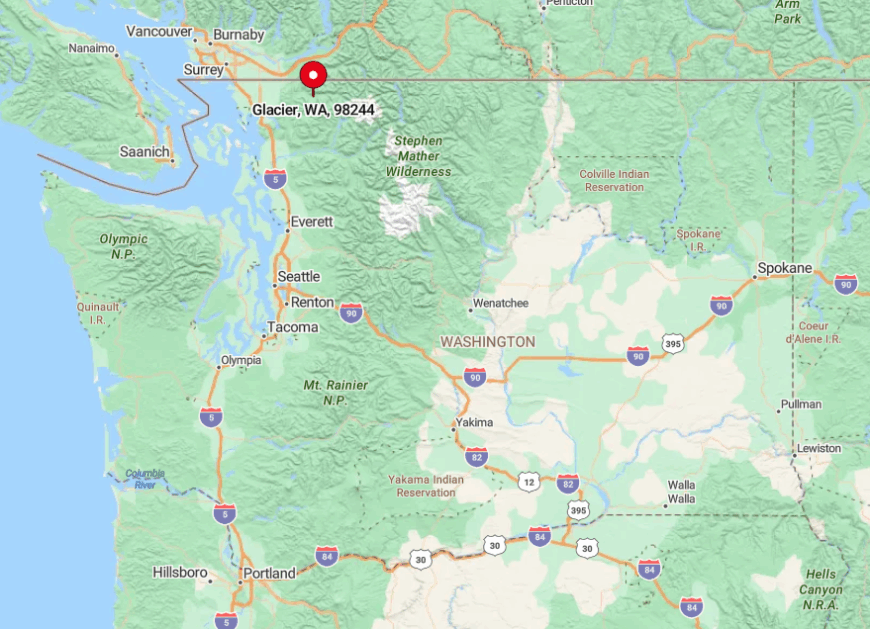
Glacier sits on State Route 542 in Whatcom County, 35 miles east of Bellingham and only a dozen miles from the Canadian border. The road ends at Mount Baker’s ski area, so Glacier is literally the final outpost before wilderness.
Winter storms often bury the route beyond town, sealing Glacier into a snow globe setting for days. Most travelers fuel up in Bellingham, then wind through forest and alongside waterfalls before reaching this hushed cedar enclave.
3. Marblemount – Gateway Hamlet Lost in the North Cascades
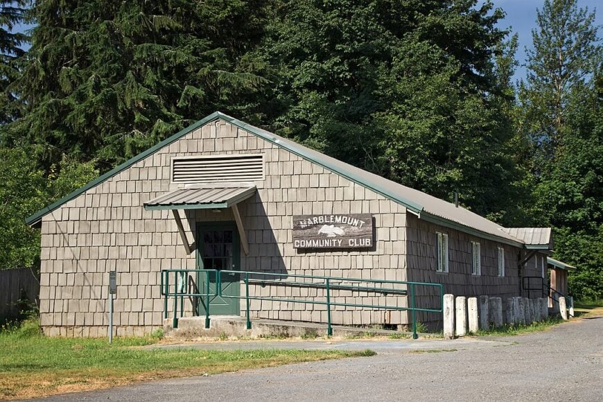
Fewer than 300 people occupy broad riverbank parcels where the Skagit and Cascade Rivers meet. Anglers target salmon runs, climbers stage expeditions to Eldorado Peak, and families savor berry pie at the Cascadian Farm roadside stand three miles east.
Guiding outfits, the National Park Service, and a lone gas station café form the slim economic backbone. Federal land surrounds the settlement, so new development is rare and rustic cabins dominate the scene.
Snow-capped summits loom in every direction, and the nearest sizeable grocery store sits 40 miles away in Sedro-Woolley. Limited infrastructure, frequent highway closures, and the roar of rivers create a sense of isolation that deepens after dusk.
Where is Marblemount?
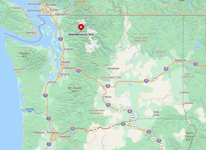
The hamlet stands on State Route 20 in Skagit County at the western gateway to North Cascades National Park. Mountains hem in both sides of the narrow valley, and the highway’s steep grades discourage heavy traffic.
When November snows close Washington Pass, Marblemount becomes the eastern terminus for drivers coming from Puget Sound. Most visitors arrive along SR-20, crossing steel truss bridges and watching the forest grow denser with every mile.
2. Index – Granite Walls Guarding a 200-Person Riverside Village
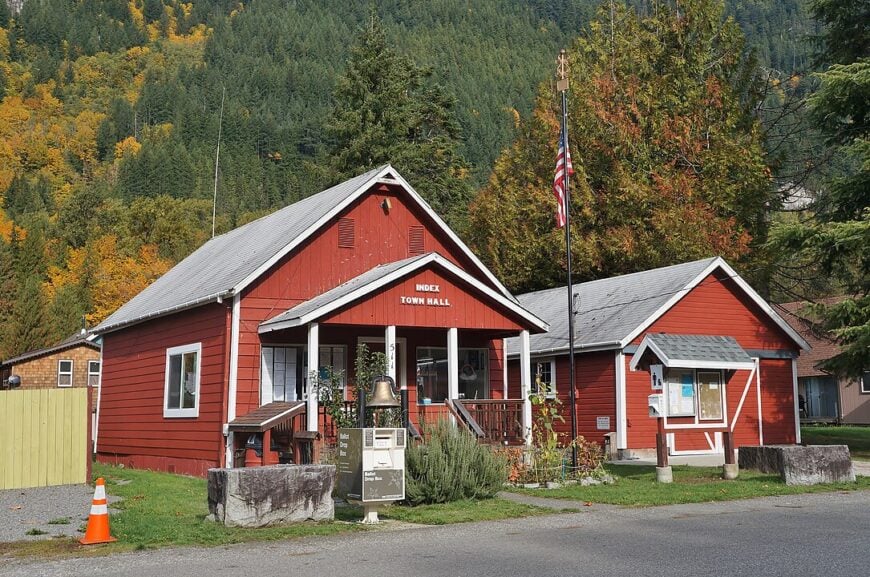
Roughly 200 residents live within 0.3 square miles bounded by the Skykomish River and the sheer 1,200-foot Index Town Wall. Rock climbers test their skill on polished granite, kayakers thread boulder gardens downstream, and photographers snap morning light on weathered river cottages.
The local economy revolves around guiding, a single general store, and weekend diners who come for views of Mount Index. Dense cedar groves and dramatic cliffs screen the village from the busy flow of US-2 just across the river.
Index feels wrapped in a natural amphitheater where every sound echoes off stone and water instead of pavement. Lack of developable flat land and the ever-present roar of the river make expansion unlikely, preserving its hidden atmosphere.
Where is Index?
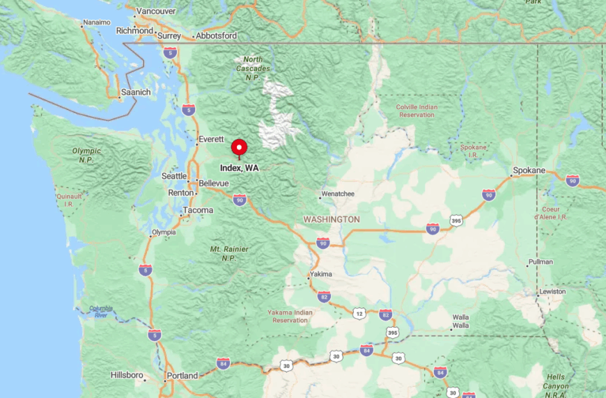
Index lies barely a mile south of US-2 in Snohomish County, yet a one-lane steel bridge over the river marks the only entrance. Granite walls rise immediately behind town, blocking any alternate roads or cell coverage.
During high water, the bridge sometimes closes, leaving residents to enjoy complete quiet until levels drop. Visitors leave the highway at Exit 36, cross the bridge, and suddenly find themselves in a pocket of mountain calm.
1. Greenwater – Cabins Tucked Beneath Mount Rainier’s Eastern Timberline
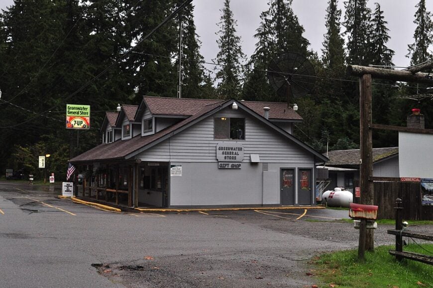
Only about 90 people call Greenwater home, many residing in log cabins spaced widely among Douglas fir and western red cedar. Days revolve around hiking the Naches Peak Loop, fishing for brook trout in the Greenwater River, or browsing the tiny handmade-knife shop hidden behind Wapati Woolies outfitters.
Small-scale tourism, seasonal Forest Service work, and a lone espresso stand sustain the local budget. Commercial buzz never reached these woods, and even the gas station closes before nightfall.
Towering trees, frequent fog, and a single paved road ensure that sounds fade fast once the sun dips behind Mount Rainier. With parcels measured in acres rather than lots, neighbors remain visible mostly by chimney smoke winding above the canopy.
Where is Greenwater?
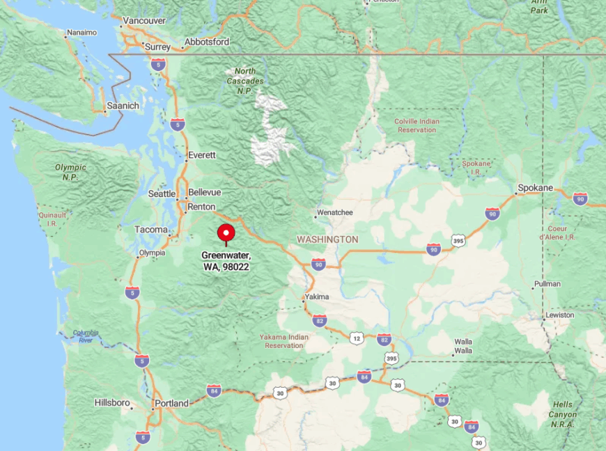
Greenwater sits along State Route 410 in eastern Pierce County, 25 miles southeast of Enumclaw and just west of Chinook Pass. The route narrows to forest on both sides, and winter closures of the pass remove through traffic entirely.
Cell service fades minutes outside Enumclaw, and snow gates drop whenever heavy storms sweep in. Most travelers reach Greenwater via SR-410, then continue a few more hushed miles to the trailheads circling Crystal Mountain and Rainier’s eastern ridge.