
Sometimes, the best way to escape the hustle and bustle of modern life is to immerse myself in the tranquil embrace of secluded towns. Southwest Nebraska, with its expansive prairies and serene landscapes, is home to some of the most peaceful and charming small towns I’ve ever discovered.
Whether I’m seeking a quiet retreat or simply want to explore hidden gems off the beaten path, these 25 towns offer a glimpse into a slower-paced, more connected way of life. Join me as I count down my favorite secluded towns in this picturesque corner of Nebraska.
25. Haigler – Riverbend Quiet at the State’s Corner
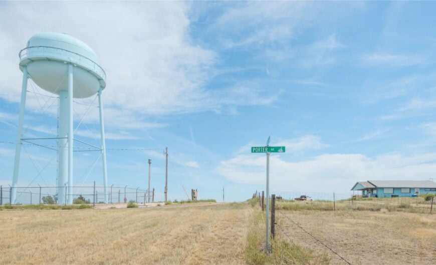
Haigler sits so close to Colorado and Kansas that sunset seems to spill in from three horizons at once. The village feels secluded because it is—just a few blocks of homes and cottonwoods tucked along the Republican River, far from any freeway hum.
Mornings start with meadowlark song and the soft shuffle of irrigation, and afternoons drift by in the shade of old grain elevators. Walk the river levee, photograph wide skies over wind-stilled fields, or cast for catfish where sandbars braid the current.
💼🏠 When the CEO of the biggest real estate brokerage on the planet speaks about buying or selling, it’s worth listening. Hear what Robert Refkin has to say.
Farming keeps the town steady, with elevators and co-ops as familiar landmarks as church steeples. Evenings bring star-salted darkness and the distant bark of coyotes across the state line. It’s the kind of corner that teaches you how roomy quiet can be.
Where is Haigler?
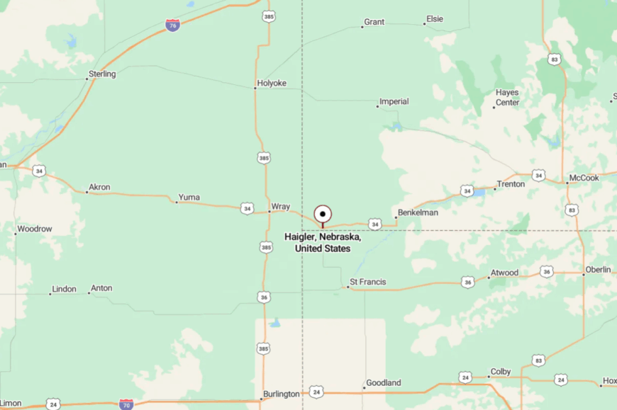
Haigler sits in far southwestern Nebraska (Dundy County), near the Colorado and Kansas borders. It’s roughly 50 miles west of McCook via US-34.
The last miles are straight shots through open prairie and river bottomland. Close to everywhere on the map’s edge, but far enough to feel like you’ve stepped off it.
24. Benkelman – Small County Seat with Big Horizons
Benkelman keeps its voice low, a handful of neighborhoods spread along the Republican River with fields rolling out like a quilt. Seclusion comes from distance: it’s the western anchor of towns along US-34, with the next big city a long drive away.
Browse a tidy main street, wander riverside parks where cottonwood leaves hiss, or scout shorebirds in season on shallow bends. Summer brings a county fair that feels like a family reunion; winter brings skies so clear the Milky Way looks painted on.
Agriculture is the steady pulse—grain, cattle, and the co-ops that tie them together. Trains whisper by and then the valley returns to stillness. Benkelman is a reminder that a county seat can be as calm as a Sunday.
Where is Benkelman?
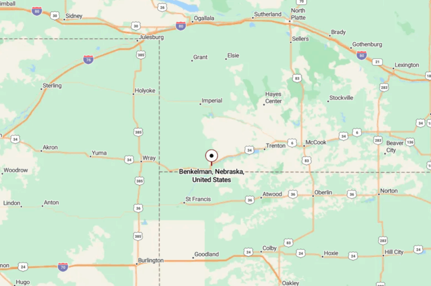
Set in Dundy County along the Republican River, Benkelman is about 35 miles west of McCook on US-34. The route slides through prairie and farmsteads with little traffic.
Side streets lead quickly to river parks and fields. It’s simple to reach, yet solitude greets you at the city limits.
23. Max – One-Store Hamlet on the Republican
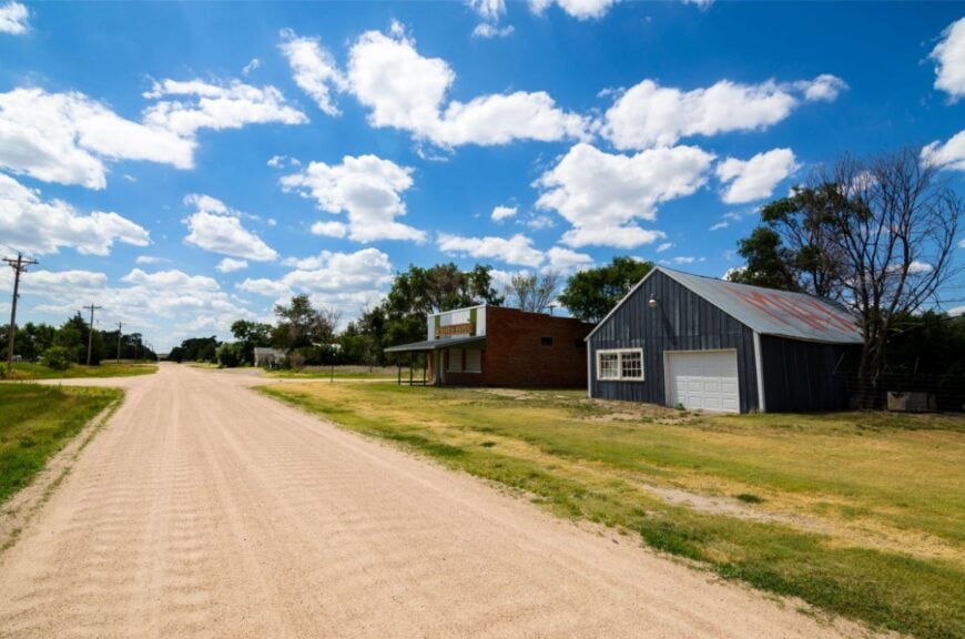
Max is barely there, and that’s the beauty—an unincorporated clutch of homes and a store set beside the slow green ribbon of the Republican River. Its seclusion is geographic and deliberate; travelers blink and miss it unless they’re looking for quieter ground.
Fish shaded pools, watch pelicans wheel during migration, or hunt for fossils on legal public stretches after a good rain. Conversation happens at the counter, where the coffee is strong and the weather is everyone’s second cousin. Ranch work and fieldwork stitch the seasons together.
At dusk, the valley hum fades to crickets and river talk. Max is the pause between towns that you end up remembering most.
Where is Max?
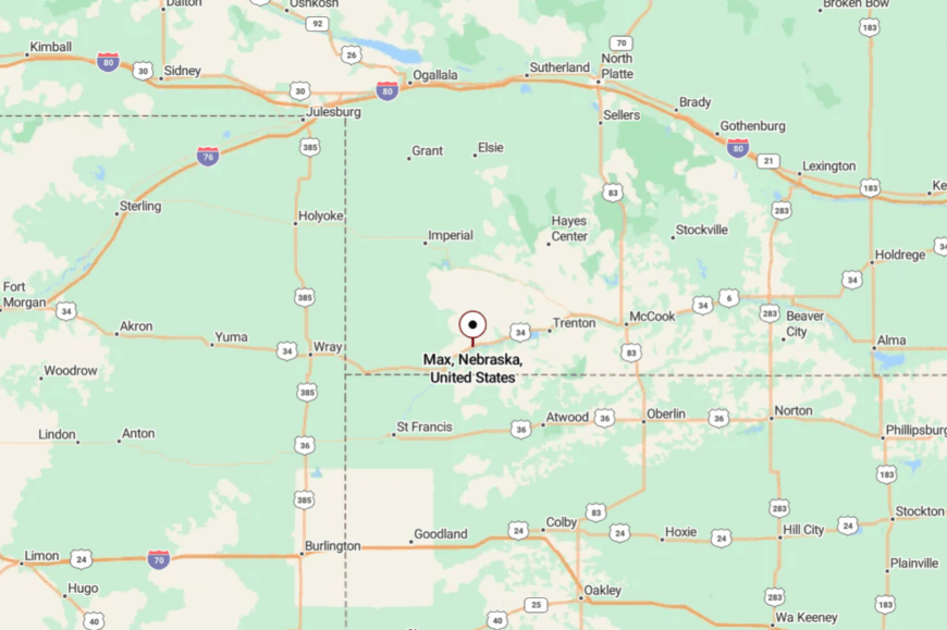
Max rests on US-34 in eastern Dundy County, between Benkelman and Stratton. It’s a straight, scenic drive from McCook with the Republican never far from sight.
Turnoffs become gravel within minutes, heading for pastures and river access. The quiet arrives as soon as your tires leave the highway.
22. Parks – Fencelines, Wind, and Wide Pasture
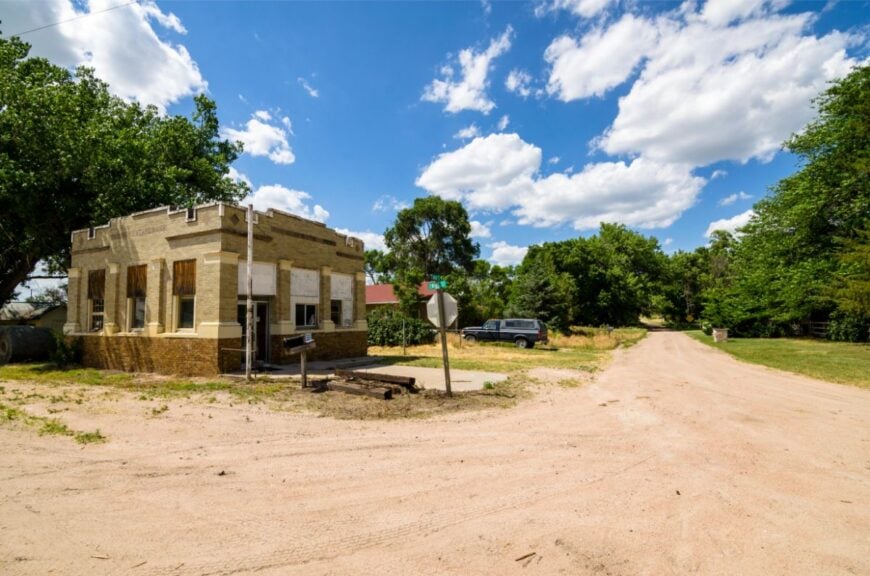
Parks looks like a painting of the High Plains: a few streets, big skies, and wind corrugating tall grass in unbroken waves. It feels off-grid thanks to long distances between neighbors and the absence of any big-box glow.
Bring binoculars for pronghorn on the flats, walk section roads at sunset, or photograph thunderheads shouldering up over Kansas. A small post office and church are the soft heart of the place.
Grain and cattle keep the calendar, with harvest and calving the local holidays. Nights are so dark that you learn the constellations by heart. Parks is a whisper of a town that still carries.
Where is Parks?
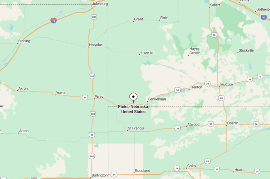
Parks sits in western Dundy County along US-34, west of Benkelman. Getting there is a matter of cruising two-lane blacktop through open country.
Most side roads are graded gravel that end at pastures or the river. It’s close to the highway, but far from any hurry.
21. Lamar – Prairie Crossroads Near the State Line
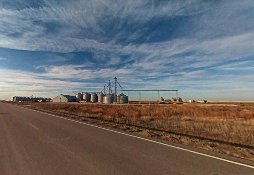
Lamar is a scatter of farmhouses and shade trees stitched to the land by gravel lanes. Seclusion comes easy out here—no interstates, few signs, just windbreaks and wheat fields to mark the miles.
Watch hawks kite over terraces, picnic beside a shelterbelt, or take an unhurried loop to photograph windmills at golden hour. The rhythm is agricultural: grain bins, cattle pens, and trucks that raise dust like small weather.
A modest church bell and the creak of a screen door pass for traffic. When dusk falls, the horizon glows and then goes black. Lamar is the sound of your own footsteps on a county road.
Where is Lamar?
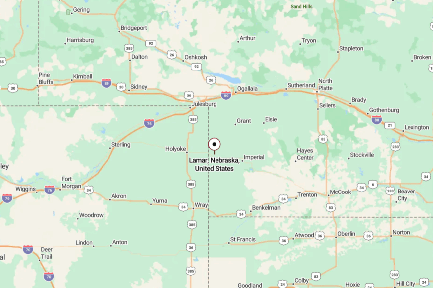
In southwestern Chase County, Lamar lies not far from the Colorado border. Most visitors reach it by county roads spurring off US-6/34.
The last stretch is gravel, lined with pastures and pivot circles. It’s close enough to find, far enough to feel alone.
20. Enders – Reservoir Calm on a Prairie Rim
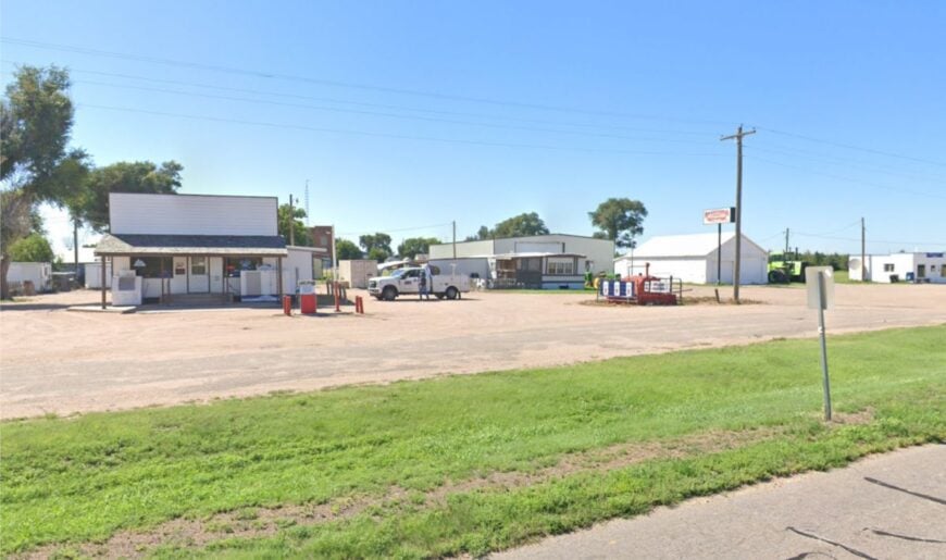
Enders stands a few miles above a broad blue bowl—Enders Reservoir—where cottonwoods and cattails ripple in the slightest breeze. Its tucked-away feel comes from the sweep of open land and the way water and sky meet with no city noise between them.
Cast for walleye at dawn, spot migrating waterfowl from a quiet cove, or pedal empty roads that contour the lake’s edge. A handful of lodges, the SRA campground, and farm work form the backbone here.
The air smells like sun-warmed hay and lake water. Even weekends feel unhurried once the boats trailer out. Enders is prairie exhale.
Where is Enders?
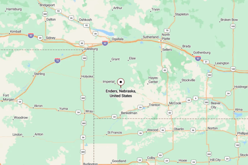
Enders sits in eastern Chase County along US-6/34, east of Imperial. A short spur drops south to Enders Reservoir State Recreation Area.
The approach is two-lane and scenic, with fields giving way to water in a single curve. It’s easy to reach, yet the quiet hangs on the shore like fog.
19. Champion – Mill Pond Reflections and Cottonwood Shade
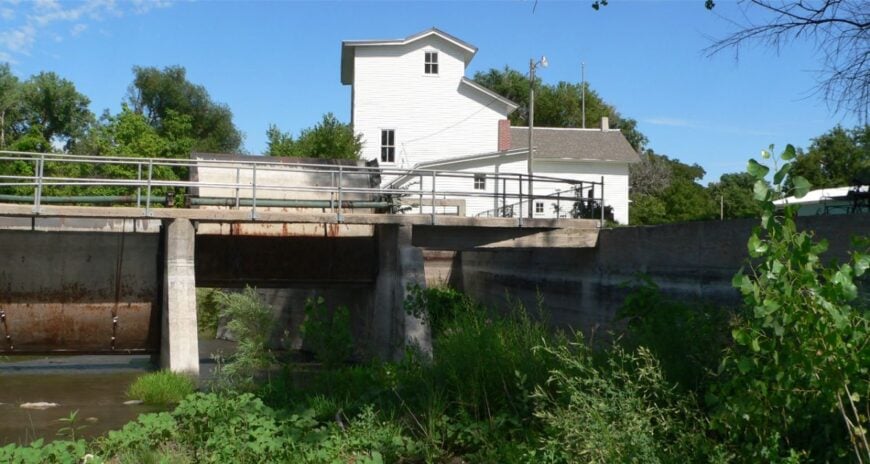
Champion gathers around a spring-fed lake and a preserved mill, the kind of tableau that makes you slow the car without meaning to. Seclusion lingers because development never crept far beyond the water and the old road.
Walk the grounds of the historic mill, launch a canoe on still morning water, or picnic where willow branches trail the surface. Imperial is close enough for supplies, but evenings belong to frogs and lilting meadowlarks.
Farming frames the hamlet; the lake sets the pace. Even the breeze seems gentler here. Champion feels like a picture you can step into.
Where is Champion?
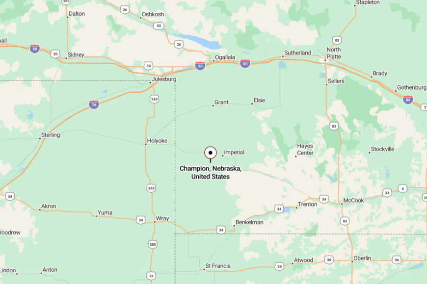
Situated in southern Chase County, Champion lies a few miles south of US-6/34 near Imperial. County roads lead you down to the lake and the historic park.
The final approach is slow by design—narrow lanes, big shade trees. It’s the pleasant kind of detour that ends with water light.
18. Venango – Border Village with Big Night Skies
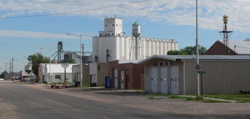
Venango sits on the last rise before Colorado, where grain elevators stand like quiet sentries and streets end in prairie. Its out-there vibe comes from distance and the simple geometry of fields and sky.
Stroll a sleepy main drag, photograph long trains under high clouds, or set up a tripod after dark for sky shots unspoiled by town glow. Neighbors swap tools as often as stories, and the café chalkboard does community duty.
Grain and cattle keep the week moving without hurrying it. There’s space enough to let your thoughts stretch. Venango is a margin that feels like a center.
Where is Venango?
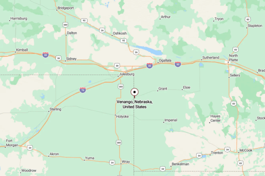
Venango is in western Perkins County on US-6/34 near the Colorado line. It’s roughly 25 miles west of Imperial and due south of Grant by back roads.
The drive is pure plains—straight runs, long horizons. You arrive when the sky seems to get even bigger.
17. Elsie – One-Stoplight (If That) Plains Village
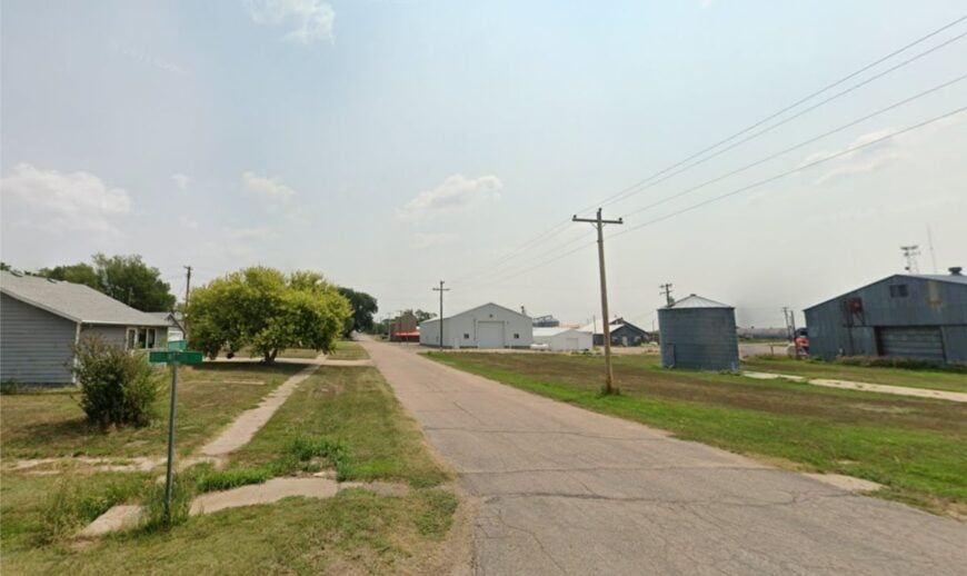
Elsie is the kind of place where a grain truck and a school bus count as a parade. Its seclusion stems from being set on a two-lane ribbon (NE-23) with miles of pasture and wheat between neighbors.
Grab a soda at a small counter, watch harvest roll in like a moving horizon, or walk a section road in the glow of a prairie sunset. The vibe is friendly and unornamented; life here is practical poetry.
Elevators, farm shops, and a few storefronts anchor the work week. Nights are so quiet that you hear geese long before you see them. Elsie is unbusy in the best way.
Where is Elsie?
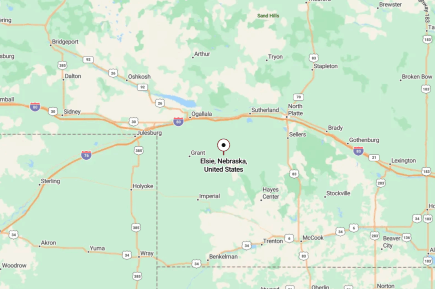
Elsie sits in Perkins County along NE-23, between Wallace and Madrid. The approach is all two-lane, with fields unspooling in every direction.
Cross streets turn to gravel within a minute or two. It’s as easy to pass by as it is rewarding to stop.
16. Madrid – Elevator Silhouettes and Summer Thunderheads
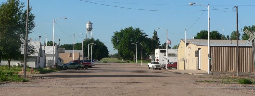
Madrid rises from the plains in clean lines—elevators, a water tower, and porch roofs bright against big weather. It feels tucked away because the nearest city is a memory, and traffic is mostly local.
Browse a small main street, catch a ball game under bleachers that creak just right, or chase storm-edge light along NE-23. Coffee comes poured by someone who already knows your name.
Agriculture is the metronome, with harvest dust making its own sunsets. When the wind drops, everything else does too. Madrid is a pause button on the prairie.
Where is Madrid?
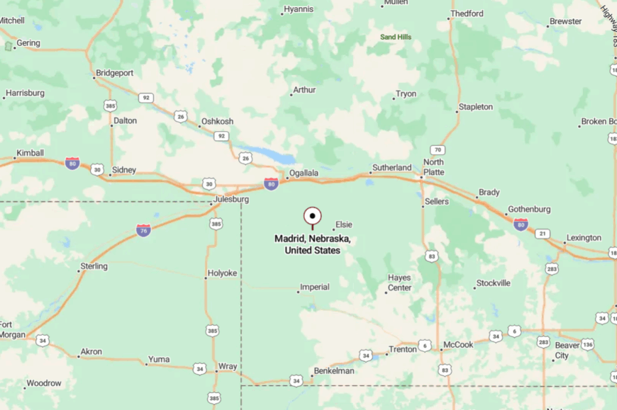
Located in central Perkins County on NE-23, Madrid lies west of Wallace and east of Grant.
You’ll get there on two-lane blacktop with long sight lines and few stop signs. Side streets end quickly at fields. It’s close to your route but far from routine.
15. Wellfleet – Cottonwood Shade off the Highway
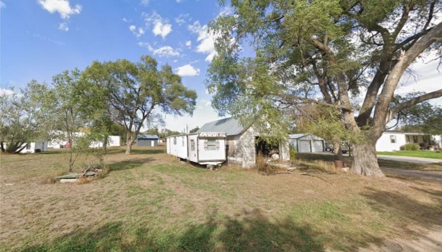
Wellfleet gathers around a bend in a creek south of North Platte, a short jog off US-83 that might as well be a time zone. Seclusion is a function of small scale and shelterbelts that mute the world beyond town.
Fish a shady culvert, bike quiet county roads strung between pastures, or count shooting stars over the elevator. The vibe is neighborly and no-nonsense; folks wave whether they know you or not.
A few shops and farm work keep lights on and doors unlocked. After sunset, the loudest thing is the crickets. Wellfleet feels like a porch light in big country.
Where is Wellfleet?
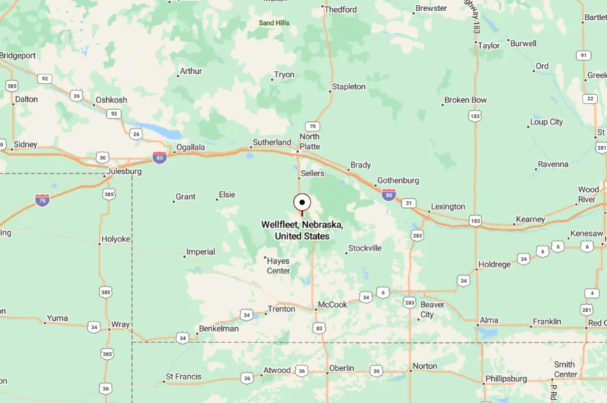
In southern Lincoln County, Wellfleet is roughly 20–25 miles south of North Platte via US-83 and county roads.
The last turns slip behind windbreaks and creek bottoms. Gravel spurs reach farms in every direction. It’s close to the highway, yet the quiet takes over fast.
14. Stockville – Courthouse on the Creek, Town in No Hurry
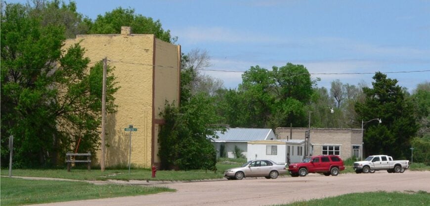
Stockville sits on Medicine Creek with a historic courthouse set like a keepsake above the water. Its tucked-away character comes from being a small county seat reached by meandering country roads.
Walk the creek bridge at twilight, wander past tidy lawns, or drive gravel loops where meadowlarks escort your car. Government jobs and ranch work anchor the week; the rest is conversation and chores.
There’s pride in the quiet here—nothing flashy, everything cared for. When the wind combs the cottonwoods, the whole town seems to listen. Stockville is a gentle page in a long book.
Where is Stockville?
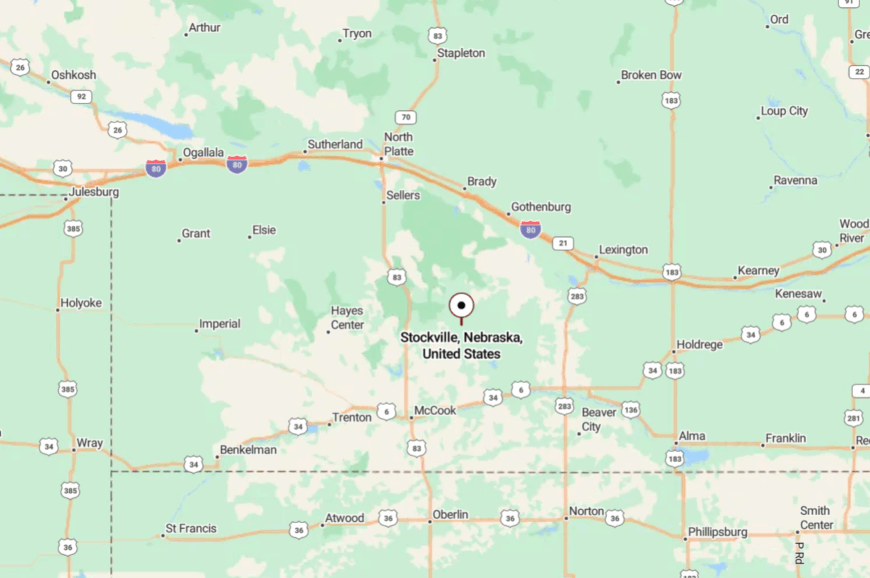
Stockville lies in Frontier County, south of Curtis and west of Eustis, reached by county roads off NE-23/NE-47. The approach crosses rolling pasture and creek draws.
Distances are short, horizons long. It’s easy to get to slowly—and that’s the point.
13. Moorefield – A Wide Spot with Wider Views
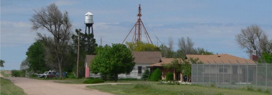
Moorefield is small enough to count its blocks on one hand, which only adds to its calm. Seclusion comes by way of NE-23’s long, empty stretches and the hills that fold town into the landscape.
Photograph windmills against sundown, walk the grain-scented edge of town, or cruise to nearby canyons for birding. The vibe is welcoming and spare—what’s here matters.
Elevators and farm sheds sketch the skyline; harvest and planting write the calendar. At night, the stars feel almost local. Moorefield is proof that little places hold big quiet.
Where is Moorefield?
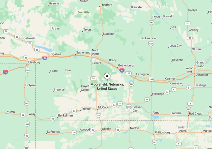
Moorefield sits in Frontier County on NE-23, between Curtis and Eustis. The approach is a gentle ribbon through farm and pasture.
Crossroads are few and purposeful. It’s close enough to pass, but better to pause.
12. Hamlet – Gravel Roads, Big Skies, Few Footprints

Hamlet is a scatter of homes and outbuildings tucked into the folds south of the highway, where silence seems to pool. Its off-the-map feel comes from gravel access and long distances between mailboxes.
Walk section lines at sunrise, glass for mule deer along draws, or sit on a tailgate and let the sky do the talking. Work here is the land: corn, cattle, and calving seasons.
The pace is set by chores and weather, not clocks. When night falls, the constellations feel close enough to count. Hamlet is in solitude with a local address.
Where is Hamlet?
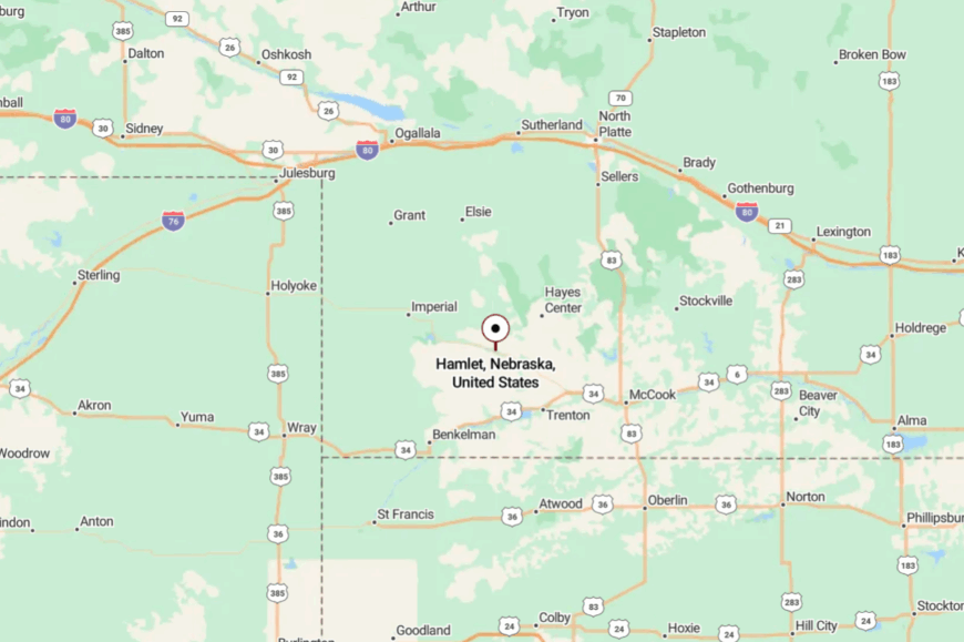
In Hayes County, Hamlet lies south of the US-6/34 corridor between Palisade and Hayes Center. Reaching it means turning off pavement onto well-graded gravel.
The final miles are all pasture and windbreaks. It’s near a highway, yet the hush is immediate.
11. Grainton – Elevator Echoes on NE-23
Grainton is little more than an elevator, a few streets, and the sound of wind threading through milo heads—but that’s enough. Its seclusion is by design and distance, set on NE-23 with fields for neighbors in every direction.
Photograph old rail spurs, walk a quiet mile at dusk, or watch summer storms build anvils over an endless horizon. The economy is grain and grit—bins, trucks, and long days that end in satisfied silence.
People wave from pickups and mean it. When the breeze drops, you can hear the harvest a county away. Grainton is prairie minimalism at its most beautiful.
Where is Grainton?

Grainton sits in eastern Perkins County on NE-23 between Elsie and Wallace. The road in is exactly the road out—two lanes, straight and sure.
Cross streets turn quickly to gravel and field access. It’s easy to find and even easier to feel far away.
10. Maywood’s Rural Retreat

With a population of around 250 residents, Maywood is a quaint village where everyone seems to know each other.
I love visiting this small community for its annual Old Settlers’ Picnic, a tradition that brings together locals and visitors for parades, games, and good old-fashioned fun. Surrounded by rolling farmland, the main industry here is agriculture, with many families farming the land for generations.
What makes Maywood truly secluded is its peaceful rural setting, far from the noise of city life, offering a serene environment that’s perfect for relaxation and reflection. The village’s simplicity and the warmth of its residents make it a charming escape for anyone looking to slow down.
Where is Maywood?

Nestled in Frontier County, Maywood lies in southwest Nebraska, approximately 40 miles south of North Platte. Its remote location, tucked away among vast fields and open skies, contributes to its sense of isolation.
Accessing Maywood requires a scenic drive along Highway 23, which winds through the countryside and underscores the town’s seclusion. For me, the journey to Maywood is as calming as the destination itself, offering an escape into Nebraska’s tranquil heartland.
9. Wallace’s Wide Open Spaces

Wallace, home to about 360 people, is a small village that embodies the essence of rural Nebraska.
One of my favorite activities here is exploring the expansive landscapes that stretch as far as the eye can see, perfect for hiking, bird-watching, and simply soaking in the quiet. Agriculture is the backbone of Wallace’s economy, with vast cornfields and cattle ranches dotting the horizon.
Its seclusion comes from the wide-open spaces and low housing density, providing a true sense of freedom and connection with nature. The tranquility found here is unmatched, making it an ideal spot for reflection and rejuvenation.
Where is Wallace?

Located in Lincoln County, Wallace sits approximately 45 miles southwest of North Platte. Its position away from major highways and cities enhances its secluded feel.
To reach Wallace, I usually take Highway 25, which offers a peaceful drive through the countryside. The town’s remote setting, amidst Nebraska’s prairie lands, makes it a haven for those looking to escape into simplicity and tranquility.
8. Indianola’s Hidden Heritage

Indianola, with a population of just over 600, is a town rich in history and quiet charm. I enjoy visiting the Indianola Historical Society Museum, which showcases artifacts and stories from the area’s past, including its connections to the Republican River Valley.
The town’s main industries are agriculture and small businesses that serve the local community. Indianola’s seclusion stems from its slow-paced environment and distance from urban centers, offering a peaceful lifestyle steeped in heritage and tradition.
The quiet streets and historic buildings make it a perfect place to unwind and step back in time.
Where is Indianola?

Situated in Red Willow County, Indianola is about 15 miles east of McCook along U.S. Route 6. Its location in the rolling hills of southwest Nebraska, away from bustling highways, contributes to its hidden nature.
Getting there involves a scenic drive through farmland and gently rolling terrain, which I find adds to the experience. The town’s seclusion and rich history make it a unique destination for those interested in both tranquility and the stories of the past.
7. The Reclusive Beauty of Bartley

Bartley is a small village of around 280 residents that offers a peaceful respite from the outside world.
One of Bartley’s hidden gems is the unique Church of Christ (Bartley Christian Church), a beautiful structure that reflects the town’s close-knit community spirit. The town thrives on agriculture, with many local farms producing corn, soybeans, and wheat.
Its secluded nature is enhanced by the expansive farmlands and the quiet, day-to-day life that characterizes this close-knit community. For me, the serenity found in Bartley is a refreshing change from the fast pace of larger towns.
Where is Bartley?

Bartley is located in Red Willow County, approximately 12 miles east of McCook along U.S. Route 6. Its position amid Nebraska’s agricultural heartland, away from major urban areas, adds to its sense of seclusion.
The drive to Bartley, passing through sweeping fields and open skies, reinforces the feeling of stepping back into a simpler time. The town’s peaceful environment and friendly residents make it an inviting place to visit or even call home.
6. Palisade’s Peaceful Vineyards

With a population hovering around 350, Palisade is a village known for its surprising presence of vineyards and wineries in the heart of Nebraska. I’m particularly fond of visiting the Feather River Vineyards, where I can enjoy local wines in a serene setting overlooking the picturesque countryside.
Agriculture remains the mainstay, but the growing wine industry adds a unique twist to the local economy. The quiet roads and vast open spaces contribute to Palisade’s peaceful rural atmosphere, making it a secluded getaway that delights the senses.
Where is Palisade?

Palisade straddles the border of Hayes and Hitchcock counties, situated along the Frenchman River. Nestled between gently rolling hills and agricultural land, the village’s remote location enhances its solitude.
Access is via Nebraska Highway 25, which meanders through scenic countryside. For me, the journey to Palisade is enriched by the natural beauty that surrounds it, reinforcing its status as a peaceful retreat perfect for wine enthusiasts and nature lovers alike.
5. Trenton’s Lakeside Seclusion

Trenton, home to around 500 residents, offers a unique blend of small-town life and outdoor recreation.
One of my favorite spots is the nearby Swanson Reservoir State Recreation Area, perfect for fishing, boating, and camping. The main industries include agriculture and tourism, thanks to the reservoir’s draw.
Trenton’s remote location and natural barriers, like the reservoir and surrounding open land, make it an ideal spot for those seeking solitude and a close connection with nature. The town’s serene environment provides a wonderful backdrop for both adventure and relaxation.
Where is Trenton?

Located in Hitchcock County, Trenton lies along U.S. Route 34, about 20 miles west of McCook. Its seclusion is enhanced by the vast stretches of farmland and the presence of the reservoir, which acts as a natural buffer.
Getting to Trenton involves a tranquil drive through Nebraska’s rural landscapes, something I always find refreshing. The combination of water and land-based activities, along with its secluded setting, makes Trenton a unique and inviting destination.
4. Culbertson’s Countryside Retreat

With approximately 600 residents, Culbertson is a charming village that offers a peaceful retreat into Nebraska’s countryside. I enjoy visiting the historic 1886 Hotel Wilson, a beautifully preserved building that speaks to the town’s rich history.
Agriculture is the primary industry, with large land parcels offering privacy and a sense of openness. Culbertson’s tranquil environment and the spaciousness of its surroundings provide a secluded atmosphere that’s hard to find elsewhere. The friendly community and rural charm make it a delightful place to spend time.
Where is Culbertson?

Culbertson is situated in Hitchcock County, along U.S. Route 6, roughly 10 miles west of McCook. Its location, nestled among rolling farmlands and away from crowded urban centers, enhances its sense of seclusion.
The drive to Culbertson is a peaceful one, with open fields and the gentle curves of the Republican River Valley guiding your way. For me, Culbertson’s blend of history and rural charm makes it a perfect countryside retreat.
3. Stratton’s Serene Surroundings

Stratton, with a population of about 340, is a village that offers a serene escape amid Nebraska’s western plains. I find that the peaceful streets and friendly locals make it an inviting place to unwind.
The town is surrounded by open spaces ideal for outdoor activities like hiking and bird-watching. Agriculture is the mainstay here, and the low population density accentuates the sense of solitude. Stratton’s secluded location makes it a perfect spot for those seeking a quiet lifestyle, free from the distractions of busier locales.
Where is Stratton?

Located in Hitchcock County, Stratton sits along U.S. Route 34, about 40 miles west of McCook. Its position, far from major urban areas and surrounded by expansive farmland, contributes to its seclusion.
Accessing Stratton involves a scenic drive through Nebraska’s western landscapes, which I find both calming and picturesque. The town’s remote setting underscores its appeal as a place to truly get away from it all and enjoy the simple pleasures of rural life.
2. The Quiet Charm of Wauneta

Wauneta is a village of approximately 570 residents, where the pace of life is as gentle as the nearby Frenchman Creek.
I love strolling through its quaint downtown, visiting local shops and the historic Wauneta Roller Mills, which has been in operation since 1925. Agriculture shapes the economy here, but the natural beauty of the surrounding area offers plenty for outdoor enthusiasts.
Wauneta’s peaceful rural setting and tight-knit community make it a haven for those looking to escape the hustle of city life. The combination of friendly faces and scenic landscapes creates a truly charming atmosphere.
Where is Wauneta?

Situated in Chase County, Wauneta lies along U.S. Route 6, about 70 miles west of McCook. Its remote location, nestled among rolling hills and farmlands, enhances its secluded feel.
Getting to Wauneta means traveling through some of Nebraska’s most beautiful countryside, something I always look forward to. The town’s serene environment and welcoming locals make it a special place that embodies the quiet charm of rural Nebraska.
1. Hidden Gem of Hayes Center

Hayes Center, the county seat of Hayes County, is a tiny village with a population of just around 200 people. I find its secluded location amidst rolling plains offers a tranquil escape unlike any other.
The town doesn’t bustle with tourist attractions, but its simplicity is its allure, providing a perfect backdrop for stargazing or enjoying the peaceful Nebraska sunsets.
Agriculture is the lifeblood of Hayes Center, with expansive landscapes ideal for those seeking solitude and a close connection to the land. Its sparse population and quiet streets truly make it a hidden gem waiting to be discovered.
Where is Hayes Center?

Located in the heart of Hayes County, Hayes Center sits along Nebraska Highway 25, roughly 35 miles northwest of McCook. The village’s remote position, far from major highways and urban centers, contributes to its deep sense of isolation.
The journey to Hayes Center takes you through unspoiled prairie lands, which I find both calming and inspiring. For anyone yearning to disconnect and immerse themselves in the tranquility of the Great Plains, Hayes Center is the place to be.