Northeast Louisiana is dotted with tiny settlements where traffic lights are rare, porch swings outnumber storefronts, and the night sky still puts on an unfiltered show. We gathered twenty five such places that sit beyond the glare of larger cities yet remain rich in character, scenery, and local history.
Each offers a different slice of Delta or pine-hill life, whether it is a cotton-gin ghost site hidden behind the Mississippi River levee or a farm hamlet wrapped in misty bayous at dawn.
Our list moves in countdown fashion, beginning with the most photographed of these hideaways and ending with a pasture-ringed patch of parish road that even lifelong Louisianans sometimes struggle to find.
Expect mentions of faded country stores, gravel lanes, the postal service visits only three times a week, and wildlife corridors where egrets stand motionless at sunset. For travelers, photographers, or anyone who just wants to feel the hush of open country, these towns prove that quiet corners still exist.
25. Monticello

Set deep in the rolling pinewoods of northern Louisiana, Monticello sits far from main highways, hidden behind farm fields and quiet rural routes. This small community feels more like a crossroads than a town, its rhythm marked by tractors rumbling past and neighbors chatting beneath spreading oaks.
Time moves gently here, stitched into porch swings, church suppers, and the steady hum of cicadas at dusk. Visitors may meander toward Bayou D’Arbonne, fish in shaded farm ponds, or wander dirt roads past weathered barns.
Small-scale farming and forestry still support many who’ve stayed, echoing traditions rooted in red-clay soil. Monticello doesn’t ask for attention—it simply reminds you how rare it is to find somewhere that still feels this grounded.
Where is Monticello?

Monticello sits in the piney woods of northeastern Louisiana, about 20 miles southeast of Monroe and several miles off busy U.S. Highway 165. Reached by a quiet two-lane parish road that winds through forests and fields, the town feels tucked away from fast-moving traffic and city bustle.
Its location between stretches of timberland and open rural countryside creates a sense of distance even though it isn’t terribly far from larger communities. It’s close enough to reach, but far enough to feel like you’ve stepped into another world.
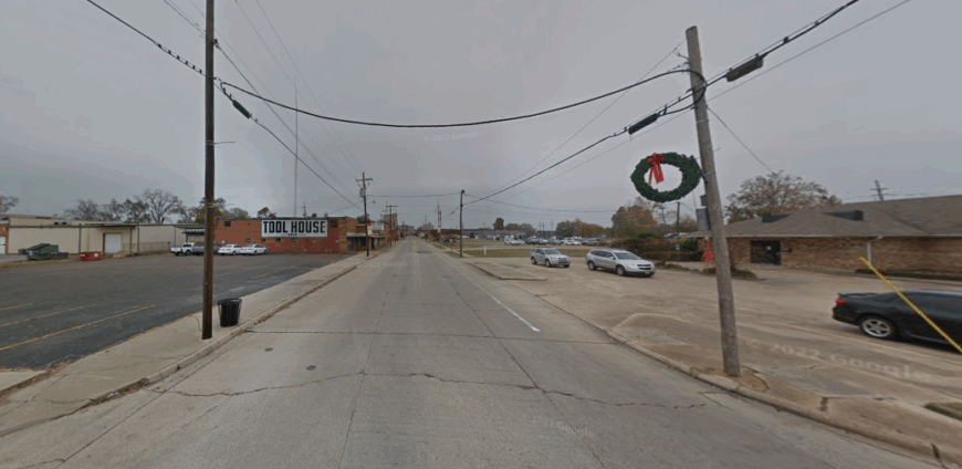
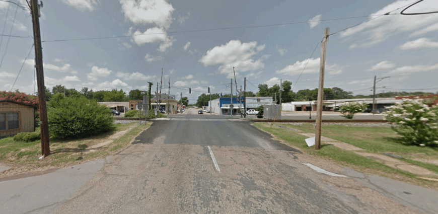
24. Delhi
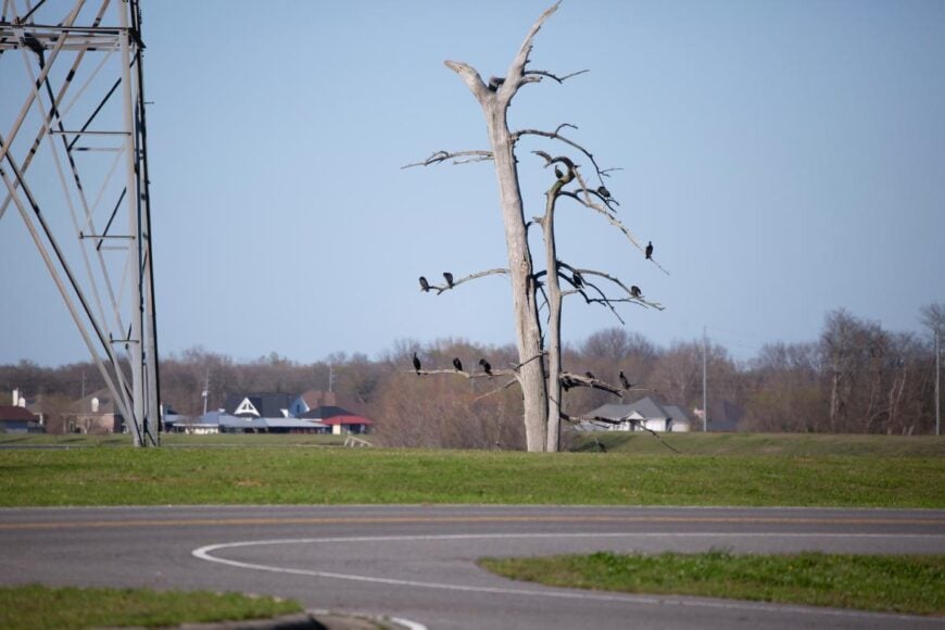
Surrounded by flat stretches of cotton fields and bayous that glint beneath wide Louisiana skies, this Delta town feels tucked away from the rush of the interstate. Dirt roads split off into pecan groves and catfish ponds, where egrets skim the surface and the air smells faintly of loam and river water.
Downtown is small—a few storefronts, a café, and stories traded across gas station counters with familiar ease. Travelers might fish along Poverty Point Reservoir, explore ancient earthworks at the nearby UNESCO site, or follow country roads past weathered farmsteads.
Agriculture still drives daily life here, with cotton, corn, and soybeans anchoring much of the local economy. Delhi wraps itself around you slowly, the kind of place where the days feel stitched together by silence and sun.
Where is Delhi?
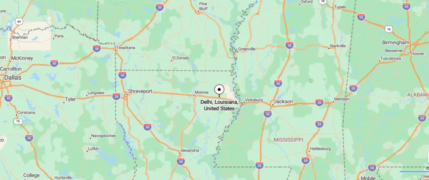
Delhi rests in northeastern Louisiana’s Richland Parish, about 30 miles east of Monroe and just south of Interstate 20. Though technically near a major highway, it sits slightly removed along quiet state roads that weave through cotton fields and open delta farmland.
This gentle separation from the interstate’s rush preserves a slow, unhurried character rarely found along such a well-traveled corridor. It’s easy enough to find, yet distant enough to feel like you’ve slipped into a quieter corner of the state.
23. Bosco
Hidden along quiet parish backroads, Bosco feels more like a memory than a marked town, surrounded by cotton fields that blur into the horizon. Old barns lean into windblown oaks, and the world narrows to gravel roads, rusted mailboxes, and the steady hum of insects under a hot Louisiana sky.
Life here moves with unspoken rhythm—early mornings, long afternoons, and neighbors who know one another by heart. Visitors may follow the bayou for fishing spots, photograph abandoned farmsteads, or simply watch trains thunder past on distant tracks.
Farming remains the heart of the community, with soybeans, corn, and cotton guiding each season’s work. Bosco lingers quietly, a reminder that some places survive not through growth, but through staying exactly as they are.
Where is Bosco?

Bosco is an unincorporated community in northern Ouachita Parish, about 15 miles south of Monroe along U.S. Route 165. Set just off the highway amid fields and pine stands, it feels quietly removed from the pulse of nearby towns.
The approach is simple—a straight drive on a rural highway that narrows into slower, tree-lined local roads. It’s close enough to reach quickly, yet distant enough to feel like a pause in time.
22. Archibald
Tucked along the backroads of northeast Louisiana, Archibald drifts quietly between cotton fields and sun-scorched pastures. The town is small—little more than a post office, grain silos, and a scattering of homes rooted deeply in Delta soil.
Long summer days slip by to the buzz of cicadas and the slow roll of tractors heading toward the fields. Travelers might detour to fish nearby bayous, photograph rusting barns, or drive gravel roads lined with towering pecan trees.
Farming still shapes nearly every life here, with crops and harvests setting the pulse of the year. Archibald doesn’t bustle—it simply endures, offering the kind of stillness the world rarely allows.
Where is Archibald?
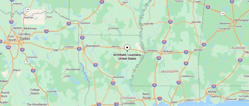
Archibald sits in Richland Parish in northeastern Louisiana, about 8 miles south of Rayville and tucked just off Highway 15. Reached by quiet two-lane country roads bordered by fields and pine, it feels gently sheltered from busier routes.
Its location between farmland and scattered woodlands keeps it connected yet subtly apart from neighboring towns. It’s easy enough to drive to, yet far enough to feel like a place where time drifts a little slower.
21. Crew Lake
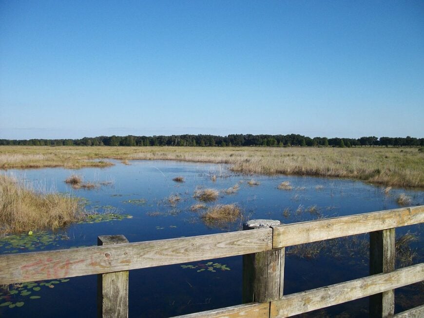
Tucked deep in Louisiana farm country, Crew Lake appears almost by surprise—a sleepy bend in the road framed by soybeans and swamp maples. There’s no main street, just a scattering of homes, a weathered church, and a bayou locals fish as if it were their private pond.
Humidity hangs thick, making the sound of crickets, frogs, and distant tractors feel like the town’s true heartbeat. Wanderers can cast a line from tilted wooden docks, walk levee paths shaded by pecan trees, or spot herons stalking the shallows.
Work here is tied to the land, with cotton, corn, and beans dictating the rhythm of every season. Crew Lake holds tight to its quiet, reminding visitors that not all places were meant to be found in a hurry.
Where is Crew Lake?
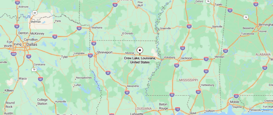
Crew Lake lies in northeastern Louisiana near the tiny community of Start, about 7 miles west of Rayville in Richland Parish. Though only a short drive from I-20, it sits off rural two-lane roads that wind through farmland before reaching the quiet shoreline.
Its location amid open delta fields and scattered timber gives it a hushed, tucked-away feel despite the nearby highway. It’s close enough for a quick visit, yet remote enough to feel like a peaceful hiding place.
20. Dunn

Down a lonely stretch of Delta backroad, Dunn appears almost like a mirage—just a handful of homes, grain silos, and a railroad crossing blinking into the endless fields. There’s no main street here, only farm roads lined with cotton and soybeans stretching beneath a sky that seems too big to hold.
The hush of the place is broken only by distant tractor engines, bird calls, and the occasional train rumbling past without stopping. Travelers might pull over to explore abandoned barns, cast a line into quiet irrigation ponds, or watch deer slip through windbreaks at dusk.
Nearly everyone who stays works the land, their year defined by planting, harvesting, and the stubborn persistence farming requires. Dunn isn’t meant to impress—it simply stays rooted, steady, and untouched by the rush of the world outside.
Where is Dunn?
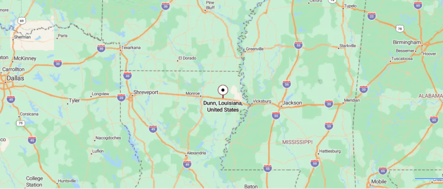
Dunn is an unincorporated spot in Richland Parish, about 10 miles east of Rayville in northeastern Louisiana. Access comes via quiet two-lane parish roads that split from the main highway and meander past fields and timber.
That gentle detour from busier routes keeps Dunn feeling quietly set apart even though it isn’t far from neighboring towns. It’s easy enough to find, yet distant enough to feel wrapped in rural stillness.
19. Foules
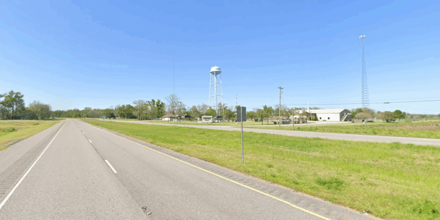
Hidden deep in the northeastern Louisiana Delta, Foules barely announces itself—just a few houses, a church, and fields that seem to swallow the horizon. The road into town narrows beside endless rows of cotton and soybeans, where summer heat shimmers and time stretches thin.
There’s a stillness here that feels intentional, as if the town exists in a pause between sunrise and sunset. Visitors may spot catfish ponds tucked behind levees, wander dirt roads past pecan groves, or catch sight of deer slipping from wooded bayous at daybreak.
Farming remains the backbone of life, with generations working the same land their forebears cleared. Foules lingers in memory like a whispered secret—quiet, enduring, and untouched by hurry.
Where is Foules?
Foules is a tiny hamlet in Catahoula Parish, northeastern Louisiana, about 4 miles southeast of Sicily Island and tucked just off small parish roads. Reaching it means leaving main highways and following winding rural byways through fields and timber.
That short detour keeps it feeling quietly detached despite its nearness to nearby communities. It’s easy to find on a map, yet far enough off the route to feel like a quiet corner of the delta.
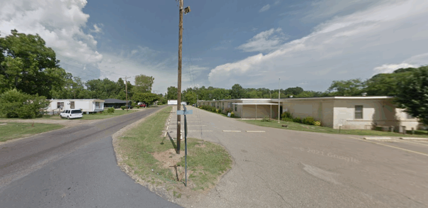
18. Tullos

Tucked where pinewoods meet the northern edge of Louisiana’s hill country, Tullos sits at the junction of two old rail lines, its origins tied to the timber boom of the early 1900s. The scent of resin still lingers in the air, and clapboard mill houses stand as quiet reminders of when sawmills once roared day and night.
Today, life feels steadier—marked by backyard gardens, kids riding bikes beneath longleaf pines, and freight trains that pass through without stopping. Visitors might explore nearby Kisatchie National Forest, hunt for quartz pebbles along creek beds, or photograph rusted mill relics hidden in second-growth forest.
A few locals still work in timber and pulpwood, while others commute to jobs in small towns strung along Highway 165. Tullos doesn’t dazzle—it simply endures, rooted in wood, grit, and the lingering echo of train whistles.
Where is Tullos?
Tullos is a small town in LaSalle Parish in north-central Louisiana, set near the junction of U.S. Routes 84 and 165—about 16 miles northwest of Jena and 22 miles southeast of Winnfield. Reaching it involves turning off the highway onto quieter two-lane roads that wind through piney woods and farmland.
Nestled near Castor Creek at the edge of the Little River basin, it feels subtly tucked into the landscape despite its highway access. It’s close enough to reach easily, yet far enough to feel like a pause beneath the pines.
17. Goodwill

Down a winding country highway in northeastern Louisiana, Goodwill sits quietly between rich Delta farmland and patches of deep, shadowed woods. There’s no real town center—just a scattering of homes, a church, and fields that stretch toward a sky too wide to hold.
Life moves slowly here, carried by tractor engines, church bells, and the soft rustle of cotton leaves in summer wind. Travelers might fish hidden ponds, photograph weathered barns, or spot herons stalking flooded ditches at dawn.
Farming still roots the community, with soybeans, corn, and cotton shaping each season’s pulse. Goodwill doesn’t shout for attention—it gently reminds you that the simplest places often hold the deepest calm.
Where is Goodwill?

Goodwill is a rural community in northwestern Louisiana’s Webster Parish, about 45 miles southeast of Shreveport and a few miles west of Minden. Reached via narrow parish roads branching off Interstate 20, the journey slips quickly from highway pace to quiet farmland and scattered pine.
Its position among open pastures and wooded tracts keeps it lightly shielded from nearby towns despite the proximity of major routes. It’s close enough for an easy drive, yet far enough to feel quietly tucked away from the wider world.
16. Lamar
Tucked along a quiet stretch of Louisiana backroad, Lamar slips almost unnoticed between pinewoods and sprawling farm fields. There’s no busy main street here—just a church, a few homes, and silos rising like sentinels above the flat Delta land.
Days unfold slowly, marked by crop dusters swooping low, frogs calling from roadside ditches, and tractors rumbling into long rows of cotton and soybeans. Visitors who linger might fish small ponds, explore forgotten barns edged in kudzu, or walk levee paths where deer step out at dusk.
Farming remains the heart of life, tying generations to the soil and seasons. Lamar doesn’t try to stand out—it simply offers the kind of stillness that makes the rest of the world feel far away.
Where is Lamar?
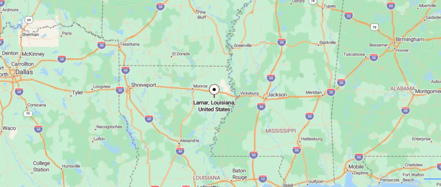
Lamar is a tiny settlement in Franklin Parish in northeastern Louisiana, about 10 miles south of Delhi and 13 miles east of Winnsboro. It’s reached by turning off nearby highways onto narrow parish roads that wind through open delta farmland.
That gentle detour keeps Lamar feeling quietly set apart despite its proximity to neighboring towns. It’s easy to reach, yet far enough off the beaten path to feel like a soft pause in the countryside.
15. Girard
Hemmed in by miles of cotton fields and dark bayou woods, Girard rests quietly beside a long-forgotten stretch of northeastern Louisiana highway. The town feels more whispered than spoken—little more than a post office, grain silos, and homes weathered by wind and time.
Summer heat shimmers above soybean rows while cicadas pulse like a heartbeat through the stillness. Visitors might pause to fish a nearby pond, wander gravel roads past abandoned barns, or watch trains thunder past without stopping.
Farming remains the backbone of life here, binding generations to the soil in rhythms as old as the Delta itself. Girard lingers not because of what happens here—but because of how little the outside world seems to matter once you’ve arrived.
Where is Girard?
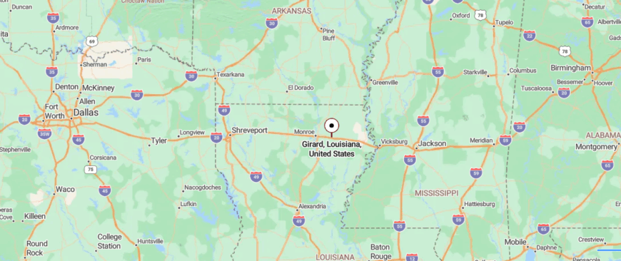
Girard is an unincorporated community in Richland Parish, northeastern Louisiana, sitting along the Boeuf River about 3 miles west of Rayville on U.S. Highway 80. Despite the highway and nearby rail line, reaching it means easing off faster routes onto calmer, tree-lined local roads.
Its riverbank setting and surrounding farmland create a sense of gentle separation from nearby towns. It’s close enough for a short drive, yet far enough to feel quietly removed from the rush.
14. Baskin

On a stretch of Delta highway where fields meet sky with no clear seam, Baskin arises like a whisper—one blinking stoplight, a water tower, and a scattering of clapboard homes. Summer cicadas hum from dawn until dusk, filling the humid air above cotton rows and dirt lanes winding past worn-out tractors.
It’s a town of porch swings, screened doors, and conversations that last longer than chores. Those passing through might fish farm ponds speckled with lilies, trace forgotten wagon ruts, or catch sunset as it pours gold over endless crops.
Farming keeps the pulse steady here, every season marked in seed, bloom, and harvest. Baskin doesn’t try to be more than it is—and that honest simplicity becomes its quiet kind of refuge.
Where is Baskin?
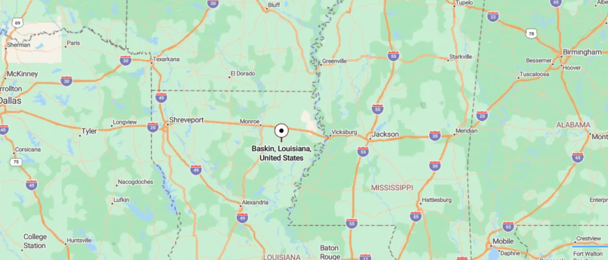
Baskin is a tiny village in northwestern Franklin Parish, about 7 miles north of Winnsboro along U.S. Route 425. The approach leaves larger highways behind in favor of quiet country roads threading through farmland and pine stands.
That short shift in pace gives Baskin a hushed, tucked-away character despite being near nearby towns. It’s close enough for a quick drive, yet far enough to feel like a peaceful pause in the countryside.
13. Start
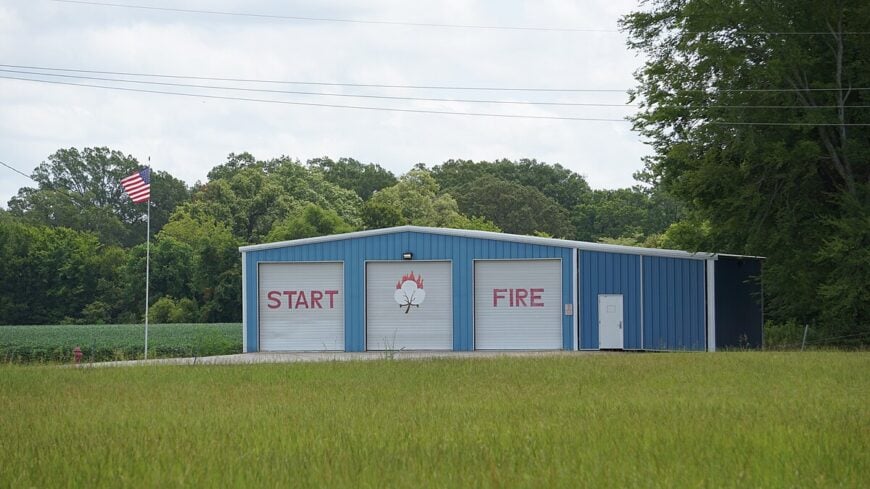
Just off a lonely stretch of highway in northeastern Louisiana, Start unfolds across flat farmland like a secret stitched into the Delta. There’s little fanfare here—just a blinking light, grain elevators, and a handful of homes holding tight to their roots.
Days move slowly beneath a sky so wide it seems to swallow thought, filled with the sounds of cicadas, distant trains, and tractors moving through cotton and soybean fields. Travelers might cast a line in a muddy bayou, photograph rusted farm trucks sinking into tall grass, or sit beneath pecan trees watching dragonflies skim irrigation ditches.
Agriculture still anchors everything, from conversations to calendars, with harvests marking time more faithfully than clocks. Start doesn’t try to make you stay—it simply settles into your memory as a place where quiet is king and nothing feels rushed.
Where is Start?
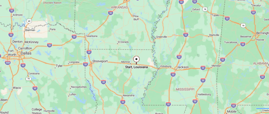
Start is a rural community in Richland Parish in northeastern Louisiana, about 6 miles west of Rayville just off Interstate 20. Leaving the interstate, you follow quiet two-lane roads through farmland until the landscape eases into fields, timber, and winding waterways.
Though close to a major route, its setting between the Boeuf River, Crew Lake, and the Lafourche Diversion Canal gives it a hushed, apart feeling. It’s easy to reach, yet far enough to feel gently removed from the rush.
12. Mangham
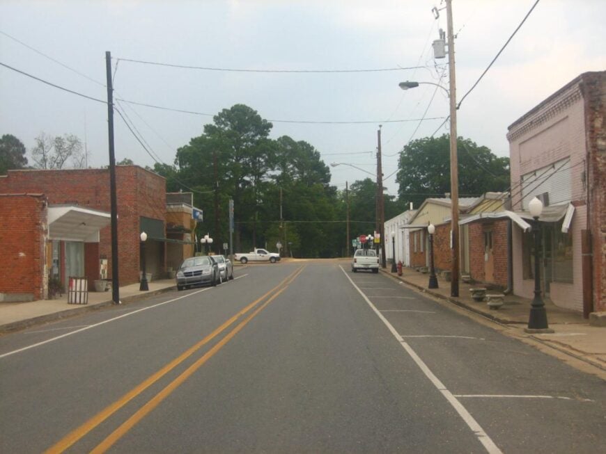
Once a stop on a busy railroad line, Mangham now moves at a gentler rhythm beneath magnolia trees and a fading brick main street. Painted ghost signs and a lone track hint at the days when cotton wagons crowded town and travelers filled its dry-goods stores.
Kids pedal past old storefronts while elders trade stories about harvests, trains, and Friday night football. Travelers might veer off the highway to photograph abandoned sharecropper cabins or spot migrating geese across winter-flooded fields.
History still anchors life here, celebrated through small-town events and stubborn tradition. Mangham doesn’t make noise—it simply holds tight to what made it.
Where is Mangham?
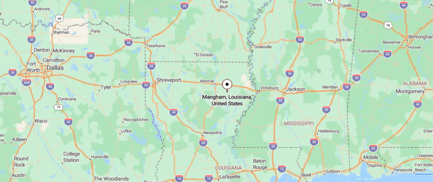
Mangham is a small village in Richland Parish in northeastern Louisiana, set along Highway 15 about 12 miles southeast of Rayville. You reach it by leaving larger routes for calm two-lane roads that wind through farmland and scattered timber.
Its placement between open fields and pine gives it a softly secluded character despite its proximity to nearby towns. It’s easy to reach, yet removed enough to feel quietly apart from the hurry of the outside world.
11. Gilbert
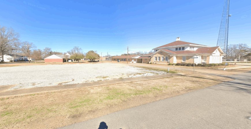
Once a thriving mercantile center along the Missouri Pacific Railroad, Gilbert now stretches quietly along Highway 4, its past written across faded storefronts and a century-old steel water tower. The hum of traffic barely registers against the sounds of tractor engines and courtyard oaks sighing in the Delta breeze.
Old commercial buildings, some with brick facades still bearing 1920s advertisements, stand beside a new generation of bait shops, dollar stores, and farm supply depots. Travelers might pull over to explore a tiny rail museum display, watch graduating seniors decorate the roadside “G” each spring, or glimpse white pelicans circling over nearby Turkey Creek Lake.
Farming remains the heartbeat here, but pride in the town’s railroad start bubbles just under the surface. Gilbert doesn’t rush toward the future—it simply keeps moving forward with one foot planted firmly in yesterday.
Where is Gilbert?
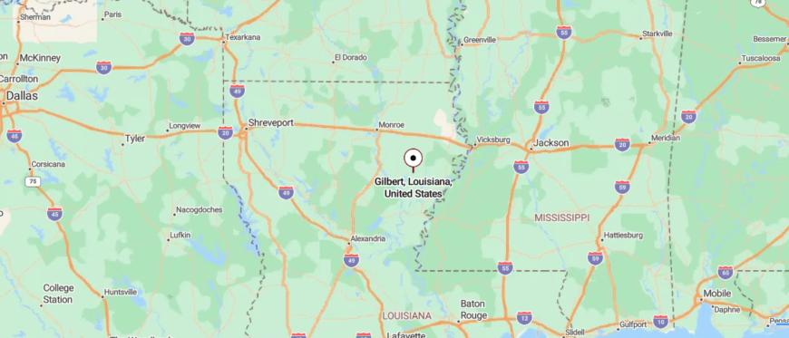
Gilbert is a small village of about 435 people (as of mid-2024) nestled in southern Franklin Parish in northeastern Louisiana, along U.S. Route 425—roughly 9 mi south of Winnsboro and 14 mi north of Sicily Island. To reach Gilbert, you turn off larger highways onto quiet two-lane roads that thread through farmland and gentle pine woodlands before arriving at its modest center.
Its location amid fields and trees gives it a softly secluded feel, even though it’s not far from neighboring towns. It’s close enough for a short drive, yet just remote enough that the pace seems to slow as you arrive.
10. Transylvania
With barely 60 residents, Transylvania sits almost alone on the Mississippi River levee in East Carroll Parish. Photographers stop for shots of the bat-shaped cutout above the old general store, then wander dirt roads flanked by endless cotton rows and aging grain silos.
Farming remains the backbone, especially cotton and corn, though seasonal duck-hunting guides pick up winter income. Social life centers on church fish fries and the volunteer fire station’s fall jambalaya supper.
The nearest grocery lies more than 25 miles away in Lake Providence, so weekly supply runs become a small pilgrimage. All that distance, plus cypress brakes that flood each spring, keeps the outside world at a comfortable arm’s length.
Where is Transylvania?
Transylvania rests along U.S. Highway 65, a straight ribbon that parallels the river north of Tallulah. Thick levee walls shield the settlement from both rising water and passing motorists, adding to its tucked-away feel.
The closest airport is in Monroe, almost an hour and a half southwest, followed by a slow cruise past soybean fields and catfish ponds. Most visitors notice the place only after the quirky roadside sign flashes by, which is exactly how locals like it.
9. Alto
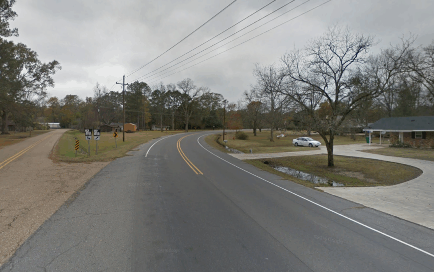
Alto claims roughly 75 people scattered around a lonely crossroads in Richland Parish. Dawn reveals fog curling over thousand-acre soybean tracts while red tractors idle near weathered pole barns.
Row-crop agriculture dominates the economy, although a small pecan-shelling shed opens each fall and briefly doubles the population. Residents host impromptu fish fries on Bayou Macon, and birders drift in for spring migrations that fill the tree-lined sloughs.
Streetlights are nonexistent, so stargazing is a nightly routine rather than a tourist activity. Long stretches of two-lane blacktop and waterlogged forest on three sides leave Alto feeling far more distant from Monroe than the odometer suggests.
Where is Alto?
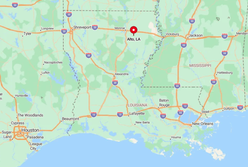
Sitting where Louisiana 15 meets Parish Road 137, Alto is 12 miles south of Rayville and well removed from interstate traffic. Bayou Lafourche and Bayou Macon wrap the area in a horseshoe, limiting access to a pair of low bridges that occasionally flood.
Most travelers arrive via LA 15, though the final curves narrow to one lane when the crops encroach. The geography, plus periodic high water, preserves Alto’s solitude more reliably than any welcome sign ever could.
8. Aimwell
Only about 90 people call Aimwell home, living between pine ridges and the backwaters of the Ouachita River in Catahoula Parish. Outdoor pursuits rule the calendar, from black-water canoe trips to squirrel hunts beneath moss-draped oaks.
Forestry and small cattle operations provide most paychecks, while a portable sawmill on LA 8 sharpens blades for half the parish. Community gatherings happen in the one-room church where Saturday night gospel sings echo through the hills.
Cell signal is fickle, and the nearest chain store sits 40 minutes away in Jena. Thick timber and seasonally flooded creeks form natural walls that keep Aimwell as hushed as its name suggests.
Where is Aimwell?
The settlement lies just off Louisiana 126, six miles east of the tiny town of Walters. It sits in a bowl of forest bisected by Aimwell Creek, with gravel roads that dead-end at hunting leases.
Reaching Aimwell requires winding through National Forest land that slows even locals to a crawl. Visitors usually follow the scent of pine resin more than any road sign.
7. Sondheimer
Sondheimer, population near 55, hides between the Mississippi levee and flooded hardwood stands in East Carroll Parish. Kayakers slide into nearby Lake Providence Cutoff to chase largemouth bass, while history buffs photograph the shell of an early 1900s cotton gin slowly being swallowed by vines.
Farming still contributes, yet many residents commute to the grain elevators in Lake Providence during harvest. Community ties center on a modest picnic pavilion beside the volunteer fire station, where domino games stretch past dusk.
Mail arrives three mornings a week, and some houses still sport hand-cranked water pumps. The tall levee blocks both the river view and any sense of connection to larger towns, sealing Sondheimer in its quiet pocket.
Where is Sondheimer?
The village sits just east of U.S. 65 but remains invisible until travelers crest a levee spur and spot a cluster of pecan trees. Flood-prone bottomland restricts additional roads, so the one paved entry doubles as the only exit.
Most visitors come by boat from the Mississippi oxbows or by following Parish Road 3132, a route locals keep secret during duck season. Those natural bottlenecks hold Sondheimer in near‐permanent seclusion.
6. Liddieville
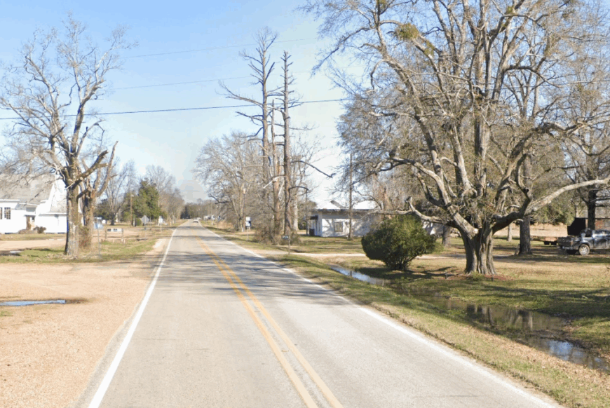
About 110 people line a winding section of LA 135 in Franklin Parish that maps label Liddieville. Early evening finds anglers casting into nearby catfish ponds, while combine harvesters hum through soy fields that run to the horizon.
Row-crop farming and aquaculture split the economy, with a family-run processing shed paying cash for channel cats on Saturdays. The highway’s gentle bends reveal mailboxes leaning in open country, making every sunset feel cinematic.
Social life centers on a little white church that doubles as a storm shelter when tornado season arrives. Wide-open farmland on all sides, coupled with a noticeable lack of signposts, causes even delivery drivers to overshoot the hamlet.
Where is Liddieville?
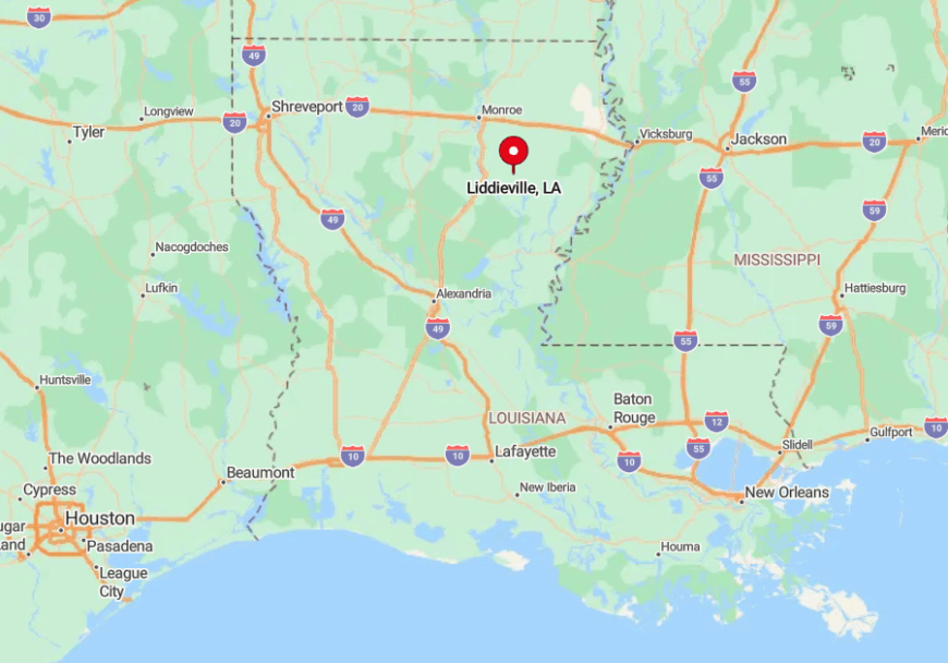
Liddieville sits nine miles west of Winnsboro on Louisiana 135, halfway between Bushley Bayou and Turkey Creek. Beyond the main ribbon of asphalt, roads turn to gravel almost immediately.
The closest four-lane route is U.S. 425, but reaching it involves weaving through levee cuts and culvert crossings that slow traffic to farm-tractor speed. That subtle inconvenience helps the community keep its slow pace year-round.
5. Manifest
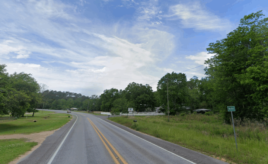
Manifest registers roughly 65 inhabitants tucked along gravel spurs branching from LA 8 in Catahoula Parish. Deer tracks decorate most yards, and evening breezes carry the pine scent that loggers have worked for generations. Timber remains king, supplemented by guiding services for the nearby Boeuf Wildlife Management Area.
The boarded-up country store stands as a relic, yet its porch still welcomes storytellers come Saturday. Nights invite porch listening sessions where barred owls outnumber road noise three to one. Dense forest on two sides and the Ouachita River floodplain on the third ensure Manifest stays hidden in plain sight.
Where is Manifest?
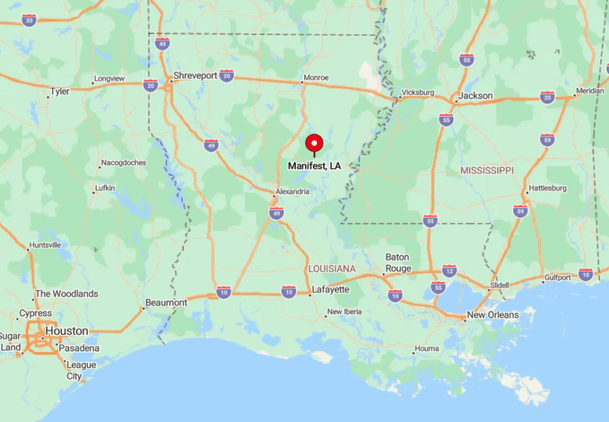
Travelers reach Manifest by taking Louisiana 8 east from Harrisonburg, then veering south on a gravel loop locals simply call the Section Line. Cell coverage fades as the pines close in, and GPS directions rarely match road signs.
The final mile narrows beside an old timber tram bed, forcing vehicles to yield to logging trucks. These quirks keep the settlement comfortably remote despite its modest distance from parish hubs.
4. Chase
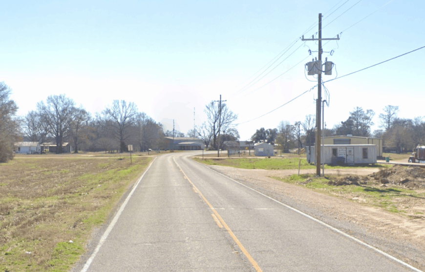
Chase houses about 140 residents across broad pasture lots 15 miles north of Winnsboro in Franklin Parish. Sweeping wheat fields and a pair of vintage grain elevators give the skyline a Midwestern look, drawing landscape photographers each spring.
Agriculture supplies nearly every job, though a small welding shop fixes everything from tractor booms to deer stands. The volunteer fire department sponsors an annual crawfish boil that doubles as a reunion for families who moved away.
Evenings bring whistling rails as freight trains bypass town without slowing. The lack of turnoffs along U.S. 425 means most drivers cruise past unaware of the community spread beyond the treeline.
Where is Chase?
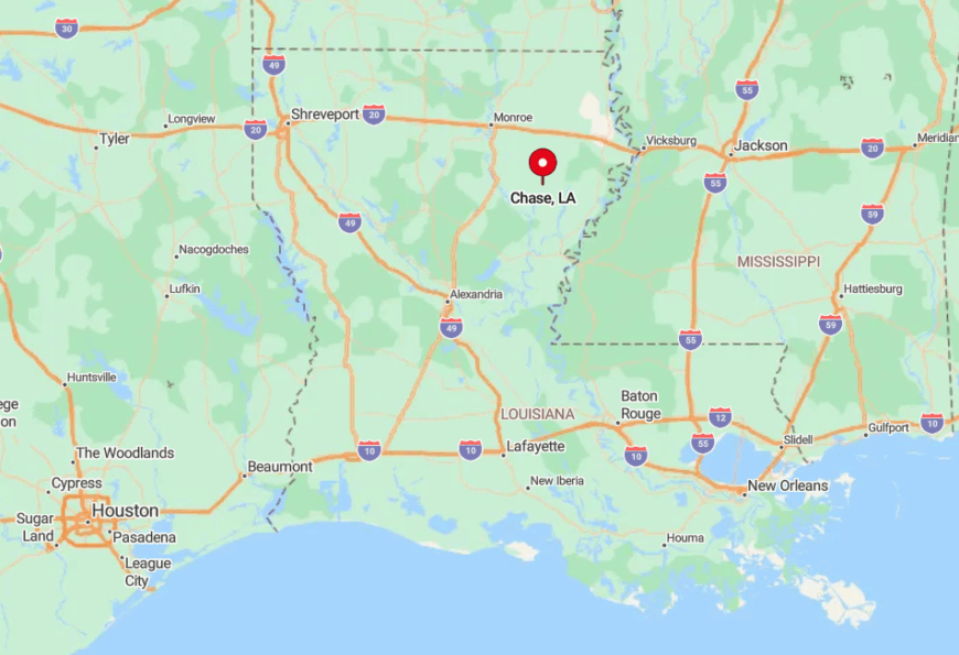
Situated on U.S. 425, Chase sits between Crowville and Gilbert yet lacks any stoplight to announce itself. The settlement stretches east along Parish Road 157, a blacktop that dissolves into dirt after two miles.
Reaching the heart of town involves a right turn by an unmarked metal building, a landmark newcomers often miss. That subtlety preserves the low-key nature that residents prize.
3. Jigger
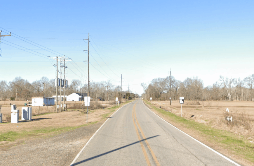
Roughly 95 people reside in Jigger, a Franklin Parish enclave ringed by mixed woodland and quiet dirt lanes. Travelers find tin-roofed cottages, aging pecan orchards, and some of the darkest skies in the state for meteor-watching.
Soybean farming and small sawmills account for most income, with a roadside produce stand selling tomatoes and honey in summer. Community events revolve around Jigger Apostolic Church’s pie auctions that draw bidders from three parishes.
On most nights, coyotes provide background music rather than traffic. The combination of underdeveloped woodland and distance from the nearest four-lane road grants Jigger its deep calm.
Where is Jigger?
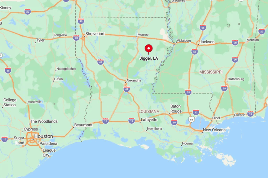
Jigger lies off Louisiana 128, ten miles south of Winnsboro and more than an hour from the Monroe city limits. Parish roads meander through the forest before opening onto unexpected hayfields.
GPS often misroutes drivers onto discontinued timber tracks, effectively creating a natural filter. Those who do arrive find a hamlet where porch lights replace street lamps.
2. Swampers
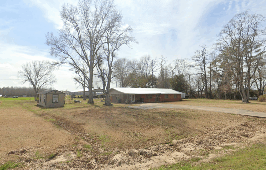
Only about 70 residents cluster in Swampers, named for the cypress wetlands that surround this Franklin Parish outpost. Fishermen launch jon boats into bayous that weave behind the levee, while wildlife photographers capture great blue herons stalking among the knees of ancient trees.
Farming plays a part, but trapping and seasonal guiding for duck hunters still matter here, reflecting a skill set passed down through generations. Locals hold fish-fry fundraisers at the two-room community center to keep the lights on during hurricane season.
Freight noise never settles, and night brings fog that muffles even the cricket song. Those wetlands act as a moat, ensuring only determined guests appear.
Where is Swampers?
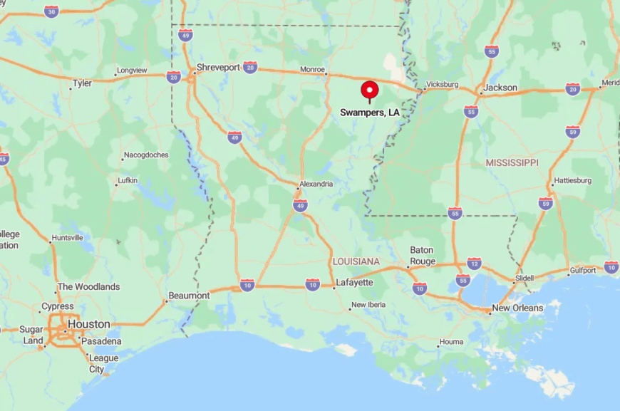
You will find Swampers west of Louisiana 17, accessible by Parish Road 129, a levee-top lane with zero shoulder. Flooded timber on both sides restricts any expansion and occasionally isolates the town after heavy rain.
Visitors typically detour from Winnsboro, then crawl along gravel levee roads that see more tractors than cars. That watery buffer sustains Swampers’ off-grid atmosphere.
1. Holly Ridge
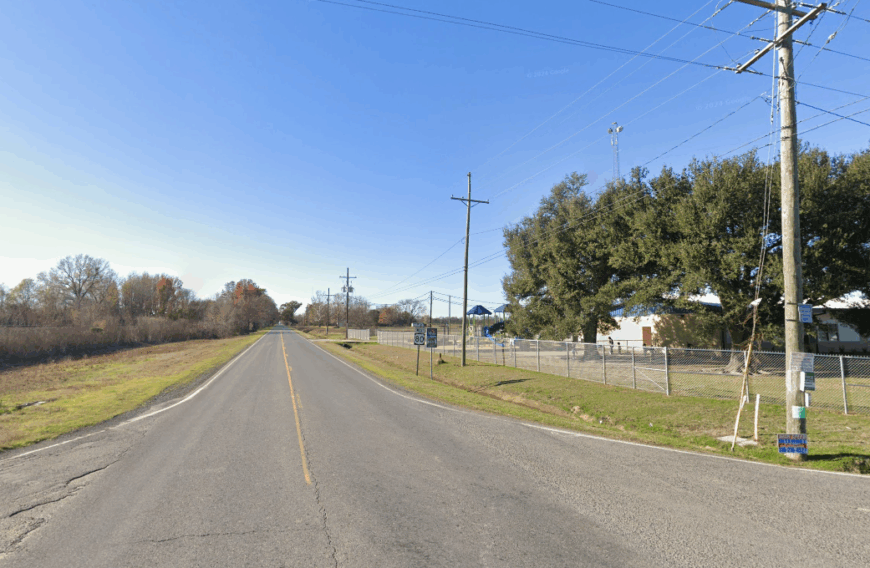
Holly Ridge counts close to 85 residents living amid rolling pasture in Richland Parish, framed by rows of windbreak pecan trees. Whitewashed churches, a rust-flecked water tower, and broad horizons give artists endless subjects, especially when late-day sun ignites the tall grass.
Cattle ranching replaces row crops here, though a honey co-op collects hives twice a year from surrounding clover fields. Saturday softball games unfold on a makeshift diamond beside the old schoolhouse, where stories travel faster than phone service.
Sonic booms of jets from nearby Barksdale never reach this far, leaving only the hum of cicadas after dark. Miles of open land and the absence of retail development help Holly Ridge remain one of the least disturbed corners of the parish.
Where is Holly Ridge?
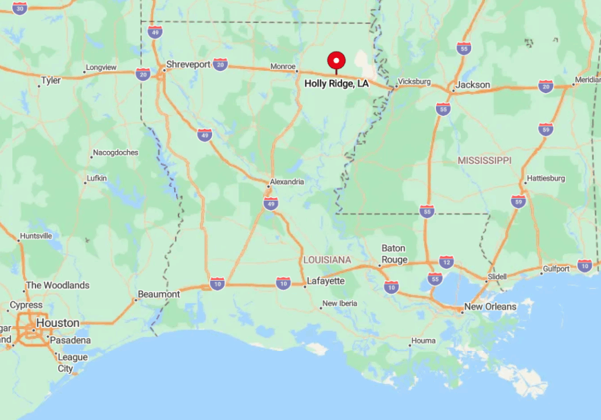
The hamlet sits along Interstate 20 yet requires exiting at Start, then doubling back on Highway 183, a frontage road that loses pavement once it bends south. That odd approach keeps most interstate travelers unaware of the community just a mile away.
Rail lines border the northern edge, but the nearest depot closed decades ago, cutting regular transport links. For those who do venture in, Holly Ridge provides an instant retreat without the need for a long detour.