
North Mississippi hides pockets of peace not far from the well-traveled interstate map. Our team took the slow roads, watched for hand-painted signs, and listened for cicadas to find 25 communities where quiet is the default setting.
Each spot offers its mix of forests, pasture, and porch conversations, yet all share a comfortable distance from crowded city centers.
A few boast historic depots, others mineral springs or night skies, but none has a stoplight to spoil the view. If the goal is to swap traffic noise for whip-poor-will calls, these towns make a fine starting list.
25. Michigan City – Piney Border Hamlet on the Tennessee Line
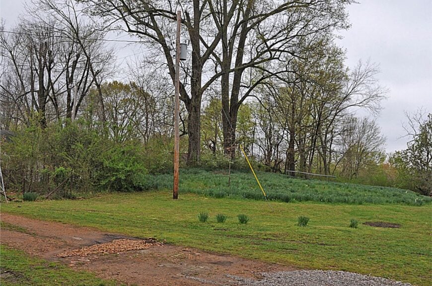
Michigan City feels like the state’s last whisper before the Tennessee hills take over, a cluster of homes tucked among loblolly pines and sandy creeks. Its seclusion comes from distance—no interstate exits nearby, no bright retail strip—just long gravel lanes and wind in the needles.
The vibe is woodsy and unhurried: porch swings, smoke drifting from brush piles, and the faint clack of a faraway freight. Wander the backroads to photograph weathered barns, walk the creek shoals, or picnic by the old rail siding; in fall, deer step out of the timber at dusk.
Small sawmills, poultry operations, and farm work keep the local calendar moving. Nights are ink-dark and generous with stars. It’s the kind of place that teaches you to hear silence again.
Where is Michigan City?
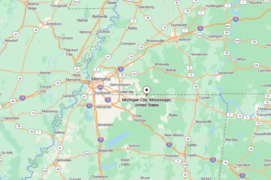
Set in northeastern Benton County near the Tennessee state line, Michigan City sits about 18 miles northeast of Ashland. You reach it by two-lane county roads branching off U.S. 72, then narrower lanes shouldered by pine.
With hills and timber on all sides, road noise fades fast. It’s close enough for a day drive, far enough to feel like you’ve stepped out of time.
24. Tiplersville – Oak-Ridge Crossroads with a Railroad Echo
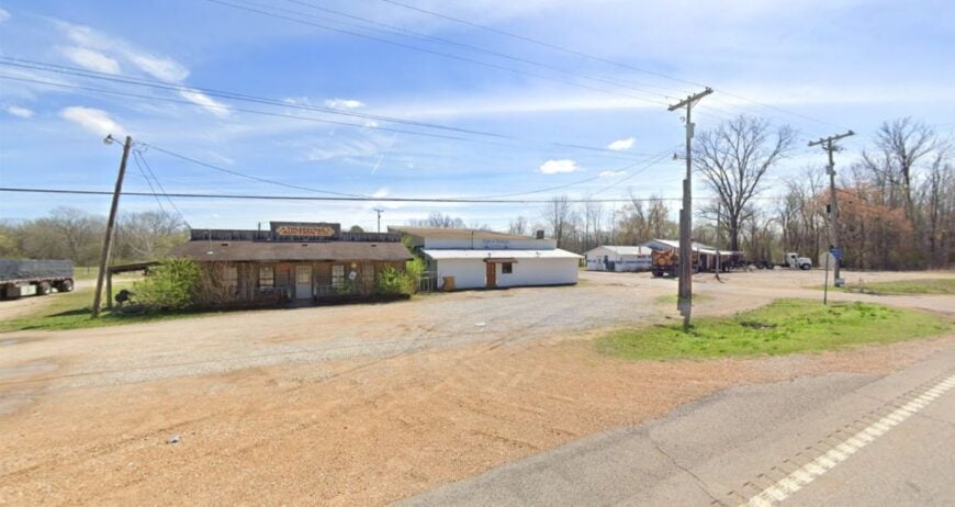
Tiplersville is a quiet crossroads where oaks lean over the road and the railroad’s history hums underfoot. Seclusion stems from its position between bigger towns with no reason for through-traffic to stop; even the store’s porch chairs look like they’ve been waiting since noon.
The mood is rustic and friendly: hand-lettered signs, garden plots, and dogs that know every truck. Hunt small game in nearby timber leases, poke around old depots, or follow sand-bottom creeks that wind through pasture.
Poultry and logging pay most of the bills, with a few folks commuting to Ripley. When the sun drops, whip-poor-wills do the announcing. You come for the quiet and leave with it in your coat pocket.
Where is Tiplersville?
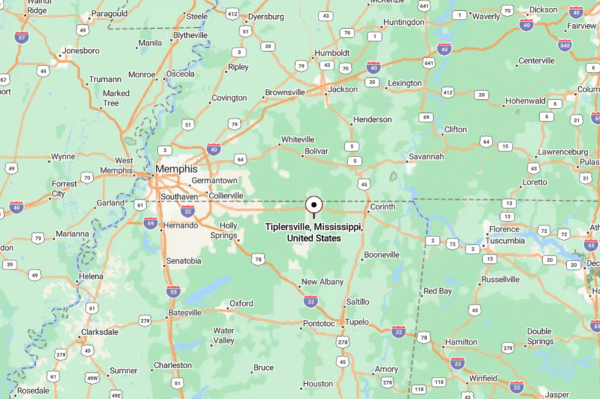
Located in northern Tippah County near the Tennessee border, Tiplersville is about 12 miles north of Ripley. Travelers slip off Mississippi 2 onto the county blacktop and then the gravel that loosens the schedule.
Low ridges and oak breaks keep the settlement hidden until you’re nearly there. It’s close enough to reach, but far enough to feel like you’ve left everything behind.
23. Dennis – Hill-Shadowed Community in Tishomingo County
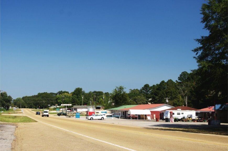
Dennis collects along a fold of hills where shade lingers and roads curve like creek lines. It stays secluded by sitting off the main corridors—no stoplights, few signs, and the hills swallowing sound as soon as it’s made.
The vibe is woodsy-neighborly: tractors idle at the store, and somebody’s always swapping garden starts. Hike sections of the Bear Creek watershed, fish quiet farm ponds with permission, or photograph the old church steps and mossy headstones.
Small forestry jobs, cattle, and park work in nearby Tishomingo State Park anchor local life. Evenings bring the tree-frog chorus and a sky bright with stars. It’s the kind of spot that reminds you how small a town can be and still feel whole.
Where is Dennis?
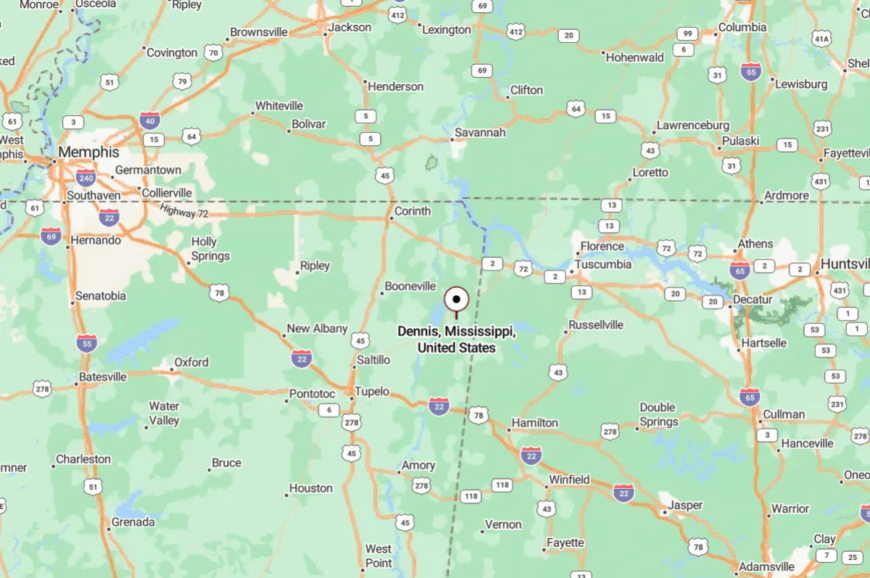
Dennis sits in central Tishomingo County, roughly 9 miles south of Belmont and west of the Natchez Trace. Access comes via winding county roads off Mississippi 25 that dip through hardwood hollows.
Those hills keep highway glare out of sight. The last mile feels like a curtain closing on the rush of the day.
22. Paden – River-Bend Hamlet with Front-Porch Evenings
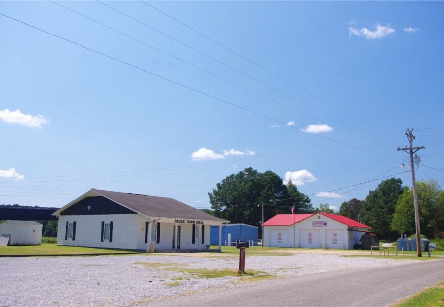
Paden rests near lazy bends of the Tennessee-Tombigbee watershed, where cottonwoods throw long shade across gravel lanes. Its off-grid feeling comes from tiny population, deep tree cover, and the absence of commercial lights.
The vibe is old-time rural: porch fans, jarred preserves, and guitar pickin’ that drifts down the road. Bird along creek corridors, launch a kayak where the water slows, or poke around the remnants of early stores.
Row-crop fields and cattle pastures make up the local economy. At sundown, the whole valley turns copper. It’s a small dot on the map with a big capacity for calm.
Where is Paden?
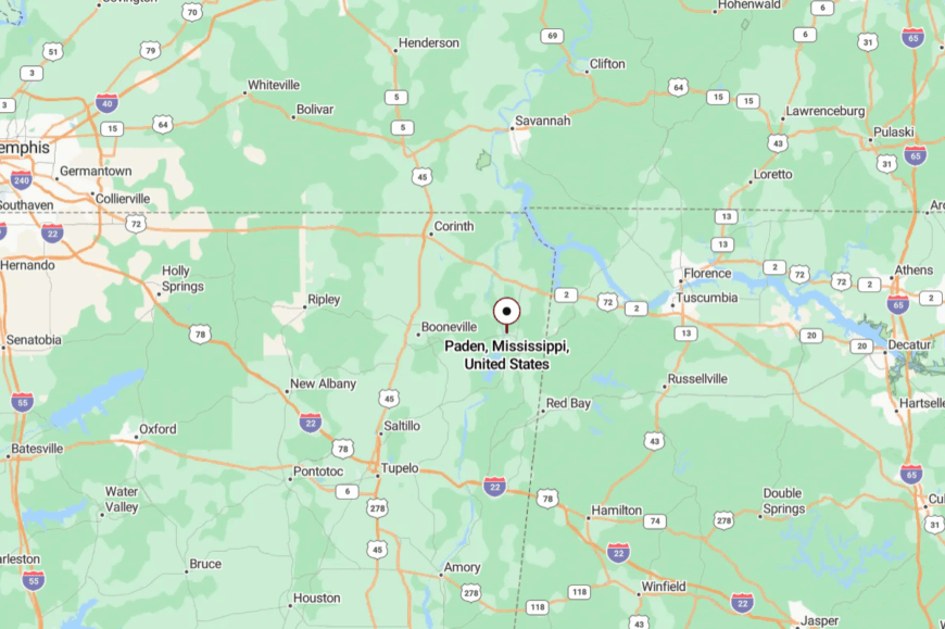
Paden is in southern Tishomingo County, about 6 miles west of Burnsville and north of Mississippi 364. You reach it on county lanes that trade pavement for gravel as the woods thicken.
Bottomland timber and soft ridges hush outside noise. Close by if you measure miles, far away if you measure mood.
21. Marietta – Prairie-Rim Village with Porchlight Nights
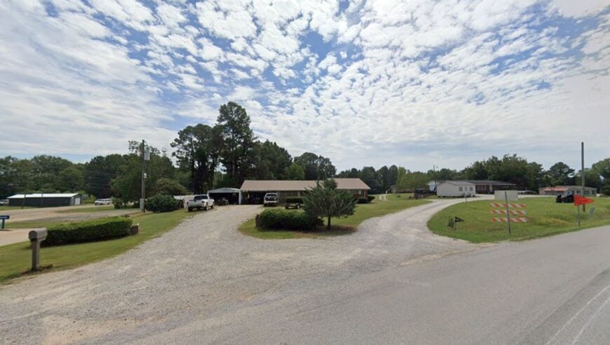
Marietta spreads gently along an open pasture where the sky feels a size larger. Its seclusion is simple: no interstate, no big retail, and farmsteads set far apart.
The vibe is bright-porch country—neighbors wave from tractors, and Friday nights drift toward the ball field. Cast a line in nearby creeks, walk a sunset loop past rolled hay, or browse the community market when gardens overflow.
Beef cattle and hay drives mark the seasons here. After dark, porchlights glow like small constellations. It’s the sort of place where you remember every star has a name.
Where is Marietta?
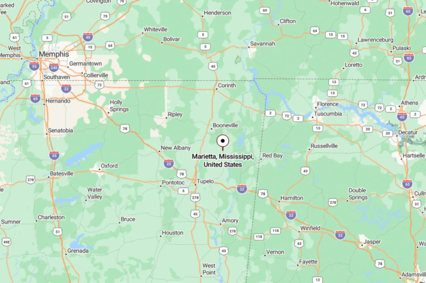
Found in eastern Prentiss County, Marietta lies about 10 miles east of Booneville. Drivers leave U.S. 45 for two-lanes that fall quiet fast, then turn onto section roads skirting pasture.
Low rises keep the town tucked away from highway sightlines. It’s accessible, yet content to remain out of the spotlight.
20. Jumpertown – Ridge-Top Community with Long Views
Jumpertown sits on a high shoulder of ground where breezes keep the air moving and the horizon wide. Seclusion comes from elevation and distance from any major junction; travelers don’t wander through unless they mean to.
The mood is practical and friendly—fresh-mown ditches, garden stands, and the soft clang of a flagpole rope in the breeze. Watch for hawks along the ridge, walk backroads that dip into shady draws, or tailgate by the ball field at dusk.
Small shops, farms, and commutes to Booneville underwrite the week. When evening hits, crickets turn the whole ridge into a choir. It’s the kind of quiet you can feel on your skin.
Where is Jumpertown?
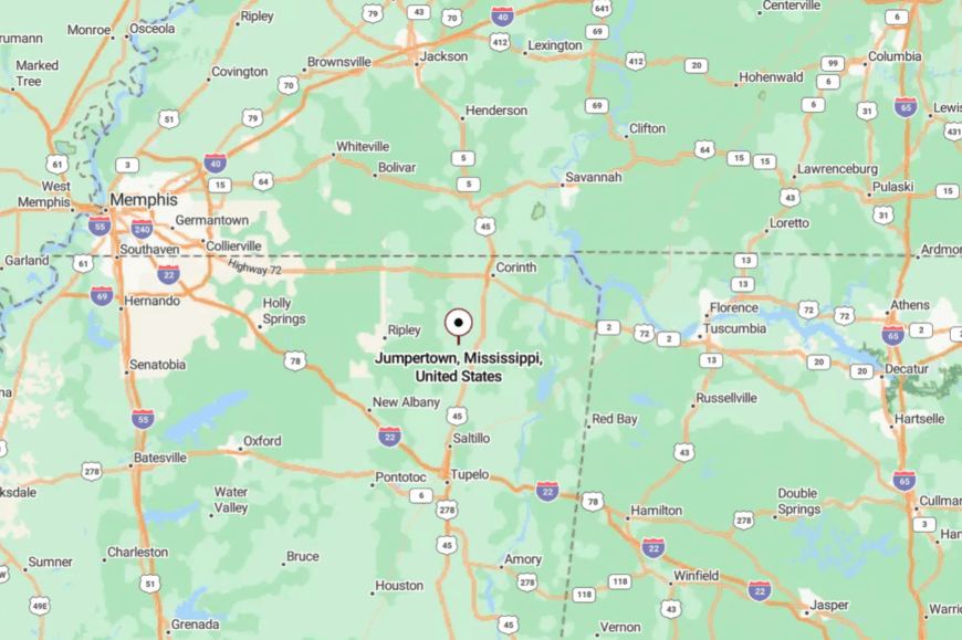
Situated in northern Prentiss County just west of U.S. 45, Jumpertown is roughly 7 miles north of Booneville. You angle off the highway onto county blacktop that climbs and falls with the land.
The ridge blocks both light and noise spill. Close in miles, distant in spirit.
19. Mantachie – River-Curve Town Where Time Moves Slow
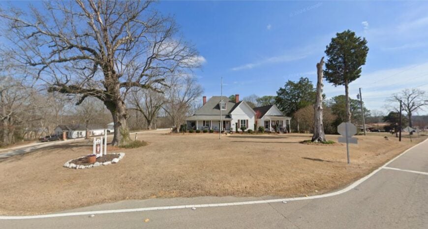
Mantachie curls along its namesake creek and river, tucked just enough off the busy routes to breathe. Its seclusion owes to water and woods—broad bottomlands and a green canopy that filters out the wider world.
The vibe is small-town friendly with a nature bend: kayaks on truck racks, lawn chairs under sycamores, and kids biking to the store. Paddle the quiet stretches, bird the river corridor, or stroll shady neighborhood grids where cicadas set the tempo. Local shops, schools, and small industry keep life steady.
Nights arrive with frogs, fireflies, and plenty of sky. It’s a place that invites you to linger without asking.
Where is Mantachie?
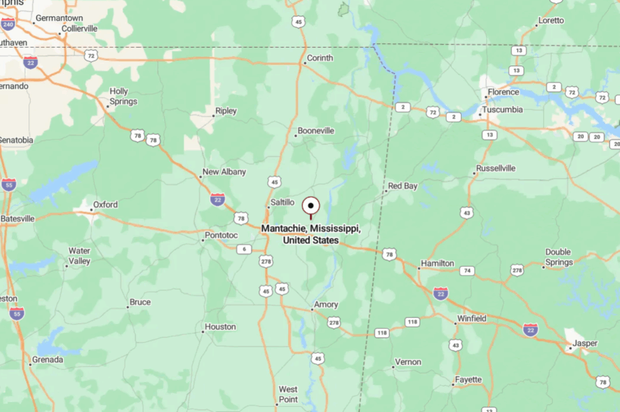
Mantachie lies in western Itawamba County, about 14 miles northeast of Tupelo. Travelers leave U.S. 78/22 for state routes, then drop into tree-lined streets near the river.
Bottomland woods muffle highway rumble. It’s near Tupelo’s orbit, yet comfortably its own world.
18. Tremont – Pine-Ringed Outpost by the Alabama Line
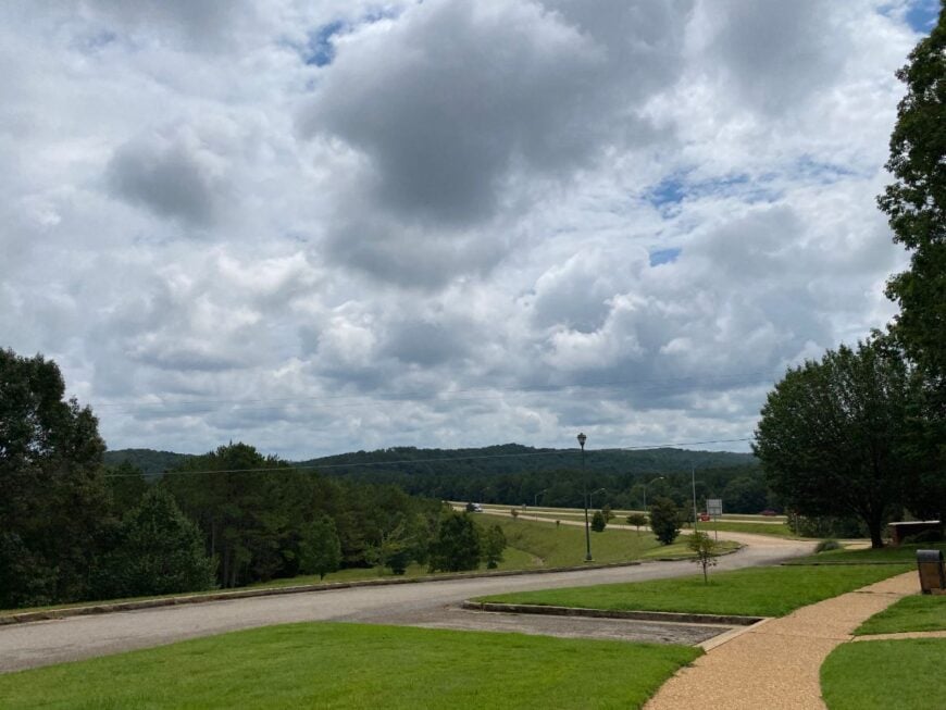
Tremont is a small circle of streets framed by tall pines and sandy soils that smell of sun-warmed resin. Seclusion comes from being the last stop before the state line and well off the interstate grid.
The vibe is soft-spoken: bait buckets by doorways, church bells on Sundays, and pickup beds filled with cane poles. Fish the Buttahatchee forks, wander forest service roads, or tour local blues heritage markers tucked along backroads.
Timber and small shops provide the day-to-day work. After dark, the stars feel closer for lack of anything else. It’s the sort of quiet that hangs on your clothes like pine smoke.
Where is Tremont?
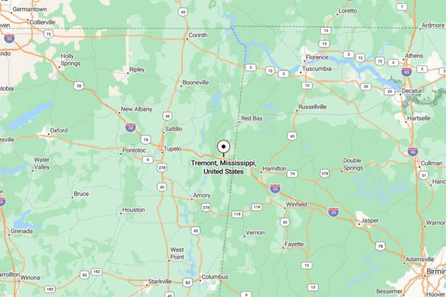
In southeastern Itawamba County near Alabama, Tremont sits about 20 miles east of Fulton. You reach it via two-lane highways that press through unbroken forest. Those woods keep it hidden until the last turn. It’s easy enough to find—and even easier to forget the clock once you arrive.
17. Smithville – Prairie-Edge Town Rebuilt with Heart
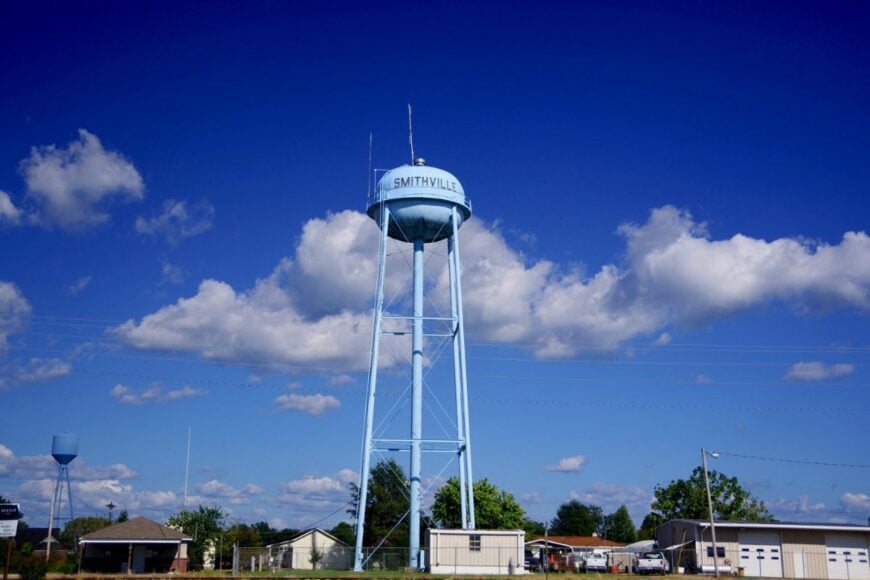
Smithville rests along open prairie and river flats, a tight-knit place rebuilt with the intention that still keeps its hush. Its seclusion comes from the distance to four-lanes and the sweep of pasture that buffers the town from sprawl.
The vibe is resilient and neighborly: flags on porches, tidy sidewalks, and kids throwing a ball at the park. Cast for bass in nearby lakes, ride quiet county roads at golden hour, or browse small memorials that tell the town’s story. Farming, local trades, and small businesses keep things grounded.
Evenings trade traffic noise for crickets and the occasional train far off. It’s a reminder that quiet and strength can live in the same place.
Where is Smithville?
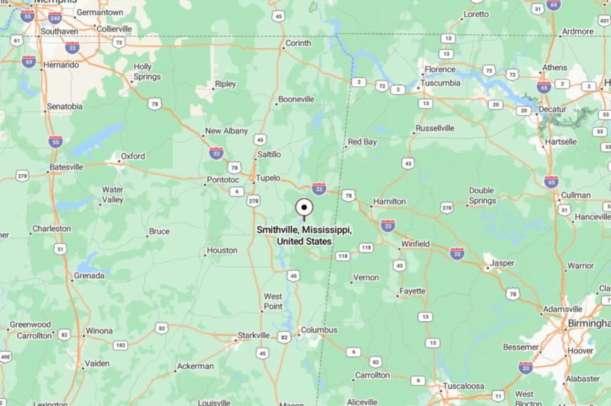
Smithville sits in northeastern Monroe County, about 20 miles northeast of Amory. Travelers peel off U.S. 278/6 onto two-lane roads that flatten into prairie.
With miles of fields around it, the town lives outside the larger rush. It’s close enough for groceries, far enough for stars.
16. Hatley – Oak-Shade Village on the Back Way to Amory
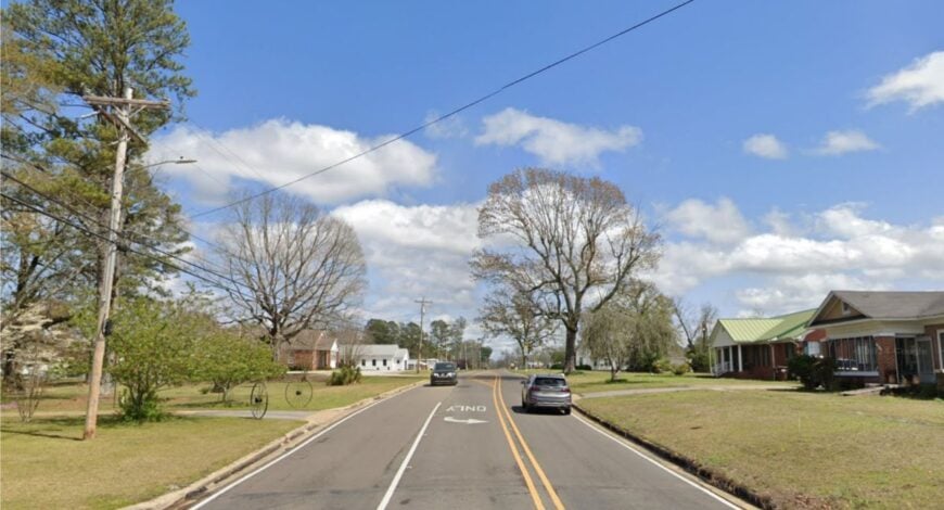
Hatley keeps to itself along oak-shaded lanes where the afternoon stretches out like a porch nap. Its hidden feel comes from being a mile off the main drag with no commercial glare to announce it.
The vibe is gentle and old-neighborhood: tidy yards, screen doors, and garden tomatoes trading hands. Walk the loop beneath big trees, bird along hedgerows, or ride bikes to farm stands just outside town.
School life and small shops form the spine of the week. After supper, the cicadas take over. It’s the sort of unassuming calm that sticks with you.
Where is Hatley?
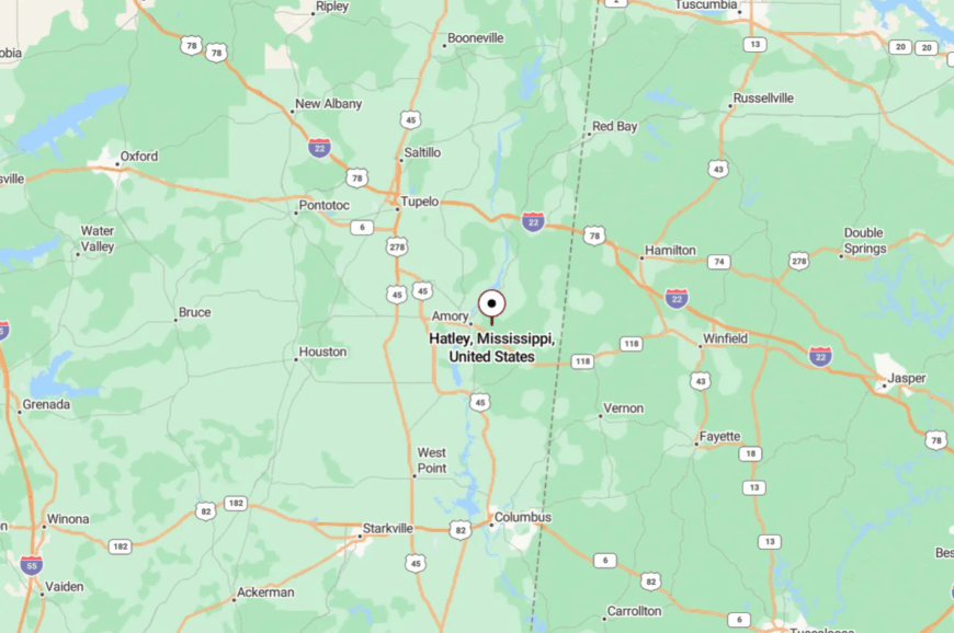
Located just east of Amory in central Monroe County, Hatley sits a few turns off Highway 278. You slip in on local roads that narrow and quiet quickly.
The big oaks and gentle rises shield it from city noise. It’s only a short detour, but it feels like another chapter entirely.
15. Abbeville – Hill-Country Corner with Storybook Streets
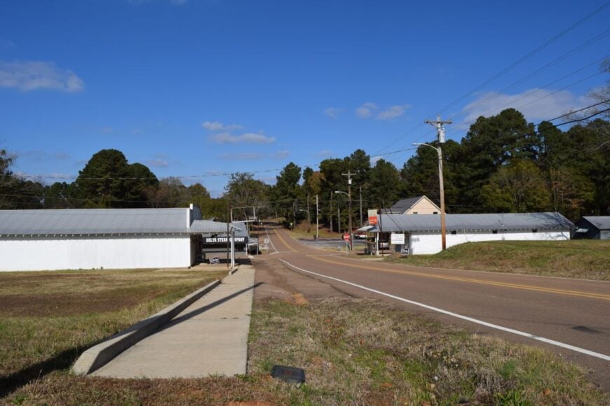
Abbeville perches on gentle hills north of Oxford, where maples and oaks knit a canopy over narrow streets. Seclusion comes from its size and the way it sits just off major routes—close to the university crowds, yet never in their path.
The vibe is heritage-sweet: church steeples, tidy porches, and neighbors who still borrow sugar. Walk shady blocks, explore nearby lakes, or chase sunsets along gravel ridges that look east forever.
Many commute to Oxford, while small trades and farm work fill in the rest. Night pulls a dome of stars over the rooftops. It’s a pocket of calm that feels carefully kept.
Where is Abbeville?
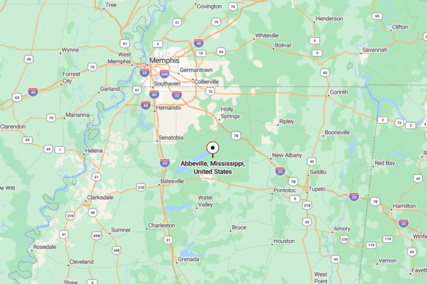
Abbeville is in northern Lafayette County, about 10 miles north of Oxford. Take Mississippi 7, then slip onto county roads that rise and fall with the hills.
Those ridges mute any city spillover. It’s near Oxford’s glow, but the last few miles dim the lights and slow the clock.
14. Taylor – Artsy Delta-Edge Village with Lake Breezes
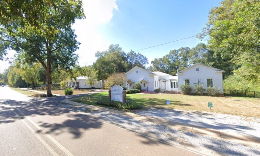
Taylor sits where hill country tips toward the Delta, a little village known for galleries and porches that hum softly after supper. Its tucked-away feel comes from the long, tree-lined approach and the absence of chain stores—night stays dark and mornings start with birds.
The vibe is creative-rustic: pottery kilns, music on the lawn, and café pies that pull people in and then send them back out satisfied. Browse studios, bike farm lanes, picnic by nearby lakes, or linger at a weekend market where produce and stories change hands.
Many locals craft or commute to Oxford; farming frames the outskirts. When the light turns honey-gold, the town feels hand-carved. It’s a small, sweet secret that invites you to exhale.
Where is Taylor?
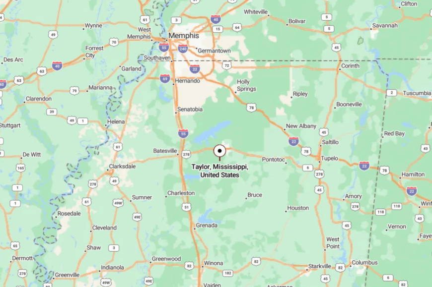
Nestled in southern Lafayette County about 9 miles south of Oxford, Taylor sits just off Mississippi 7. You turn onto a slower two-lane that threads through shade and pasture.
With no big junctions, casual traffic passes it by. It’s close to everything yet feels blissfully apart.
13. Toccopola – Ridge-Line Village with Deep Roots
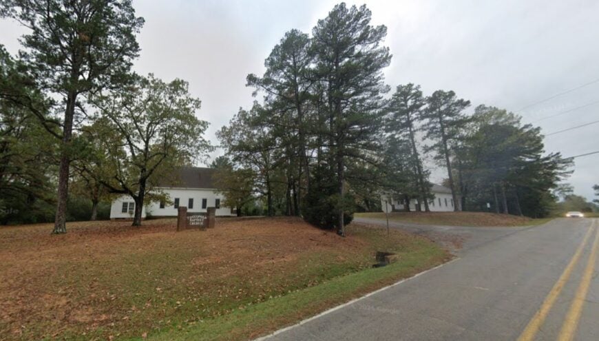
Toccopola straddles a ridge where breezes comb the pines and old stories ride the air. Seclusion is born of topography and distance from four-lane routes—travelers reach it on purpose, not by accident.
The vibe is heritage-quiet: weathered churches, family cemeteries, and tidy yards edged in crepe myrtle. Cruise gravel spurs for long views, comb the woods for spring morels, or catch a Saturday softball game where the whole town shows up.
Cattle, hay, and small trades set the rhythm. After dark, you can hear the wind talk to the trees. It’s a ridge you’ll remember long after you’ve driven off.
Where is Toccopola?
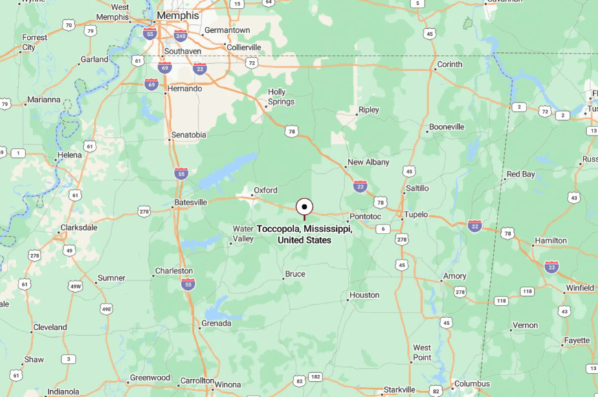
Toccopola sits in western Pontotoc County, roughly 18 miles west of Pontotoc and north of U.S. 278. Approaches are two-lane county roads that crest and dip with the land.
The ridge hides it from highway sight and sound. It’s reachable with a few turns—and unreachable by hurry.
12. Thaxton – Pine-Scented Stop with More Stars Than Streetlights
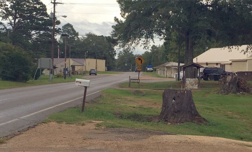
Thaxton feels like a pause button pressed in the pines: a few streets, a store, and long shadows by late afternoon. Its seclusion comes from a lack of commercial build-up and broad swaths of timber that fold around the town like a blanket.
The vibe is porch-friendly and throwback—kids on bikes, dogs that escort you down the lane, and Saturday burger smoke drifting across the road. Ride the Tanglefoot Trail spur, fish quiet ponds, or follow sandy lanes for sunrise photos.
Timber, farms, and small shops steady the week. When the sky clears, constellations pop like newly struck matches. It’s the gentlest kind of getaway—the everyday kind.
Where is Thaxton?
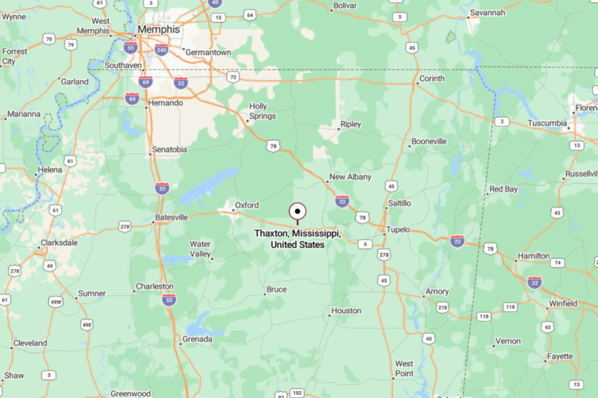
Placed in eastern Pontotoc County about 8 miles east of Pontotoc, Thaxton sits just off Mississippi 6/278 on slower county roads. Once you turn, traffic thins and the pines take over.
With few lights and fewer signs, the town keeps to itself. It’s minutes from the main route, but miles from the noise of it.
11. Pittsboro – Courthouse-Hill Village Wrapped in Quiet
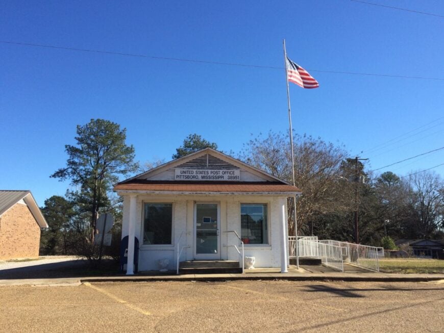
Pittsboro crowns a small rise where the courthouse watches over streets that still know every parade route. Seclusion here is geographic and gentle—no interstate nearby, just ribbons of blacktop running through oak and pasture.
The vibe is historic and homey: brick walks, white porches, and shade that lasts into the afternoon. Visit the courthouse square, bird along prairie edges, or drive to nearby lakes for bank fishing and sunset color.
County offices, schools, and farming keep life steady. When evening lands, it lands softly. It’s a hilltop that holds the day like a keepsake.
Where is Pittsboro?
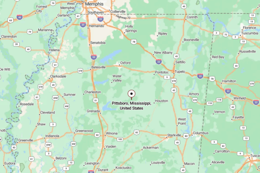
Pittsboro sits in central Calhoun County, about 4 miles west of Calhoun City and well south of Oxford. You reach it via Mississippi 9 and then quieter connectors that drift past hayfields.
Gentle hills keep it screened from long-haul traffic. It’s close enough for an afternoon loop, far enough to feel like you’ve slipped into a slower chapter.
10. Tishomingo – Forest-Wrapped Bluff Town on the Natchez Trace
Tishomingo counts roughly 400 residents who wake up to Appalachian foothills rising beyond their porches. Visitors hike the Bear Creek Canyon Trail, paddle Pickwick Lake, or explore the Civil War era graves in nearby Tishomingo State Park.
Most locals earn their keep through small-scale forestry, park service jobs, and family cattle operations that dot the surrounding hollows. The town proper contains little more than a diner, a hardware store, and a post office, so nightlife means campfire stories under plentiful stars.
Thick oak and hickory forests act as a living privacy fence, hiding homes from the Natchez Trace Parkway that skirts the settlement. That natural buffer, along with a twenty-mile gap to the nearest sizeable city of Corinth, is what seals Tishomingo’s reputation as a retreat for anyone who values elbow room.
Where is Tishomingo?
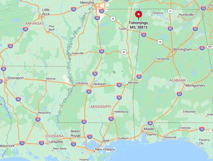
The town sits in far northeastern Mississippi, just west of the Alabama line and a stone’s throw from mile marker 304 on the Natchez Trace Parkway. Craggy ridges funnel roads into narrow valleys, so through traffic rarely passes the courthouse square.
Drivers reach Tishomingo via Mississippi Highway 25, a winding two-lane route that leaves cellular coverage behind for long stretches. Those willing to trade speed for scenery are rewarded with quiet views of sandstone bluffs draped in mountain laurel.
9. Paris – Lafayette County’s Quiet Crossroads of Horse Farms
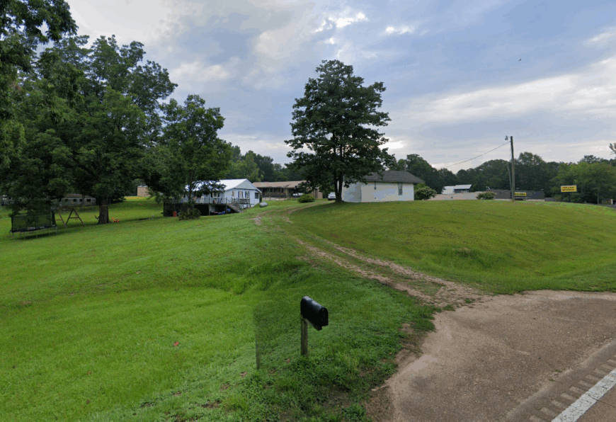
Paris in Lafayette County hosts about 250 people scattered across rolling pastureland punctuated by white-fenced horse farms. Weekend pleasures center on trail rides to Hurricane Creek, impromptu bluegrass jams at Paris Community Center, and browsing the flea market held in a converted feed barn.
Equine breeding, hay production, and small vegetable plots generate most household income, with many residents hauling their stock to Oxford’s auction ring. Civic life revolves around one intersection where a gas pump, a barbecue pit, and a rural fire station share the same acre.
The absence of streetlights, combined with parcels averaging more than an acre, keeps neighbors out of earshot and the night sky dark enough for meteor watching. A fifteen-mile green belt of pine and oak between Paris and bustling Oxford ensures the only sounds after dark are whinnies and the wind rustling the oaks.
Where is Paris?
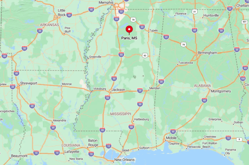
Paris lies in north-central Lafayette County, south of Abbeville and east of Mississippi Highway 7. No major highway cuts through the crossroads, so travelers must follow county roads 428 or 303 that snake past hay bales and farm ponds.
This indirect access discourages drive-through traffic, reinforcing the quiet atmosphere that defines the settlement. Those coming from Oxford typically allow thirty minutes to crest the forested ridges before emerging into the open prairies around the community.
8. Blue Springs – Tiny Pine-Framed Village off the Old Highway
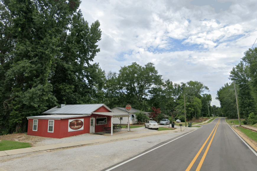
Blue Springs counts just under 330 residents who share their village with tall pines, spring-fed creeks, and serenading tree frogs. Photographers seek out the abandoned clapboard schoolhouse at dusk when golden light filters between the trunks.
Local livelihoods revolve around pine-timber harvesting, the nearby Toyota manufacturing plant in Union County, and seasonal hunting leases. The town has no traffic signal and only one café where homemade biscuits sell out before eight, reinforcing its unhurried rhythm.
Houses sit back from Old Highway 9 behind stands of shortleaf pine that muffle the rare passing car. That natural curtain, along with a lack of big box stores within ten miles, contributes to the feeling that Blue Springs belongs to another era.
Where is Blue Springs?
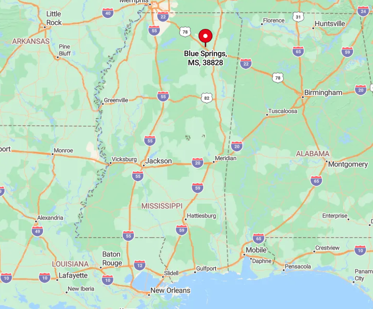
The village rests in Union County, a few miles south of New Albany, tucked just off the original alignment of Highway 9. Modern Highway 9 bypasses the settlement, leaving the old road to locals, cyclists, and logging trucks.
Travelers exit Interstate 22 at the Blue Springs interchange, then meander three miles through pine plantations before seeing the first mailbox. With thick forests on every side and no fast-food glare, nightfall arrives quietly and completely.
7. Etta – Tallahatchie River Hideaway
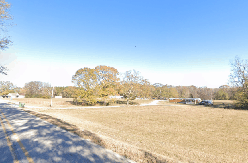
Around 200 people call Etta home, many living along gravel lanes that parallel the Tallahatchie River’s lazy bends. Days are filled with catfishing from sandbars, canoe trips that start at the CR 47 boat ramp, and pick-up softball games behind the volunteer fire station.
Small-scale row cropping, riverine timber harvest, and remote work via satellite internet support most households. Commercial development is nonexistent apart from a bait shop that doubles as the community bulletin board.
Century-old oaks shade widely spaced farmhouses, creating postcard scenes of porch swings and tin roofs beyond view of the main road. The Tallahatchie and its floodplain form a natural moat that keeps suburban growth at bay, sealing Etta’s hideaway status.
Where is Etta?
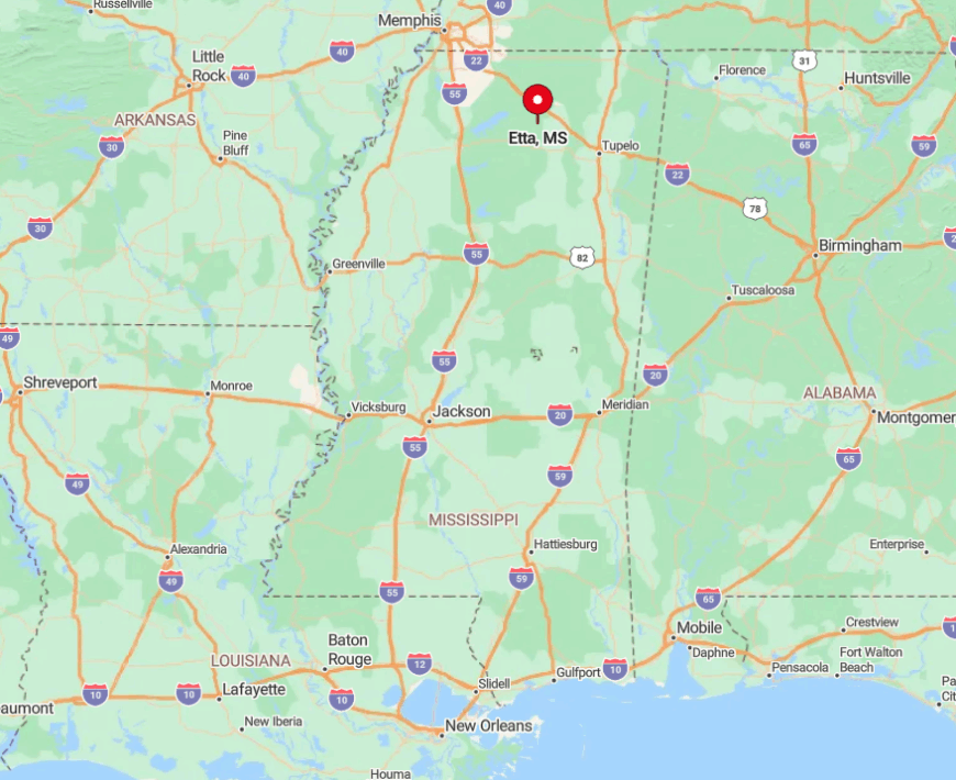
Etta sits in Union County, about eight miles southwest of New Albany near the confluence of the Tallahatchie River and Cane Creek. Access comes via County Road 87, a winding gravel path that can flood after heavy rain, another reason casual travelers seldom arrive unannounced.
With the river on one side and dense bottomland forest on the other, expansion possibilities remain limited and privacy plentiful. Visitors usually approach from Highway 30, then follow handwritten signs pointing to the river landing.
6. Falkner – Hill-Sheltered Hamlet of Starry Skies
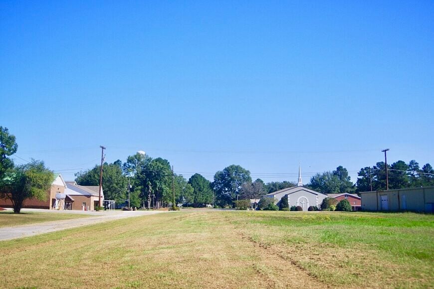
Falkner’s population hovers near 500, nestled among loblolly-covered hills that dampen noise and light from outside counties. Residents gather for Friday night catfish at Reed’s Café, gaze at constellations from Deer Run Ridge, and reminisce about William Faulkner’s ancestral connections to the area.
Primary income streams include poultry farming, small engine repair, and jobs at the hosiery mill in nearby Ripley. Civic pride shows in the meticulously maintained town square, where a modest library doubles as an art gallery for local painters.
No interstate or railway line passes within ten miles, leaving the hills to absorb the distant hum of Route 15. This protective topography gifts Falkner with some of the clearest night skies in Tippah County, a boon for amateur astronomers.
Where is Falkner?
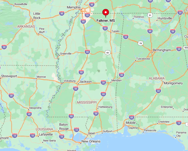
Falkner lies in northern Tippah County, roughly halfway between Ripley and Walnut along Mississippi Highway 15. Surrounding hills rise quickly on both sides of the highway, masking the town from motorists until they are practically downtown.
The closest four-lane road, U.S. 72, sits twelve miles to the north, which filters out heavy truck traffic. Those arriving by car find that the gradual climb along County Road 100 provides a panoramic reveal of tree-topped ridges and little else.
5. Algoma – Cotton Fields Meet Wooded Ridges
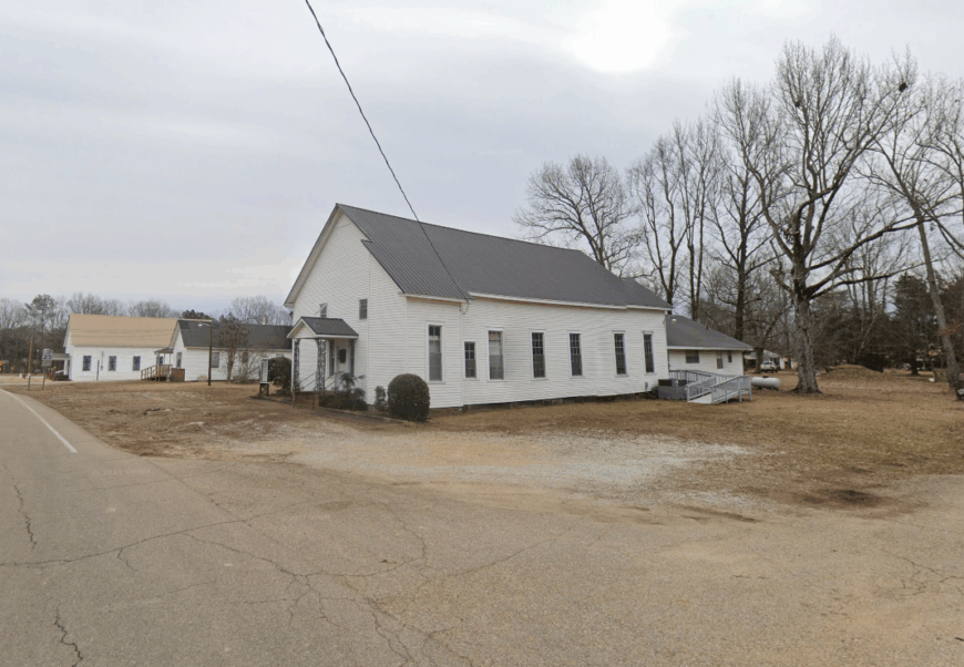
Algoma supports approximately 600 inhabitants whose homes are sprinkled among fertile cotton fields between wooded ridgelines. Weekend fun includes bass fishing in private irrigation ponds, quilt shows at the Algoma Community Center, and autumn hayrides along Potato Hill Road.
Cotton gins, row-crop agriculture, and a small cabinet-making shop form the backbone of the local economy. Wide spacing between farmhouses means neighbors wave from tractors more often than from front porches.
Tree-lined ridges encircle the community, muting noise from nearby Pontotoc and creating natural backdrops favored by landscape photographers. These gentle barriers, coupled with a lack of commercial signage, cause many drivers on Highway 341 to overlook Algoma altogether.
Where is Algoma?
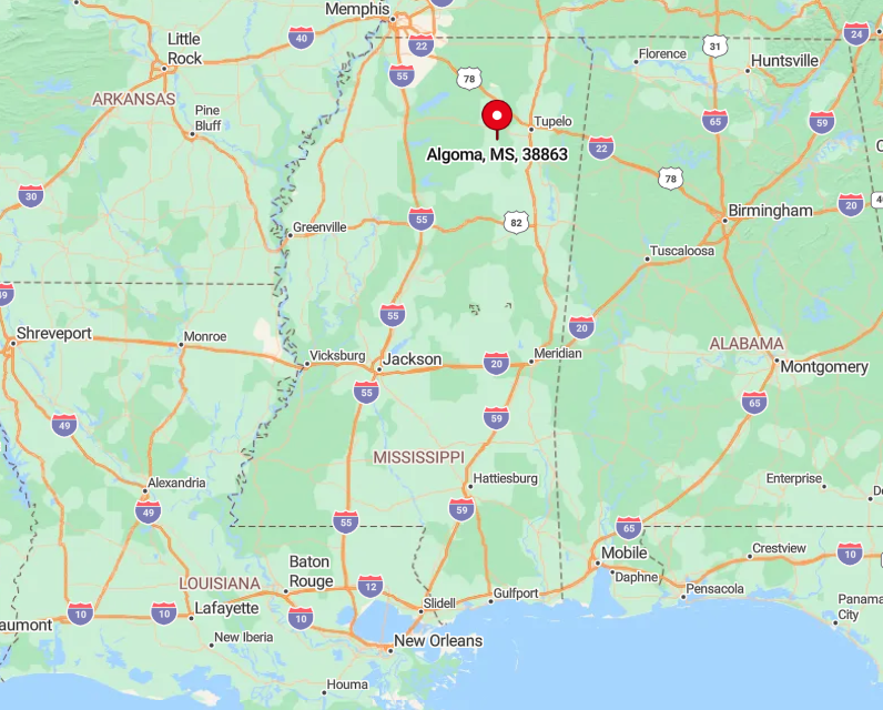
The town sits in southeastern Pontotoc County, five miles south of the county seat along Highway 345. No major thoroughfare intersects the settlement, so most visitors arrive intentionally after turning off U.S. 278 at Troy.
Rolling farmland quickly gives way to oak-capped ridges, which block cell signals and reinforce a feeling of remoteness. The Pontotoc Ridge Trail provides a scenic but indirect cycling route for those who prefer pedal power over pavement.
4. Dumas – Loblolly-Shrouded Outpost in Tippah County
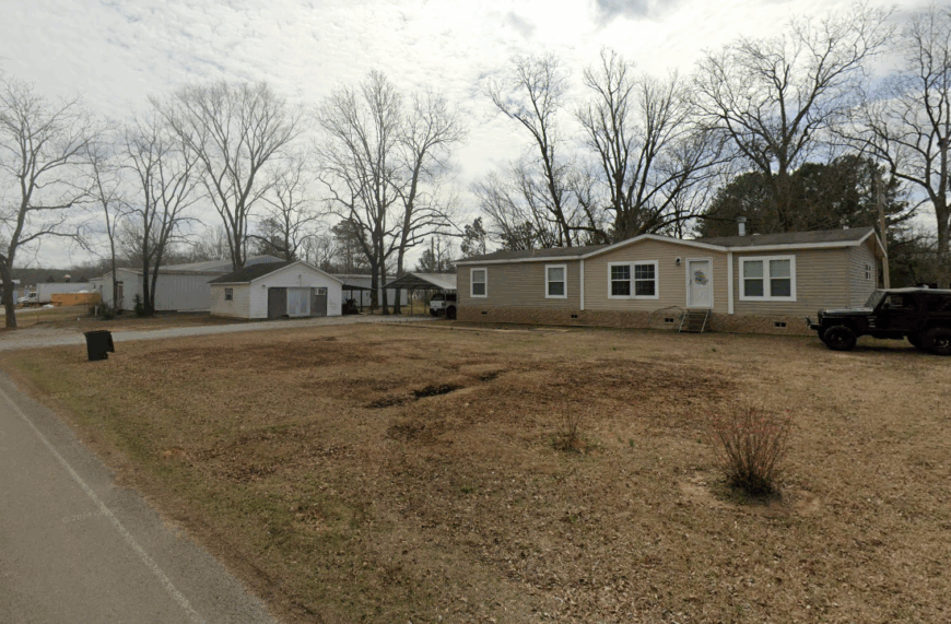
Dumas claims about 470 residents and a single country store that also houses the post office, gossip bench, and bait freezer. Locals pass time hunting squirrels in the surrounding loblolly stands, kayaking the Hatchie Headwaters, or cheering on high school baseball under vintage light poles.
The economy leans on small poultry farms, logging operations, and commuters making the short drive to factory jobs in Booneville. Homes rest on forest-rimmed lots averaging an acre, granting every backyard its own chorus of cicadas.
Narrow county roads see more farm tractors than sedans, giving photographers room to capture uninterrupted shots of rustic barns. With thick pine walls on all sides and no commercial corridor, Dumas feels like a world tucked inside green velvet.
Where is Dumas?
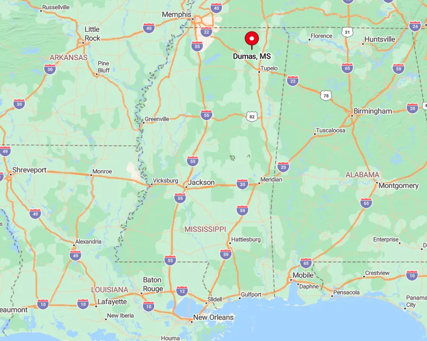
Dumas is located in western Tippah County just off Mississippi Highway 370. The closest four-lane highway lies nine miles south, leaving the town outside the regular flow of regional traffic.
Visitors typically exit U.S. 45 at Wheeler and follow a patchwork of county roads that twist through timberland before arriving at the lone flashing caution light. This indirect route, paired with dense pine cover, keeps the town hidden until one nearly bumps into the front porch of the general store.
3. Mantee – Prairie-Edged Retreat with More Ponds Than Stores
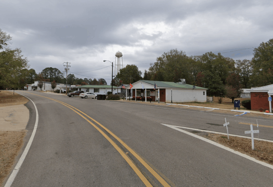
Mantee is home to nearly 230 residents spread across open prairie edged by hardwood bottoms and glimmering farm ponds. Anglers drop lines for crappie in Wardell Lake, hikers traverse the Choctaw Trail, and birders scan the tallgrass for bobwhite quail.
Beef cattle, catfish farming, and seasonal hay cutting form the economic spine, with a handful working remotely from fiber-optic connections recently installed. The village center hosts one café and the Mantee Mart, both closing by eight, so evenings default to porch sits and distant coyote howls.
Population density remains under seventy per square mile, allowing wide vistas of rolling grass without a billboard in sight. After dusk, the absence of traffic hum and the soft chorus of frogs make it clear why many call Mantee a retreat.
Where is Mantee?
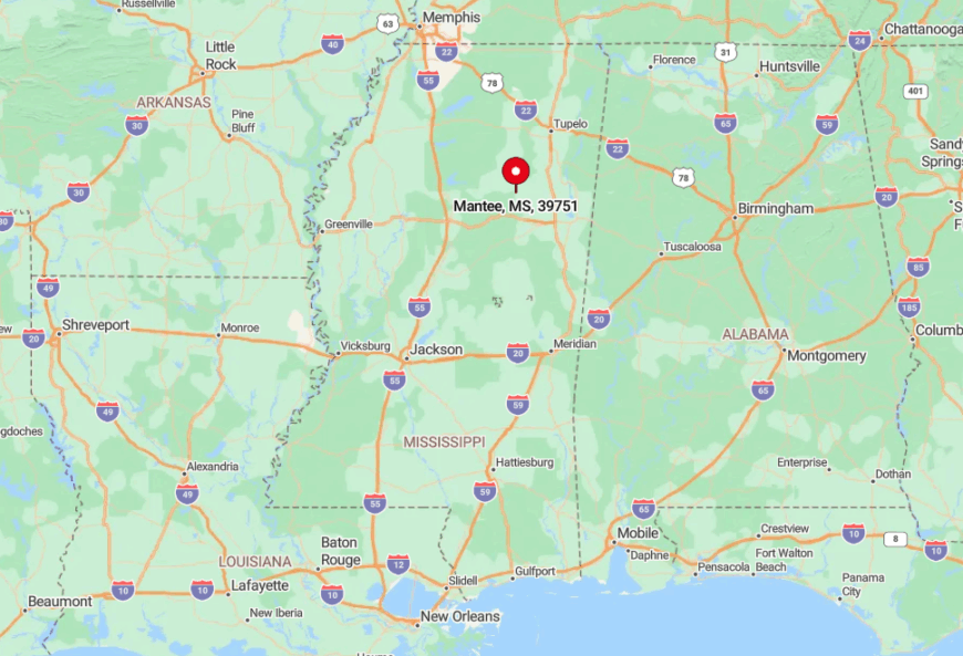
Found in western Webster County, Mantee lies just north of the Oktibbeha County line along State Highway 46. The surrounding prairie creates a natural buffer by pushing timber harvest and industrial activity farther east into the hill country.
Reaching the village requires leaving busy U.S. 82 at Mathiston and following a winding two-lane road shaded by sweetgum and walnut. The last few miles provide sweeping views of pastureland that announce the town’s isolation long before its speed-limit sign appears.
2. Myrtle – Rail Whistle-Stop Turned Woodland Refuge
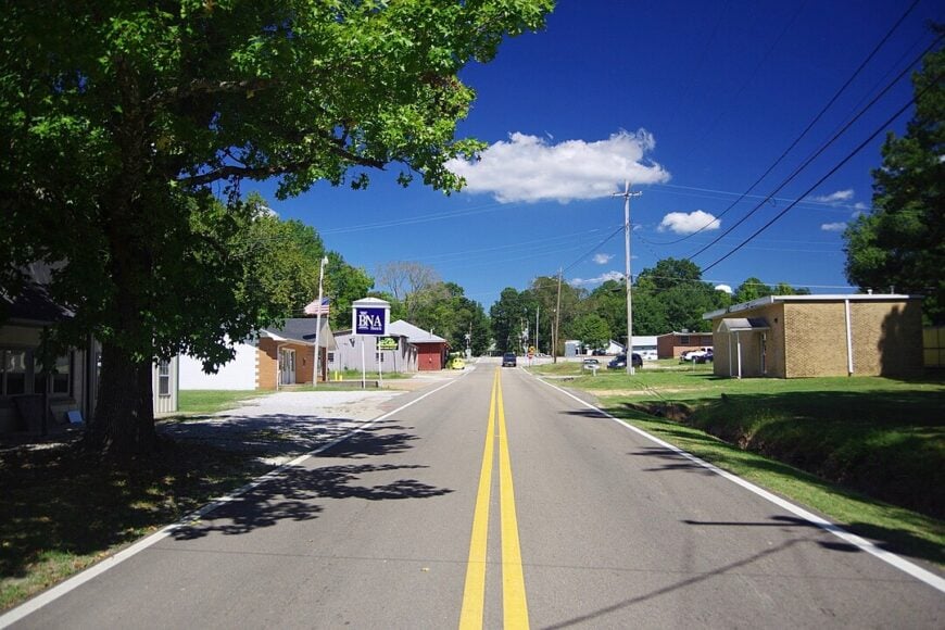
Roughly 500 residents live in Myrtle, a onetime rail whistle-stop now embraced by the southern fingers of Holly Springs National Forest. Day-trippers walk the Tanglefoot Trail extension, watch steam plumes from the restored depot, and pick muscadines at Windy Ridge Vineyard.
Jobs stem from small sawmills, furniture assembly shops in New Albany, and seasonal forest service contracts. Pastures and thick woodlands form a cushion around the grid of streets, insulating it from modern bustle and preserving a sense of yesteryear.
The nightly chorus of tree frogs replaces highway noise, and the nearest franchise restaurant sits eight miles away. This combination of rail history and natural shielding gives Myrtle its reputation as a woodland refuge.
Where is Myrtle?
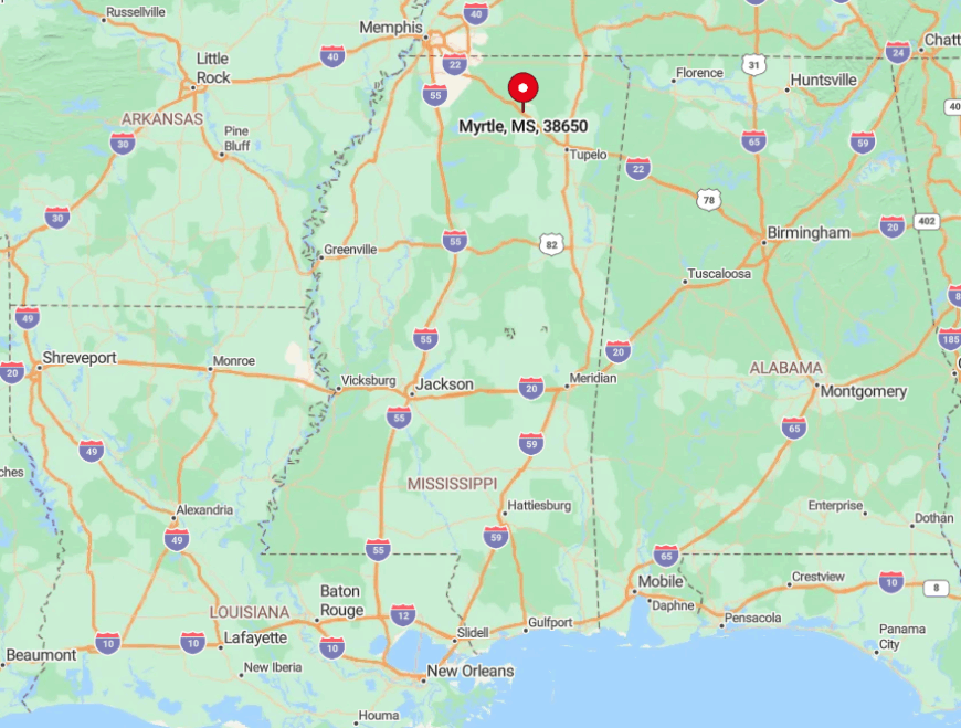
Myrtle resides in Union County along the Kansas City Southern rail line between New Albany and Hickory Flat. Interstate 22 bypasses the town to the south, funneling most traffic away and leaving local streets to bicycles and pickup trucks.
Access comes via Exit 52 followed by a two-mile drive north on County Road 107 through pine thickets that arch over the pavement. Once inside the town limits, high canopy and few commercial lights preserve a forest feel even along Main Street.
1. Chalybeate – Mineral-Spring Hollow Off the Beaten Path

Chalybeate counts fewer than 170 residents scattered along a mineral-spring hollow rimmed by mixed hardwood forest. Visitors tote mason jars to the iron-rich spring, hike the forgotten stagecoach trace, and peruse 19th-century ledgers in the tiny school museum.
Livelihoods revolve around small beef herds, firewood sales, and crafts sold at the annual Heritage Day festival. Cabins and farmhouses sit at least a mile apart, linked by gravel roads that weave past fern-lined creeks.
The absence of cellular towers and the thick tree canopy leaves radios as the most reliable form of communication during storms. Surrounded by hills and forestland, Chalybeate feels genuinely off the beaten path, making it the most secluded spot on our list.
Where is Chalybeate?
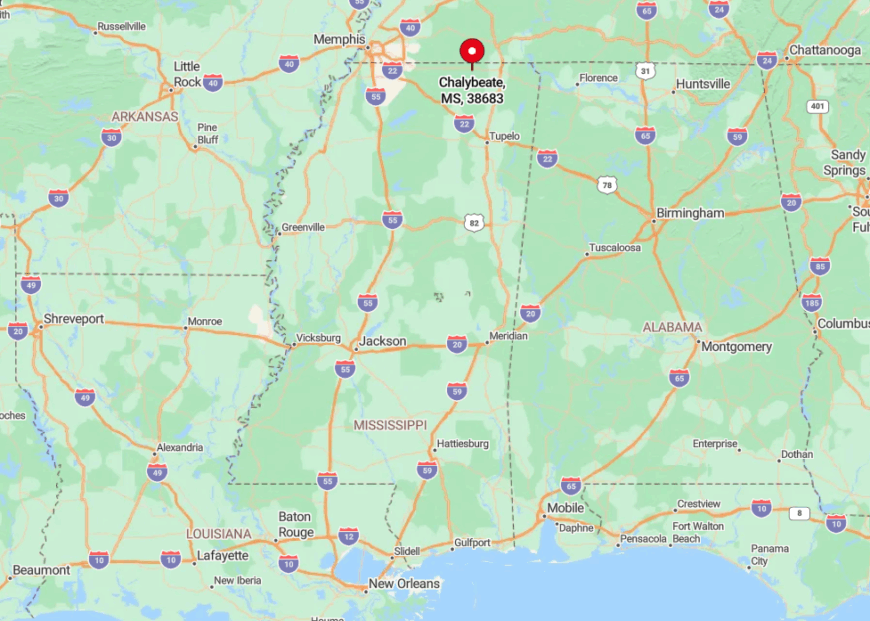
This unincorporated community lies in southeastern Tippah County, southeast of Ripley and four miles off Mississippi Highway 4. Dense forest and winding elevation changes hide the settlement from passing motorists until the final descent into the spring-fed valley.
Reaching Chalybeate requires following County Road 303, a gravel ribbon that fords two creeks and lacks guardrails or signage. The difficult approach ensures that only intentional visitors enjoy the quiet echo of water trickling from the old mineral spring.