
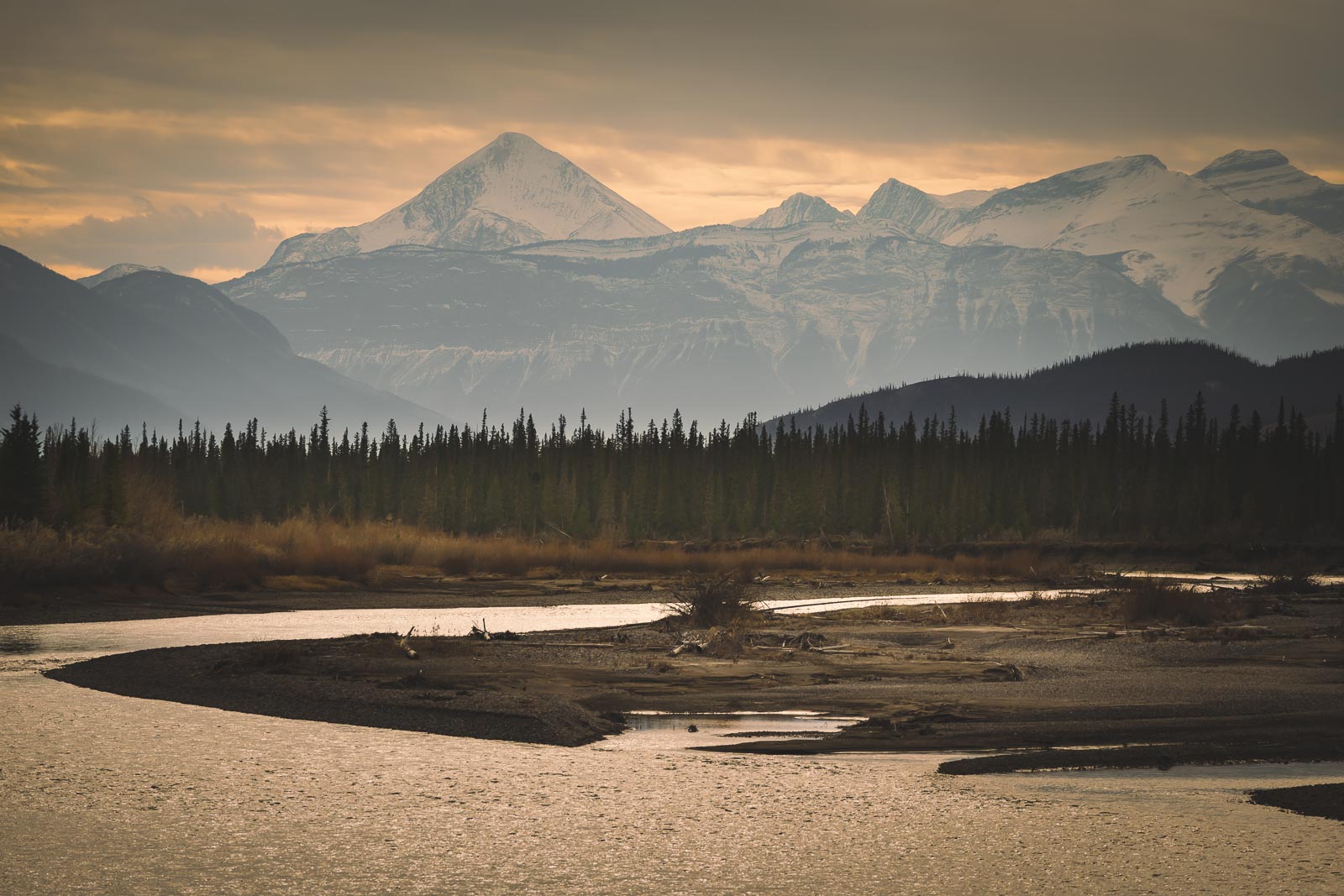
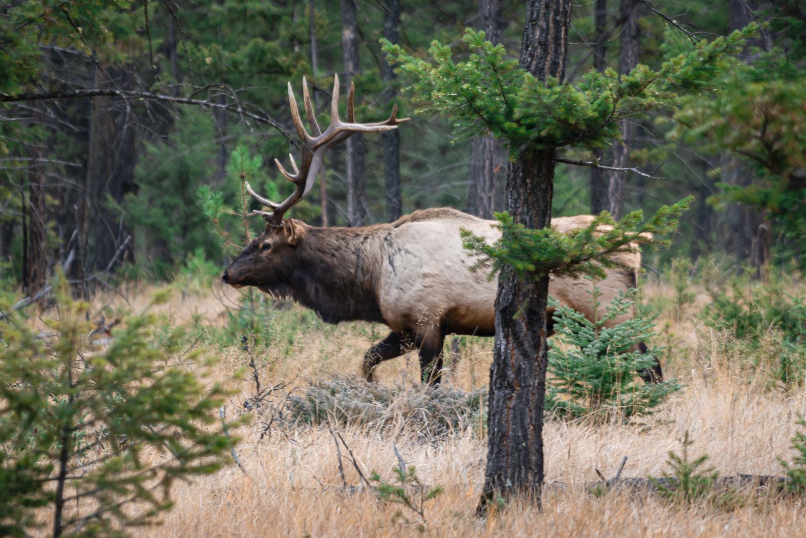
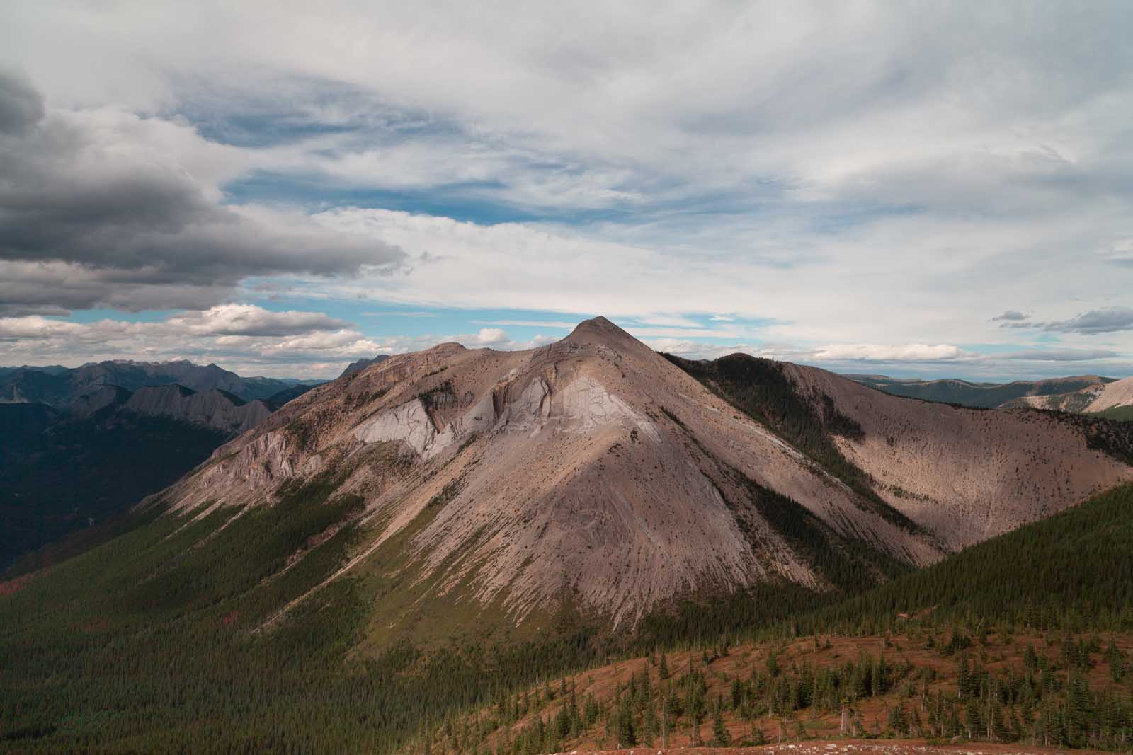
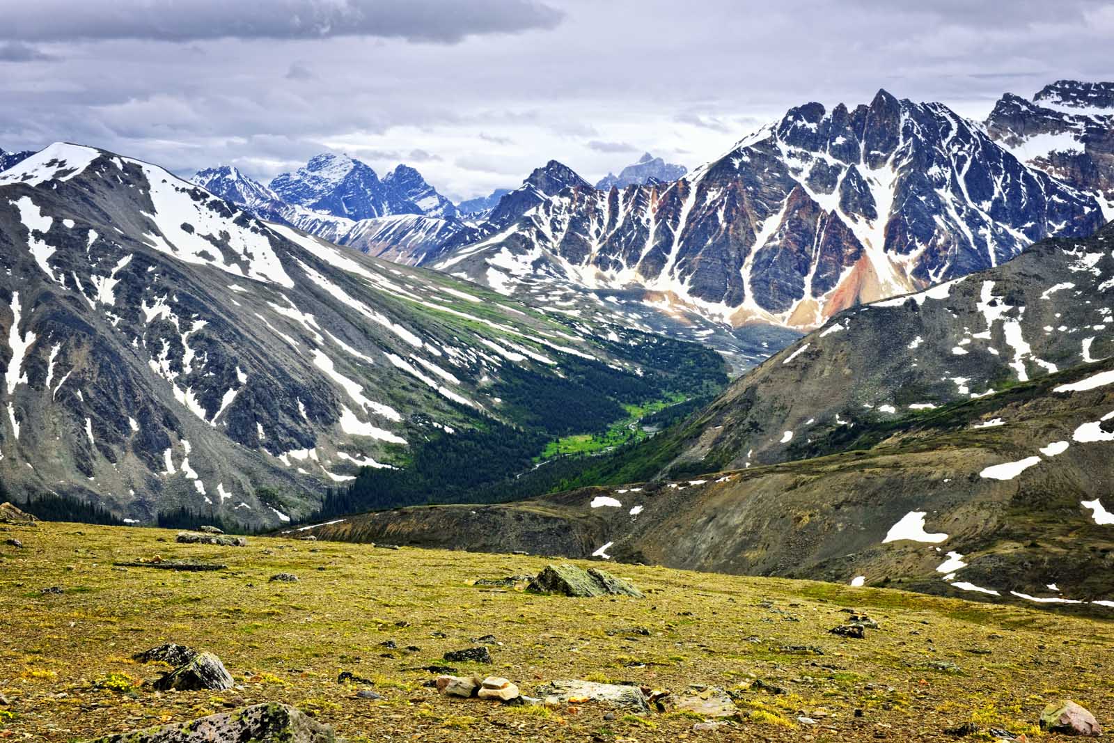
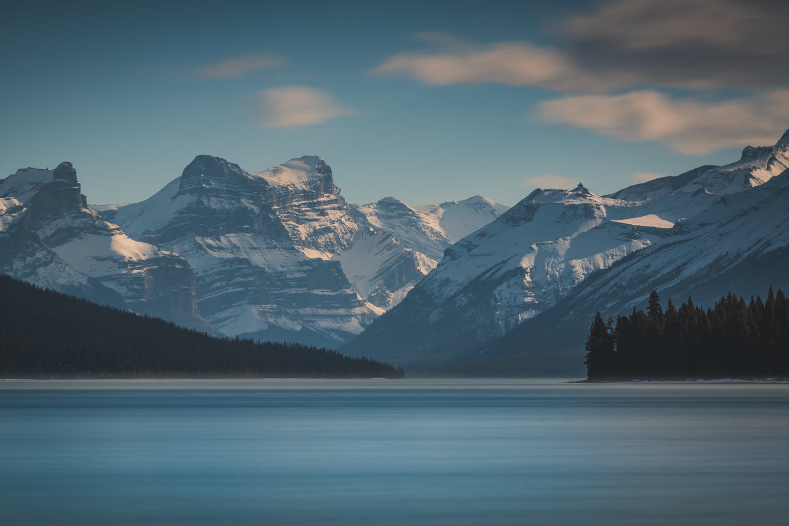
Jasper National Park is the largest national park in the Canadian Rockies, spanning an incredible 11,000 square kilometres (4,200 sq miles). It boasts some of the most awe-inspiring hikes for every skill level. With its shimmering glacial lakes, massive glaciers, and abundant wildlife, Jasper is a hiker’s paradise.
But you don’t have to venture deep into the backcountry to experience it. Many of the best trails and walking routes are just minutes from the town of Jasper, making it perfect for memorable day hikes. After many trips to this part of Alberta, we’ve learned that while Banff gets a lot of the attention, Jasper offers a wilder, more rugged beauty that we keep coming back to.
This guide is designed to help you find the perfect trail for your trip. We’ve broken down our favourite hikes by difficulty and included all the practical details you need to hit the trail with confidence.
Map of the Best Jasper Hikes
Best Jasper Hikes at a Glance (Top 5 Picks)
If you’re short on time, this quick guide will point you to the can’t-miss trails in the park.
| Hike | Distance (Round Trip) | Difficulty | Best For |
| Maligne Canyon | 3.4 km loop | Easy | Waterfalls & Gorges |
| Valley of the Five Lakes | 4.7 km loop | Easy / Moderate | Beautiful Lakes & Families |
| Edith Cavell Meadows | 8.4 km loop | Moderate | Glacier & Wildflower Views |
| Sulphur Skyline | 7.9 km loop | Moderate | 360-Degree Views & Hot Springs |
| Bald Hills | 15 km | Difficult | Panoramic Vistas |
Planning Your Jasper Hiking Trip
Before you lace up your boots, here are a few essential tips for planning your adventure.
Jasper National Park Pass Info
To enter Jasper National Park, you must have a valid Park Pass. You can buy it at the park gates upon entry or online in advance.
- Daily Pass (2025 rates): $10.50 CAD per adult or $21.00 per vehicle/group.
- Discovery Pass (Annual): $72.25 CAD per adult or $145.25 for a family/group. This gives you unlimited access to all of Canada’s national parks for 12 months. If you plan to visit for more than a few days or see other parks like Banff, this is the best value.
You can purchase your pass online from the Parks Canada website. Please verify all prices on the official site, as they can change.
Getting to the Trailheads
Jasper is best explored by car. The park is located approximately 4 hours (365 km / 226 miles) from Edmonton and about 3.5 – 4 hours (288 km / 179 miles) from Banff via the incredibly scenic Icefields Parkway.
- Check car rental rates here.
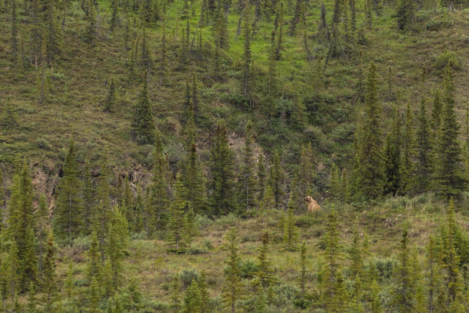
Bear Safety & What to Pack
Jasper is home to both grizzly and black bears. It is essential to be bear-aware on all trails.
- Carry Bear Spray: Know how to use it and keep it accessible on your hip, not in your pack.
- Make Noise: Talk, sing, or call out periodically to avoid surprising a bear.
- Pack in Layers: Mountain weather changes quickly. Bring a waterproof jacket, a warm mid-layer, and a hat, even on a sunny day.
- Bring Water and Snacks: There are no shops at the trailheads. Pack more than you think you’ll need.
Where to Stay in Jasper
We stayed at the Fairmont Jasper Park Lodge, which makes for a great luxury base. For other options, you can check out vacation rentals and hotels in the town of Jasper. There are also numerous front-country and backcountry campsites managed by Parks Canada, which should be booked well in advance.
Easy & Accessible Jasper Hikes
These trails are perfect for families, casual walkers, or for a day when you want maximum scenic reward with minimal effort. They showcase some of Jasper’s most iconic features without requiring a strenuous, all-day commitment.
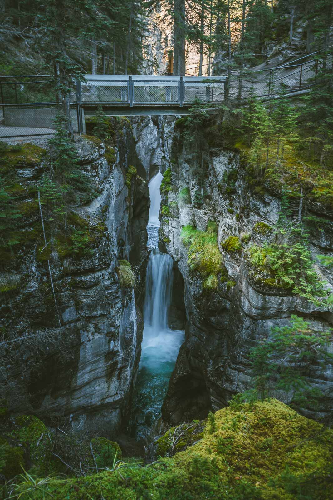
1. Maligne Canyon
- Length: 3.4 km (2.1 miles) loop
- Elevation Gain: 118 m (387 ft)
- Difficulty: Easy
- Approx. Time: 1.5 – 2 hours
- Trailhead: Maligne Canyon Trailhead
Maligne Canyon is one of the most spectacular hikes in Jasper National Park. Located just 10 minutes from town, the trail is easily accessible. The well-maintained path crosses several bridges, offering incredible views down into the deep, narrow gorge carved by the Maligne River. You’ll see waterfalls and unique rock formations as you wind your way along the canyon rim.
Dave & Deb’s Tip: The canyon is stunning in summer, but it’s a completely different world in winter. If you’re visiting then, a guided ice walk with cleats through the frozen canyon floor is one of the most unique and memorable experiences you can have in the Rockies.
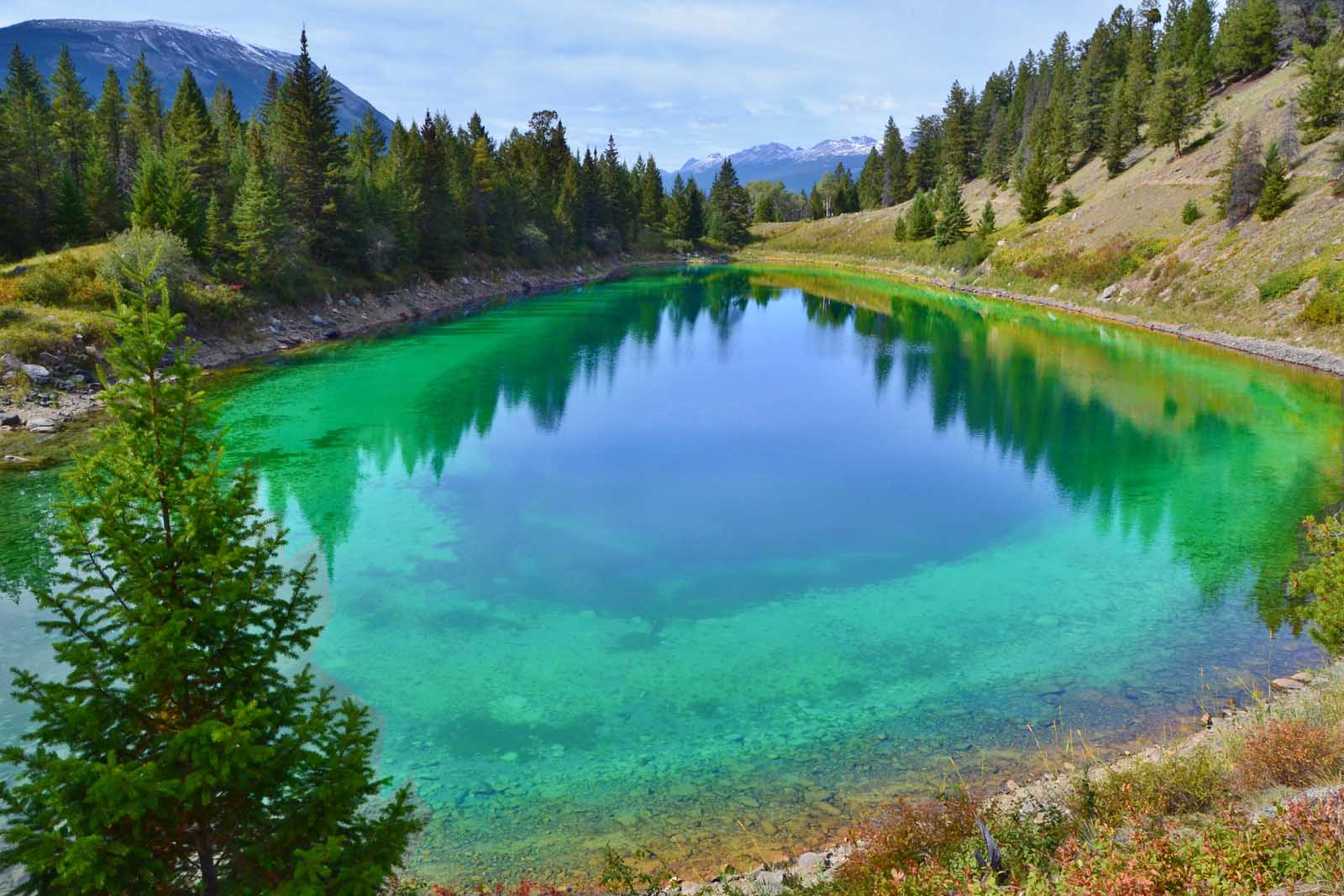
2. Valley of the Five Lakes
- Length: 4.7 km (2.9 miles) loop
- Elevation Gain: 162 m (531 ft)
- Difficulty: Easy to Moderate
- Approx. Time: 1.5 – 2 hours
- Trailhead: Valley of the Five Lakes Trailhead on the Icefields Parkway.
This hike is a local favourite for good reason. The trail takes you through a lush forest before arriving at a series of five pristine lakes, each glowing with its own distinct shade of jade and blue. The trail has some gentle rolling hills but is a rewarding hike for the whole family.
Dave & Deb’s Tip: The colour of the lakes is truly unbelievable on a sunny day. The Third Lake is the most vibrant and the best for photos. It’s also the most popular spot for a very chilly swim if you’re feeling brave!
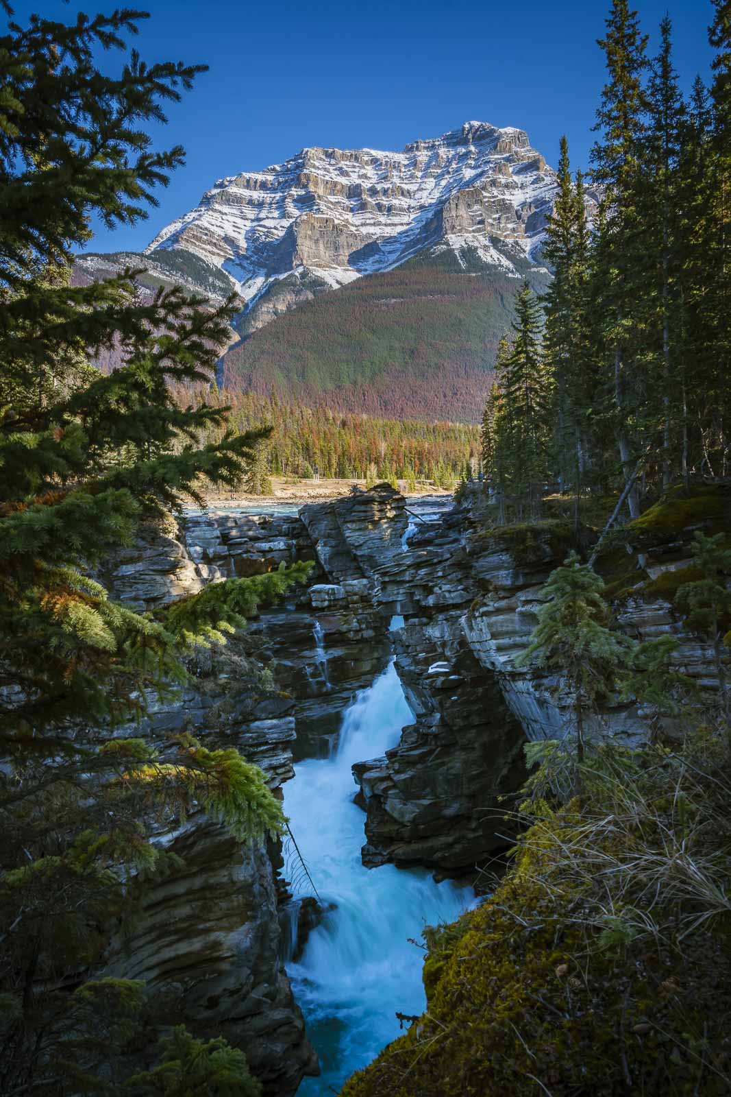
3. Athabasca Falls
- Length: 1.0 km (0.6 miles)
- Elevation Gain: 26 m (85 ft)
- Difficulty: Easy
- Approx. Time: 30 – 45 minutes
- Trailhead: Athabasca Falls Parking Lot on the Icefields Parkway.
While not a long hike, Athabasca Falls is one of the most powerful and picturesque waterfalls in the Canadian Rockies. The easy, paved pathways lead to various viewpoints overlooking the falls as they roar through a narrow gorge. It’s a busy trail, but well worth the stop for the incredible views of the falls and the Athabasca River.
Dave & Deb’s Tip: The power of the water here is the main event. While the upper viewpoints are great, be sure to take the stairs down to the lower platform. You can feel the mist and hear the roar of the canyon, which really puts the force of the river into perspective.
4. Toe of the Athabasca Glacier
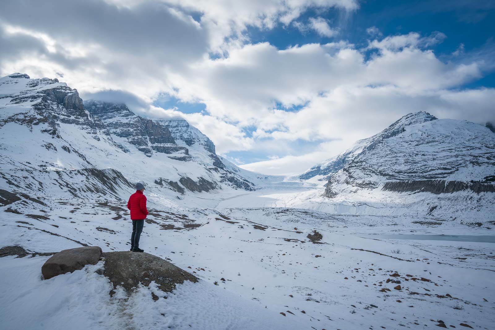
- Length: 1.4 km (0.8 miles)
- Elevation Gain: 60 m (196 ft)
- Difficulty: Easy
- Approx. Time: 45 minutes – 1 hour
- Trailhead: Toe of the Athabasca Glacier Trailhead at the Columbia Icefield.
This is a brilliant, family-friendly hike that offers a free alternative to the guided tours on the glacier. The trail leads you over the rocky moraine left behind by the retreating glacier. Along the route, signs mark the glacier’s location in different years, providing a sobering look at how much it has shrunk.
Dave & Deb’s Tip: It is extremely important to stay behind the ropes and on the marked trail. The terrain near the glacier can be unstable and there are unobservable crevasses that are very dangerous. This hike is about witnessing the glacier’s scale from a safe distance.
5. Jasper Discovery Trail
- Length: 8.5 km (5.2 miles) loop
- Elevation Gain: 264 m (866 ft)
- Difficulty: Easy
- Approx. Time: 2 – 3 hours
- Trailhead: Multiple access points from parking lots in the town of Jasper.
If you want to explore close to town, the Jasper Discovery Trail is a great choice. This easy trail takes you on a stroll around the town’s perimeter, offering lovely views of the surrounding mountains and the Athabasca and Miette rivers. It’s easy to navigate; just follow the bear signs.
Dave & Deb’s Tip: This is the perfect thing to do on your arrival day. It helps you get your bearings, stretch your legs after a long drive, and you can scout out some dinner spots in town along the way.
6. Wapiti Trail
- Length: 4.8 km (3 miles) out & back
- Elevation Gain: 113 m (370 ft)
- Difficulty: Easy
- Approx. Time: 1 – 1.5 hours
- Trailhead: Wapiti Campground
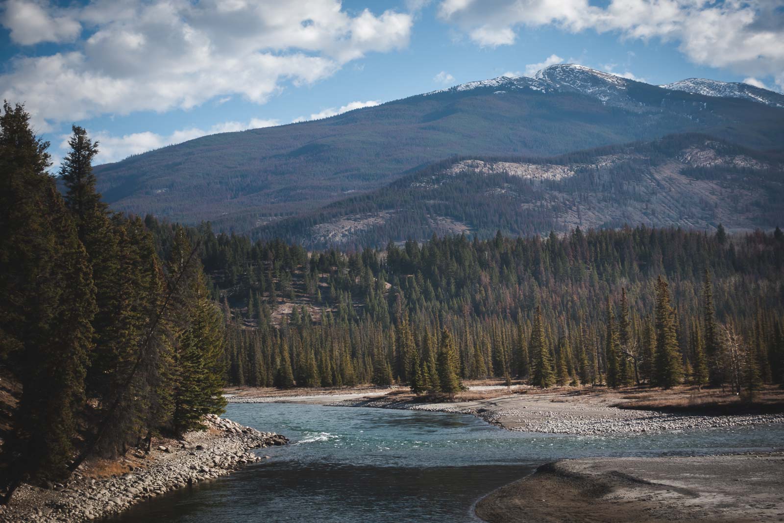
The Wapiti Trail is a lovely, gentle walk that follows the path between the Icefields Parkway and the Athabasca River. Starting from the Wapiti Campground, it heads northbound towards the town of Jasper. It’s a relatively flat and quiet trail, perfect for a morning stroll or for families looking to enjoy the riverside scenery without a major climb.
Dave & Deb’s Tip: While it’s a great short hike on its own, you can also use this trail to walk all the way from the campground into town for dinner, which is a great way to earn your meal and enjoy the evening light on the mountains.
7. Wabasso Lake Trail
- Length: 7.7 km (4.7 miles) out & back
- Elevation Gain: 276 m (905 ft)
- Difficulty: Easy
- Approx. Time: 2 – 2.5 hours
- Trailhead: Wabasso Lake Trailhead
The Wabasso Lake Trail is a popular but peaceful hike that takes you through a dense forest to a secluded, marshy lake. The trail has some rolling terrain but isn’t overly strenuous, making it another great option for families. The real reward is reaching the quiet shores of Wabasso Lake and enjoying the solitude and mountain reflections before heading back.
Dave & Deb’s Tip: This trail is known for being muddy in sections, especially after it rains, so waterproof hiking shoes are a good idea. It’s also a great spot for birdwatching if you take your time by the lake.
Moderate Hikes in Jasper (5km – 10km)
Ready for more of a challenge? These moderate trails involve more elevation gain but reward you with spectacular, high-country views that you have to work for.
8. Edith Cavell Meadows
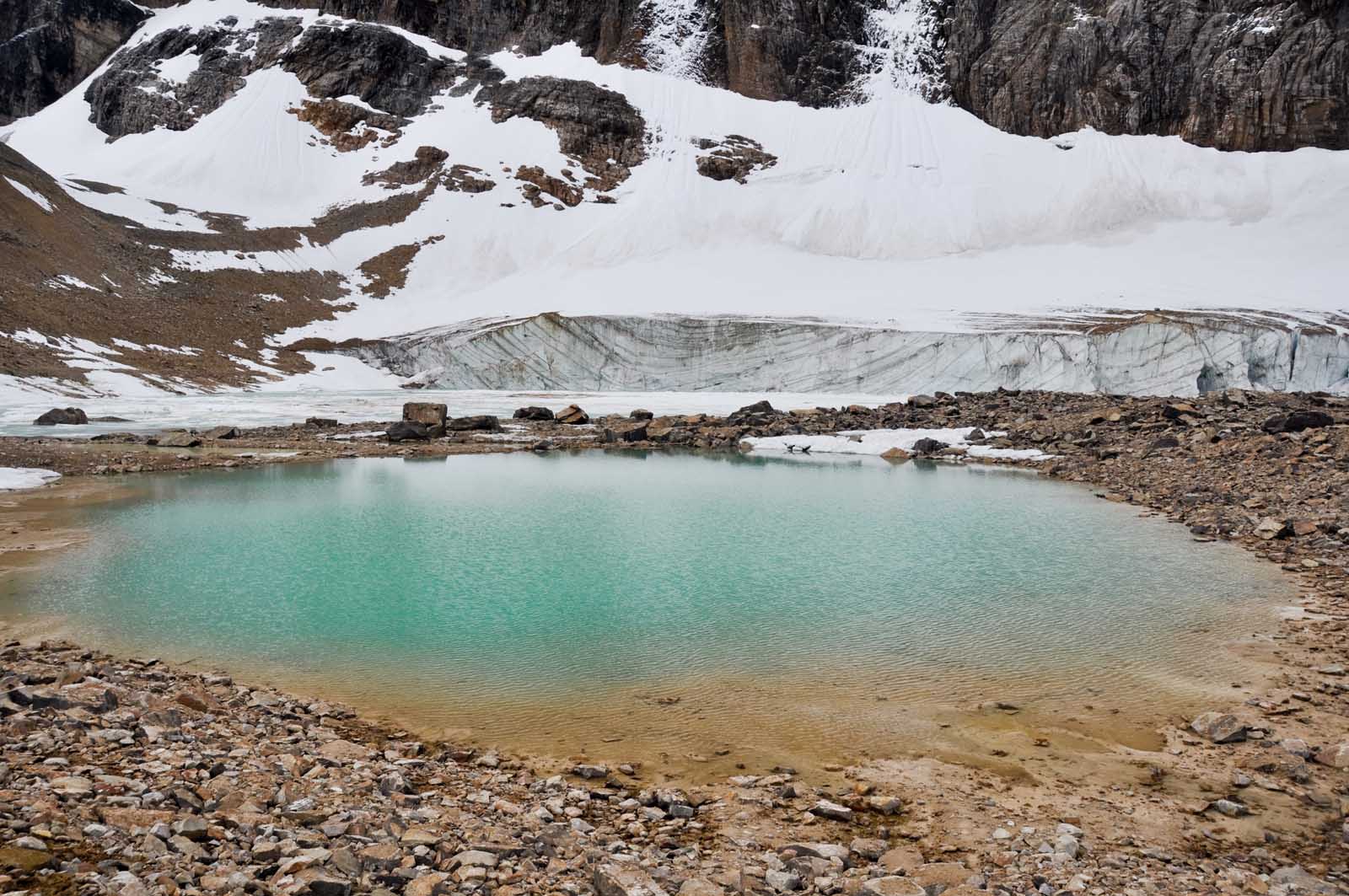
- Length: 8.4 km (5.2 miles) loop
- Elevation Gain: 582 m (1909 ft)
- Difficulty: Moderate
- Approx. Time: 3 – 4 hours
- Trailhead: End of Cavell Road
The Edith Cavell Meadows hike is a beautiful and rewarding trail in Jasper National Park. It begins on a paved path along the Glacier Trail, leading to a stunning viewpoint of Angel Glacier and Cavell Pond. The trail then climbs steadily through a rocky moraine and subalpine forest before opening up into a beautiful meadow that is filled with wildflowers in July and August. You are treated to incredible glacier views for the entire journey.
Dave & Deb’s Tip: The drive to the trailhead is an adventure in itself, with tight switchbacks. The real star here is Angel Glacier. You get great views from the lower lookout, but push on to the upper meadows. The sight of the glacier framed by wildflowers is absolutely worth the climb.
9. Sulphur Skyline Trail
- Length: 7.9 km (4.8 miles) out & back
- Elevation Gain: 653 m (2142 ft)
- Difficulty: Moderate
- Approx. Time: 3.5 – 5 hours
- Trailhead: Miette Hot Springs parking lot
The Sulphur Skyline Trail is one of Jasper’s signature hikes, known for its unrelenting uphill climb that pays off with some of the best panoramic views in the park. The trail starts at a steady incline and just keeps going. Once you break through the treeline, the path continues to a ridge offering a breathtaking 360-degree scene of the surrounding peaks and the Fiddle Valley below.
Dave & Deb’s Tip: Don’t forget your swimsuit! The ultimate reward for this tough hike is a long soak in the Miette Hot Springs, located right at the trailhead. Trust us, your tired muscles will thank you. It’s the perfect end to a challenging day on the trail.
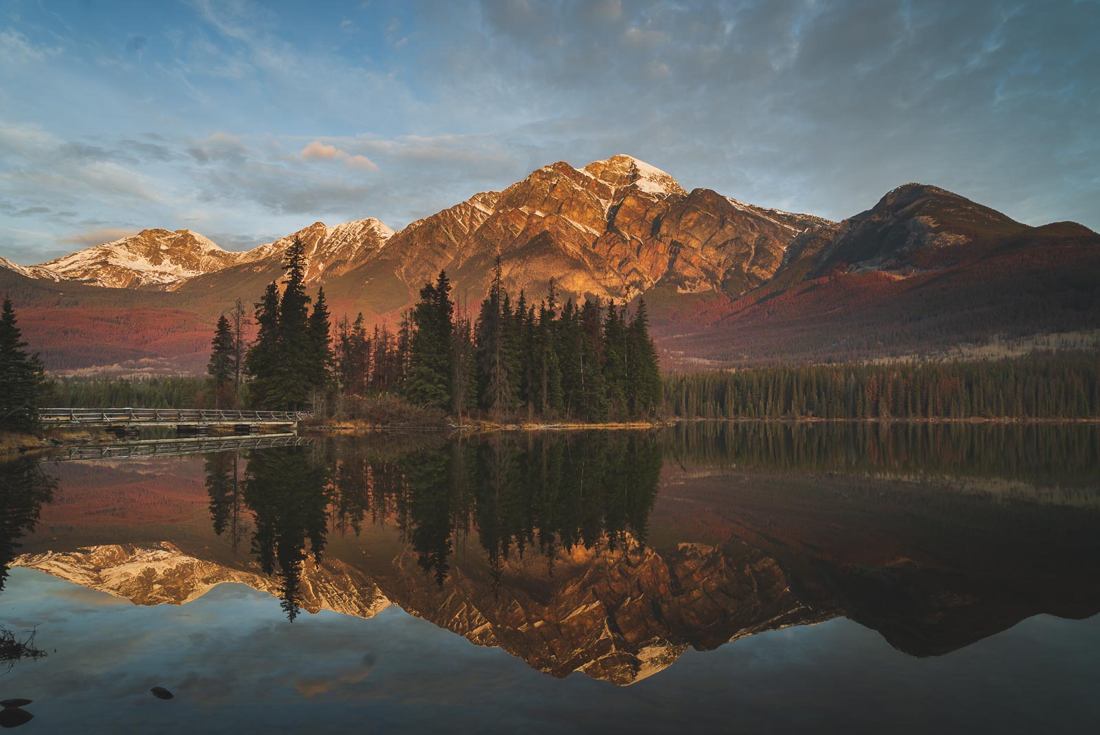
10. Pyramid Lake Loop
- Length: 5.6 km (3.4 miles) loop
- Difficulty: Moderate
- Elevation Gain: 203 m (666 ft)
- Trailhead: Multiple access points near Pyramid Lake.
The Pyramid Lake Loop is a great choice for an afternoon hike with beautiful views, located just a few minutes from the town of Jasper. The trail climbs through the forest to viewpoints overlooking the iconic Pyramid Mountain and Pyramid Lake. There are many different intersecting routes in the area, but most lead back to the main trail. It’s also a dog-friendly trail, as long as your canine companion is on a leash.
Dave & Deb’s Tip: For the best photos of Pyramid Mountain reflected in the water, make sure you take the short walk over the bridge to Pyramid Island either before or after your hike. It’s one of the most photographed spots in Jasper for a reason.
Difficult Hikes in Jasper (10km+)
For experienced hikers looking for a serious challenge, these trails offer some of the most expansive and rewarding views in the entire park. Be prepared with sturdy hiking boots, plenty of water, and bear spray.
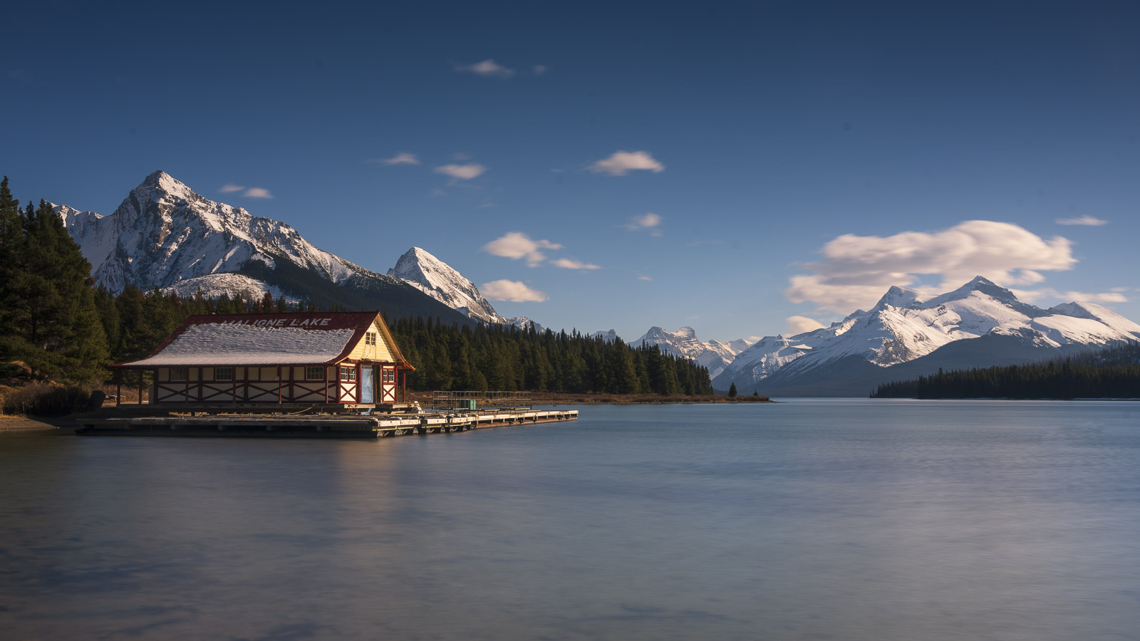
11. Bald Hills
- Length: 15 km (9.3 miles) out & back
- Elevation Gain: 780 m (2559 ft)
- Difficulty: Difficult
- Approx. Time: 5 – 7 hours
- Trailhead: Maligne Lake parking area (furthest lot).
For views high above the treeline, nowhere is better than the summit of the Bald Hills. The trail follows a wide fire road for most of the climb, with a steep shortcut option available for those who want it. As you gain elevation, the trees thin out and the views of Maligne Lake and the surrounding mountain ranges become increasingly spectacular. The final push to the summit ridge opens up to a stunning 360-degree panorama.
Dave & Deb’s Tip: The final push to the true summit beyond the main viewpoint is a bit of a scramble, but it’s where you’ll leave 90% of the other hikers behind. The 360-degree panorama from the very top is one of the best in the Canadian Rockies.
12. Opal Hills Loop
- Length: 8.0 km (5 miles) loop
- Elevation Gain: 517 m (1696 ft)
- Difficulty: Difficult
- Approx. Time: 3 – 5 hours
- Trailhead: Maligne Lake parking area (near the boat house).
Don’t let the shorter distance fool you; the Opal Hills Loop is a steep and strenuous workout that takes you straight up. The trail climbs relentlessly through the forest before opening into a beautiful alpine meadow that is often filled with wildflowers. This hike is a great choice if you’re looking for a challenging climb with rewarding views and fewer crowds than the nearby Bald Hills trail.
Dave & Deb’s Tip: This is a steep one, so hiking poles are your best friend, especially for the descent. The real reward is the alpine meadow at the top, which is a great place to spot marmots and pikas in the summer.
13. Whistlers Mountain Summit
- Length: 12.7 km (7.9 miles) out & back
- Elevation Gain: 968 m (3175 ft)
- Difficulty: Difficult
- Approx. Time: 5 – 7 hours
- Trailhead: Upper station of the Jasper Skytram.
While the Jasper Skytram whisks you most of the way up the mountain, the hike to the true summit is a challenging adventure at high elevation. From the upper tram station, the trail continues to climb across a rocky, exposed ridge. The path can be slippery with snow even in summer. The reward is an unparalleled view over the town of Jasper, the Athabasca Valley, and countless mountain ranges stretching to the horizon.
Dave & Deb’s Tip: Don’t be fooled by the tram ride; this is a proper mountain hike. Be prepared for wind and cold temperatures at the top, even in August. The view from the summit makes you feel like you’re on top of the world.
FAQ: Jasper National Park Hikes
One of the best all-around hikes is the Valley of the Five Lakes for its stunning colours and accessibility. For a more challenging day with epic rewards, the Sulphur Skyline Trail is a signature Jasper experience, especially with a soak in the hot springs afterward. The “best” one really depends on your fitness level and what you want to see!
Beyond the hiking trails, you shouldn’t miss a drive on the Icefields Parkway, a boat tour on Maligne Lake to see Spirit Island, and the chance to see wildlife like elk, bears, and moose (from a safe distance, of course). The Jasper Skytram also offers incredible views without the long hike up.
There are over 1,000 km (600+ miles) of hiking trails in Jasper National Park, ranging from short, easy walks to multi-day backcountry treks. This guide covers 13 of our absolute favourites that offer the best experiences.
So, Which Trail Will You Hike First?
And those are our favourite hikes in Jasper National Park! There are dozens more to explore, but these 13 trails offer an incredible taste of what makes this corner of the Canadian Rockies so special. Whether you’re taking an easy stroll to a waterfall or tackling a challenging summit, the views are guaranteed to be worth it.
Let us know in the comments which hike you’re adding to your list!